Of Pipsissewa, Pinedrops, and Pink Polkadot Pussypaws

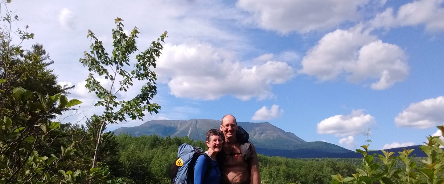
July 31 – August 4, 2018

The sun beat hotly upon my hat, and a scant half inch of water sloshed in my virtually empty bottle. A trail intersection came into sight, with Jay waiting for me at the sign. “Shall we get water here?”

“Yes! The map says Cascade Creek is just a quarter mile down the Round the Mountain Trail.” I gave a little skip of relief, already envisioning pouring half a liter of clear, cold water into my dusty throat.

We turned off the PCT, walking along the edge of Horseshoe Meadow. I could hear the creek gurgling ahead. Rounding a clump of trees, the much anticipated water came into view – a surging, splashing stream of brown silty mud!

Cascade Creek with Mt Adams in the background

“Oh!” I exclaimed, my shoulders sagging in disappointment. “We can’t drink this! It must be coming from a glacier on Mt Adams.” I consulted the map. “The next water source is Riley Creek, 4.5 miles away. It looks like it comes from Mt Adams also. What if all the creeks are full of glacial silt?”

“Maybe, if we collect a liter and let it sit, the mud will settle, and we can decant the top part into another bottle.” Jay, ever the practical problem solver, didn’t seem phased by this set back. “I could use some sitting time. We’ve been hiking for a while!”

We sat, enjoying the beauty of sunlight and meadow. After ten minutes, the upper half of the liter was definitely a lighter brown than the lower half. We decided to go ahead and decant it, treat it with Aquamira, and see if more of the mud settled out as we walked.

We continued hiking, and happily found clear cold water in a tributary of Riley Creek. Our silty liquid was poured onto thirsty plants, and we refilled with much more palatable water.

Over the next 66 miles, we would see many types of water sources. Here are just a few pictures.

Crystal clear water flows through a flower strewn meadow.

This pounding waterfall liberally sprayed me while crossing at its base.

There’s nothing quite like dipping water from a melting snow field!

We also had the privilege of dipping water from Lava Springs, an achingly cold pool emerging from the bottom of an ancient black lava flow. I didn’t get a picture because I was too busy picking blueberries and joking with Scott and Teri, two PCT hikers we had met several times.

As we climbed higher into the mountains, scenery enchanted!

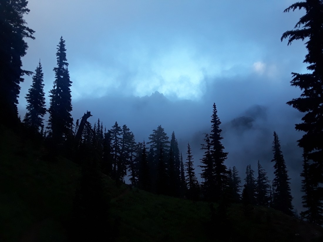
After days, weeks, months of sunshine, on Friday we awoke to lowering clouds, spitting just enough rain to coat leaves with glistening water drops. We donned rain gear and began hiking, leaving the morning’s first footprints on the trail.

We climbed into the clouds.

We crossed a very large snow field which went from flat …

… to rather steep!

At the top of the snow field, we met Lazarus from Cambridge, England, and Sonia from Seattle, WA. Sonia was a bit nervous about our route, climbing 1600 feet into Goat Rocks, walking along the top of a ridge known infamously as “the knife edge”. The wind had picked up a bit, turning rainy mist into horizontal mist.

“I don’t have to do this,” Sonia said. “Unlike the younger hikers out here, I have nothing to prove.”

In the end, Sonia decided to continue, the other three of us assuring her that we would all stick together.

I thought about her words as we climbed onto the ridge top. I was no young kid, needing to prove myself to the world. But I did need to challenge myself, facing once again my fear of heights, slowly whittling away at the acrophobia that plagued me at inopportune times. I needed to walk the knife edge for myself, no one else.

The knife edge of Goat Rocks …

… continues …

… this is one long challenge!

Jay stopped to photograph polkadotted pussypaws, an elaborately ornamental flower in this stark rock landscape!

A rococo embellishment!

After several miles of ridge walking through fog and mist, it was such a relief to finally descend below the clouds. The landscape opened, with sunshine chasing shadows in an extravagant game of tag.

My three companions pulled ahead, becoming tiny dots upon the earth.

We stopped for lunch, enjoying a last moment of camaraderie, talking of ourselves as the “fearless foursome”, the “Goat Rocks Gang”. We had encouraged and helped each other for several miles, and felt a bit celebratory.

Ten miles from our early morning beginning, we reached Tieton Pass, to be met with a wall of green florescent tape and a sign informing us of a fire closure, necessitating a nine mile detour down the Clear Fork Trail to Hwy 12. Our adventurous day was not over yet!

Sonia and Jay look at the map to orient themselves with the fire closure and alternate route.

The Clear Fork Trail sloped steeply downhill from the PCT, and was often overgrown. Yet the loveliness of this little used trail began to give Jay and me a second wind as we were challenged with obstacles and charmed with beauty.

There were several log crossings.

We ate blueberries, huckleberries, salmonberries, and – wait! Were those black salmonberries? Jay and I had never seen such a berry!

We found two flowers completely new to us also.

Woodland pinedrops, from the Indian pipe family, often grow to be four feet high.

Pipsissewa, also known as umbellate wintergreen, was scattered through the forest.

Salmonberries grew next to yet another log crossing, causing Jay to pause and pick a few.

Some of the downed trees were incredibly large!

On Saturday, near the end of our detour, we met two members of a fire crew, heading into the forest in search of a lightning strike reported by a helicopter. We chatted for a few moments. I was in awe of all the heavy equipment they had to carry. They warned us that there was a forest-wide ban on fires. Since we were in the midst of a detour to avoid a forest fire, the fire ban made sense to us. Wishing them good luck, we continued on.

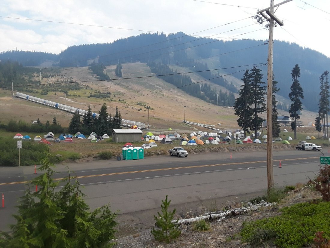
When we reached Hwy 12, we were lucky enough to get a ride to White Pass, where we planned to take a zero day. We were amazed to see a whole fire command center set up.

And so the summer continues. We hike. Firefighters chase smoke and flames. And beauty continues to bloom in the forest, whether people are there or not.

Crater Lake

July 2, 2018

Yesterday, I ran a gauntlet of winged, bloodthirsty adversaries to fetch cold, crystal clear water from Christi’s Spring. Today our watering hole was an unnamed pond near Jack’s Spring.

The forest around the pond was patchily burned, giving the breeze room to maneuver and blow away many of the mosquitoes. Sitting next to the lily pads, we drained the last drops from our water bottles.

Holding empty bottles, I slowly sidled onto a fallen log, scooping water several yards from the shore.

The water was a discouraging yellow color, but we went ahead and treated it with Aquamira drops, hoping it would taste okay.

Thirty minutes later, when the Aquamira had taken effect, I took a careful swallow. Fresh green taste permeated my mouth – reminiscent of a kale and spinach smoothie with no sugar. The last pond had tasted of fermented alfalfa (aka the smell of horse manure), so I was encouraged by the relative fresh taste of this pond. Jay and I put tea bags in our water bottles anyway. If I’m going to drink yellow water, I’d just as soon drink tea flavor!

Flowers mixed with mushrooms and burned areas gave us endless variety in the day.

Much of the forest we hiked through today was intermittently burned, with blackened tree trunks and little undergrowth, but green needles in the treetops. However, one area had been seared so badly, even the dirt was charred.

Sixteen PCT miles plus one mile of road walk brought us to Mazama Campground at Crater Lake in the late afternoon. We carefully threaded our way through a large parking lot, blessedly mosquito free, though busily full of moving cars. Jay agreed to guard our packs outside the campground store while I joined the line to register for a campsite.

I relaxed as I stood in the long, slow moving line, enjoying the opportunity to listen, trying to identify people’s origins from their accents. At the registration window, I heard a lady tell two well-dressed women before me, “I believe we have one or two campsites left.”

The second registrar beckoned me over. I grinned at him. “My husband and I are PCT hikers. We would like to camp here tonight if it’s possible?”

“Oh sure,” the young man smiled back. “It will cost $5.00 to camp at the ‘Hike In’ site. There are already several PCT hikers down there. Let me take your name and print a permit for you to attach to your tent.”

The other registrar interrupted. “Did you just give her the last empty campsite?”

From the other window, a chorus of “Oh, nooooo!” sounded from the two women, who looked slightly desperate.

“No,” my registrar reassured. “She’s a PCT hiker.”

“Yeah, he put me with all the other hiker trash,” I laughed. The two registrars snickered.

“What does that mean, hiker trash?” One woman looked puzzled.

“Oh, well,” I paused in thought. “We’re all on the trail for so long, and we get so dirty … and by the time we’re finished, our gear and clothes are ragged and done for. ‘Hiker trash’ seems a good description.”

“Oh, I see. It’s a term of endearment for your colleagues,” she nodded. I giggled as I looked down at my stained and ragged shirt. What a way to describe us!

With tent permit in hand, Jay and I bought six days of food from the camp store, treated ourselves to a delicious hot meal at the restaurant, then moseyed downhill to the campground. Jay set up our tent in the deepening dusk among other quiet PCT hiker tents. I happily stowed our heavy food bags in the bear box provided, then skipped off to the campground bathhouse for a wonderful shower!

July 3, 2018

Colors glowed with the appearance of light in the sky. We rose, silently breaking camp, trying not to waken occupants of the many tents nearby. Even in the predawn coolness, sweat beaded across my face as we climbed 1.5 miles up the steep trail from the Mazama Campground back to the PCT. From there, it was 3.5 miles to Crater Lake Lodge, still mostly uphill. Breakfast was a treat after such a workout!

How to describe the next 10 miles as we hiked alongside Crater Lake? The water glowed, a mixture of deep royal and sapphire sky blue. A breeze swept over the lake, effectively vanquishing mosquitoes as it cooled my face. Next to the lodge, the trail looked deceptively inviting, wide and flat. Soon it began a series of steep ups and downs, giving my legs a workout, but rewarding my soul with stunning vista after vista. We climbed Watchman’s Tower, and could see all the way from Mount Shasta in the south to the Three Sisters in the north!

The Klamath tribe of Native Americans have an oral history of ancestors witnessing the collapse of gigantic Mount Mazama. Geologists estimate the event happened about 7,700 years ago, with the mountain blowing out 12 cubic miles of volcanic rock, creating a caldera 5 miles in diameter. Once the insides of the exploded mountain cooled, water began collecting from rainfall and snow melt, creating the incredible beauty of Crater Lake.

Infant to the Earth

Blue abyss enclosed in rock

Ancient to mankind

(Haiku by Jay)

20180703_104118_resized1484285629.jpg

Words cannot do this place justice. Perhaps this quote from one of my very favorite books helps to illustrate that sense of being transported to a place of mystery as we hiked, seeing the lake again and again this day.

“All this he saw, for one moment breathless and intense, vivid on the morning sky; and still, as he looked, he lived; and still, as he lived, he wondered.”
Kenneth Grahame, The Wind in the Willows

The Heat Is On

September 17, 2017

Monument Mountain Motel, in Great Barrington, MA, is the cleanest place we have stayed on the whole AT.  I wanted to follow the maid and learn her secrets for leaving bathroom tiles mirror bright, and carpets smelling of fresh air!  Instead, we spent two zero days laying around, letting Jay’s hand and arm return to normal.  What luxury!

We left Great Barrington this morning, courtesy of a trail angel shuttle named Joe, who we met in the supermarket.  He returned us to the trail crossing at Blue Hill Rd, the very spot we had so precipitously left three days ago.

IMG_20170917_101423869_HDR
Joe, awesome trail angel, who shuttles hikers just for the fun of it!

(See our Trail Angel page for a little more about Joe.)

The sky was bright sapphire blue, the air hot and humid.  I was glad to be walking again, and under leafy green shade.  Six miles of hiking emptied our water bottles, making us look forward to the next water source, described as a spring at the bottom of a rocky cleft.  On our way down, we met another couple coming up the hill.

“How’s the spring?  Does it have good water?” one hiker asked.  We were confused.  Why was he asking us?  The spring was behind him, wasn’t it?

The two hikers turned back, and with us, headed to the bottom of the hill, where an obvious cleft in the rock looked just as the trail guide reported.  Close inspection showed a faint damp spot among the dead leaves clogging the very bottom of the cleft.  I searched for a way down the rocks, to see if I could dig out the spring.

“Uhh, there was a snake on those rocks when we passed this spot earlier,” the hiker told me.

Forewarned, I moved even more slowly, and much more noisily, into the cleft, about ten feet below Jay and the other two hikers.  As I dug, I could feel ice-cold moisture below the leaves and mud.  By the time I had finished, the tiny seep held about a quart of muddy water.

Jay and I decided to keep hiking, leaving the limited liquid to the other two very thirsty hikers.  Our trail guide predicted water just a couple miles away…

Four miles later, we had crossed only dry or impossibly mucky waterways.  Reaching Hwy 7, we decided to look for a civilized water source, and after ten minutes of hot walking, we thankfully filled our bottles with water from a hose at a Jehovah’s Witness church.  We were so grateful to see clear, clean water going into those bottles, and to drink as much as we needed!

September 19, 2017

We crossed the border from Massachusetts to Connecticut this morning!  We have hiked 1,800 miles, with a bit less than 400 miles to go!  What a milestone!

IMG_20170919_082413467

Last night never cooled, and we woke feeling a layer of sweat and grime covering our skin.  Clouds covered the sky, acting as a prickly blanket, holding the heat against the land.  We had been hiking about an hour when the trail turned to climb through Sages Ravine.  The creek commenced to pool and drop, creating beautiful swimming holes.  After passing at least five gorgeous pools, we couldn’t resist any longer.  Off came our packs (and clothes), and we plunged in!  Who cared that it was only 8:40 a.m. and the water was freezing cold?  It felt wonderful after walking through muggy, sticky, oppressive air!  Washing off the grunge gave us a new lease on the day.  Our next mountain, Bear Mountain, was climbed with energy and good humor, even as we felt new sweat trickle down our necks!

IMG_20170919_083036559
Sarah contemplates a tempting swimming hole in Sages Ravine.

Our last landmark of the day was a pillar, nine feet high, called the Giant’s Thumb.  A symphony of crickets and barred owls began singing as dusk fell just past the giant boulder.  When I begin to think the trail is only heat and bugs and dirt, things like Sages Ravine and the Giant’s Thumb bring beauty back to the forefront of my consciousness!

IMG_20170919_183019541
Giant’s Thumb

September 21, 2017

The sun was a copper orb, pulsing in a brassy blue sea of heat.  Most of the water sources we passed were tiny trickles of life-giving moisture.  We heard Guinea Brook several minutes before we arrived at its edge.  Several feet across, the brook poured over rocks and around boulders, dancing with sparkle and spray.  We crossed the foot bridge, then took a brush-filled side trail behind a boulder the size of a small storage shed.  This was the first large water source we had seen since the creek in Sages Ravine.  Though the pool behind the boulder was not big enough for swimming, it had ample room for wading and bathing.  I was delighted to get clean again, even if only for a few moments in this heat.  Hurray for creeks and brooks!

September 22, 2017

Once again, the heat became a very real presence in the forest today.  Though there were some lovely breezes whenever we topped a ridge, sweat beaded my face and dripped off my arms most of the day.

We passed the border between Connecticut and New York!  We’ve hiked 11 states, with three to go!

As evening approached, we came to Ten Mile Campsite, where the Ten Mile River joins the Housatonic River.  We pitched our tent in the gathering dusk, then walked to the river’s edge.  A quick bath banished the sweat of the day, then we sat on rocks to dry and enjoy the evening.  Fish jumped a few yards off shore.  Water reflected pink tinged mare’s tails drifting across a darkening sky.  Peace pervaded the scene, softly stealing into my soul, reminding me that I am blessed.

IMG_20170922_181531665_HDR

September 23, 2017

We ate breakfast on the shore of the Ten Mile River.  A great blue heron slowly flapped huge wings, heading downstream toward the Housatonic River.  The water gave us our last cool breeze of the day.

Near 3:00 p.m., as oppressive heat pressed into our skin, we approached the Appalachian Trail Metro-North Railroad Station.  We met another hiker, Daniele, who offered to drive us to a nearby deli for a meal.  We had planned on eating snacks at the Native Landscapes and Garden Center, which is right beside the trail.  However, we were delighted to accept Daniele’s generous offer and have a full meal at Tony’s Deli, which even had a separate hiker menu!  But first, we took advantage of the cold shower on the side of the Native Landscapes and Garden Center building.  Words can’t describe how wonderful the few minutes of cascading cold water felt!  And we smelled considerably better when we climbed into Daniele’s car!

(See our Trail Angel page for a little more about Daniele!)

September 24, 2017

The heat continued to rise.  Though we camped on top of West Mountain last night, in hopes of cool breezes, sticky humidity pervaded our tent.  At 9:00 this morning, we came upon Nuclear Lake.  Blue water reflected blue sky, with a golden spot of heat riding high above.  Every place touched by a sunbeam was at least ten degrees hotter than its neighboring shade.  I took a plunge into the warm water, wearing all my clothes.  Wet clothes as I hiked definitely helped combat the heat, at least for a few hours!

September 26, 2017

The highlight of yet another hot day came at its end.  At 6:00 p.m., we were half a mile from our destination, Graymoor Spiritual Life Center.  We stopped to check the map, and suddenly, over the hills and through the trees, chimes rang out.  We listened, entranced, as electronic chimes from Graymoor’s bell tower played, echoing through the forest.

The Franciscan monks allow hikers to camp at their ball field, and provide a pavilion, a privy, garbage cans, and a cold shower.  I had been looking forward to that cold shower for miles!

We pitched our tent and ate dinner in deepening dusk.  Afterwards, the shower called me.  I hung my flashlight on a hook and luxuriated in cool liquid.  The chimes rang out, marking 8:00 p.m., as I brushed my teeth and watched the Big Dipper rise over the trees at the edge of the ball field.  The peace of this place wrapped around me.  Cold shower, music, starlight, and a comfortable place to sleep.  What more could a woman ask for?

Gambling with Water!

May 7, 2017

Today, once again the trail followed ridge tops, this time with very little water available.  After hiking nine miles, we came to the turn off for Helveys Mill Shelter.  Our water bottles were empty.  The trail guide said the shelter was three tenths mile away, with water a further three tenths mile.  If we turned to get water here, we would be adding 1.2 miles to our day.  But the next water according to the trail guide was seven miles away!  We only had enough daylight to walk about three more miles.  It seemed a shame to waste one mile on getting water!

“Surely,” we thought, “with all the recent rain we’ve had, there will be a small unmarked streamlet closer to the trail!”  We knew it was a gamble, but couldn’t resist the adventure of trying!  “After all,” I told Jay, ” the worst that could happen is we spend a night thirsty, before we find water tomorrow.”  We continued, the excitement of the gamble giving spring to our steps!

Soon we met a woman hiking southbound.  “Oh boy,” I thought.  “She’ll know if there is any water near.”  We talked with her a few minutes, but she only had disheartening news.  “It’s dry, dry, dry for the next several miles,” she told us.  “Plus there’s bear sign (poop) several places down the trail!  You’d be better off turning around and going to that shelter!”

Though we acknowledged that she was giving good advice, we felt set upon our course, and, wishing each other happy trails, we continued north, while she continued south.

Ten minutes later, we met another southbound hiker!  He told of seeing, two miles further, a sign written with rocks on the trail saying “H20” with an arrow.  “I looked down the slope, but didn’t see any water.  Perhaps if you went far enough, you might find some,” he told us.

Again we continued, but now buoyed in hope for ending our day’s hike with a cool drink.  In due course we found the sign and happily turned off the trail.  A flat, sheltered spot invited us to stop and pitch the tent.  Beyond, two small slopes met, beginning a dry waterway that could, possibly lead to water…

I followed that dry stream bed all the way to the bottom of the ravine, looking for liquid.  The slope quickly steepened, until I could reach out with one hand and touch the ground without stooping!  When describing it to Jay later, he suggested, “It was so steep, you couldn’t tell whether you were standing up or laying down!”  Yes, exactly!

At the bottom, the arid waterway joined … another dry creek bed.   I stood at the confluence with my empty water bottles, shoulders sagging, twigs sticking in my hair, leaves clinging to my socks, totally disappointed and thirsty. Then, suddenly,  I realized I could hear water!  I looked up the new ravine, and there about 50 yards uphill, a stream had surfaced for 10 feet or so!  Happily, I filled my water bottles, then walked/crawled back up the mountain side to where Jay had the tent all set up.  Hurray!  With a bit of luck and persistence, our gamble had paid off!