Living in Limbo

February 11, 2019

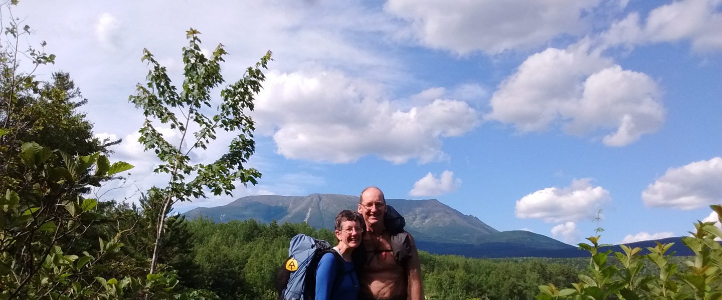
Six months ago, a crashing tree branch interrupted our Pacific Crest Trail hike. After choosing foot travel as a major form of transportation for many weeks, we entered the city of Seattle by ambulance.

Thus, our time of limbo began. Recovery in the hospital quickly led to more recovery time in an apartment near the hospital. As I healed, we progressed to visiting family in Oregon, returning regularly to Seattle to check in with the doctors.

That rogue tree branch had dealt quite a wallop. I felt as if I were in a state of suspended animation, waiting for the fractured occipital condyle and carotid artery pseudoaneurysm to heal in order for the surgeon to reassemble the eight pieces of my jaw.

While in Seattle, we explored our new home.

A ride on the ferry provided a porpoise eye view of the Seattle skyline.

The Fremont Troll, one of the better known denizens of the city, lurked beneath a bridge.

Christmas sparkles enhanced an already gorgeous winter sunset peeking between skyscrapers.

Who could resist playing next to the fountain at the Seattle Center?

One day we saw dancers getting filmed in front of a street mural.

A tugboat pushed a barge full of gravel through the Ballard (Hiram M. Chittenden) Locks, much to our delight.

One charming result of limbo time included meeting old friends and hikers from our travels. I still giggle when I think of the dinner conversation we had with Specs, a 2017 Appalachian Trail thru-hiker, now living in Seattle.

We traded tales of experiences on the trail. Specs described the odd looks given by other hikers each evening when he pulled out his after-dinner wine, packaged in a juice box with a sippy straw!

“It’s wonderful how hiking a long trail makes one appreciate the finer things in life,” I exclaimed.

Specs burst out laughing. “Yes, the perspective gained on the Appalachian Trail is what makes one designate things like wine in juice boxes as ‘finer things’ of life!”

Each time I visited the neurosurgeon, he told me my body was healing admirably, and then he’d send me off to go heal some more. When the neck brace was removed in December, I celebrated! Maybe now, four months after the accident, I would get my jaw operation!

I could scarcely contain my joy to be rid of the neck brace!

The craniofacial surgeon had other ideas. “The broken pieces in your jaw bone have grown together. Yes, there is nerve damage, and yes, none of your teeth meet, but your body has been creating new bone. We could operate, but it would put your healing back a good bit.”

“But I can’t chew, with my teeth not meeting,” I told him.

“I think orthodontics might help,” he told me. “It’s been such a long time since the accident, it might be better to look at different answers.”

He sent me to an orthodontist who had much experience with trauma victims. She was sure she could give me chewing capabilities again, possibly without surgery at all!

My mouth was measured and x-rayed and photographed. Teeth molds were made. Our most recent visit brought the fascination of seeing a digital model of my skull, with the jaw healed crooked and none of the teeth meeting.

Jay put my thoughts into words. “One wouldn’t even know how to begin to get those teeth aligned properly.”

The nurse responded encouragingly, “That’s why we have Dr. Chen! She’ll be using all this to make a plan for your teeth.”

This uncertain period, awaiting decisions and action, is almost over. My braces should arrive the last week of February, and I’ll embark on the final phase of healing. The orthodontist estimates it will take two years to put my teeth in order.

In the meantime, we’ll enjoy a bit of winter in Seattle. And begin making plans for more adventures in the spring!

City people, in general, don’t talk or even smile at one another when walking. But with snow came new opportunities. I found a temporary friend.

Afterword

December 1, 2017

It’s been exactly one month since we finished our thru-hike of the Appalachian Trail.  Jay and I spent 2,190 miles living mostly in a tent, spending each day watching the scenery pass by at walking pace, challenging our bodies with continuous exercise.  The transition to a more ‘sophisticated’ lifestyle has been interesting.  Though I enjoy daily showers, my skin has rebelled against the increased use of soap.  I can’t deny delighting in a warm bed, but I miss waking to the sunrise breaking across a ridge top.  I find that I have totally forgotten how to cook.  Our first morning home, I burned the eggs!  However, seeing family and friends is the best part of being back in civilization, and I have enjoyed every moment of those visits.

Many people asked me why we did this long hike.  After eight months, I can only conclude that curiosity was what kept me going.  I was curious as to how my body would react to such a long trek.  And I was curious to see new places, new faces, new sights each day.  The path of the AT brings incredible variety to the traveler!

So, what is next?  Jay and I will enjoy sheltering through the winter.  We plan to pare down our belongings considerably.  After living for eight months with just the contents of the packs on our backs, a houseful of stuff is overkill.  I will be re-designing this blog, making it easier (I hope) to navigate.  And next spring, we will don hiking gear and set out again, ready to enjoy this incredibly wonderful earth we inhabit.

IMG_20171117_102532006
Now that we are home, our daily walk brings a view of the Sierra Nevada mountains.

The End of Our Epic Trek

November 1, 2017

With just 8.5 miles left of our AT thru-hike, the last day dawned to rainy gray drizzle.  Once again we loaded packs into Edna’s van for the ride to Green Mountain Store, yesterday’s stopping point.  There we ate breakfast with our hostess, enjoying cups of hot coffee and tea as well as delicious omelettes.  As I hugged Edna good-bye, I could scarcely believe our hike was coming to an end.  Our last two nights had been passed in comfort thanks to these wonderful friends.  Now it was time to finish our quest.

Cold sprinkles of precipitation chilled our faces and slid down our necks as we hiked under slate-colored clouds.  But the sunless day couldn’t dampen my feelings of anticipation.  After eight months, our goal was practically in sight!

Water drops beaded across the backs of sassafras leaves and shimmered slightly on flame-colored maples and oaks.  Their beauty reminded me to slow down and savor this last day.

I could scarcely contain my excitement as we reached the northern border of Pine Grove Furnace State Park.  Our last half mile of trail was a delight – flat, wide, graveled, skirting a very scenic lake.  Quite a civilized ending after the arduous hills, mountains, cliffs, and rocks we had traversed during our journey.

Dave and Edna surprised us once more by meeting us at the state park with a thermos of hot coffee.  Such a thoughtful treat on this cold day!  But even better than the coffee was the company as Edna walked that last half mile with us, then both our friends posed in front of the Appalachian Museum.  Jay and I had last seen that building on June 21 – four and a half months ago!   Four thousand fifty hikers registered their thru-hike attempt with the Appalachian Trail Conservancy this year.  Only a quarter of those hikers finished.  And here we were, taking the last steps in our 2,190 miles.  Emotions threatened to overwhelm.  We had done it!

Appalachian Trail Museum at Pine Grove Furnace State Park was a fitting end to our trek.


Halloween on the A.T.

October 31, 2017

While hiking the A.T. in late October, a warm place to sleep is sometimes an extravagant luxury.  We were very grateful for the offer of two nights in a cabin from our new friends, Dave and Edna.  The cabin had charm, comfort, electricity, but no water.  Sunrise this morning found us well rested and ready for another day of hiking!

We climbed into Edna’s van as the sun rose over the fields and drove to Boiling Springs, the end of our hike yesterday.  This small town is the site of the Appalachian Trail Conservancy Mid-Atlantic Regional Office, an excellent place for hikers to get information and relax in comfort while recharging electronics.  Edna parked here and took us for a short walk to see the ‘boiling’ springs, millions of gallons of water forced to the surface via an artesian aquifer.  We enjoyed reading the historical signs and learning about the area before starting our day’s hike.

IMG_20171031_091221237
Part of the artesian springs which give the town its name.

It’s always hard to leave a trail town, and after saying good-bye to Edna, Jay and I couldn’t resist lingering to eat breakfast at the Caffe 101.  While there, our trail friends, Gator and Not Yet, arrived.  We dawdled over tea and coffee, chatting with the two of them, enjoying the unexpected encounter.  Gator told of spending a cold, noisy night at the Backpacker’s Campsite, near very active railroad tracks.  Not Yet had taken refuge at a convenient hiker hostel.

With “so long” and “see you down the trail”, we finally tore ourselves away and soon began climbing to Center Point Knob.  This monument from 1937 marks the original halfway point on the Appalachian Trail.

IMG_20171031_103942509
Center Point Knob – with no other hikers on the trail, we were forced to take a ‘selfie’!

Many people celebrate Halloween by navigating a corn maze with friends and family.  We celebrated by traversing a “Rock Maze,” half a mile of impressive boulders arrayed along the top of a ridge.


IMG_20171031_135647722_HDR
Inside the maze, an arrow pointed to Georgia!

From the maze, the trail led downhill to roam across streams and roads.  Stomachs growled with hunger as we reached the Green Mountain Store off PA Rt 34, eleven miles from our morning start.  We dined with Not Yet and Dave before climbing into Dave’s van.

IMG_20171031_163823255
On the porch of the Green Mountain Store, from left to right, Jay’s pack, Sarah’s pack, Not Yet’s pack.  Quite a difference in size and weight!

As late afternoon darkened to dusk, our friend, host, and driver suggested we explore Gettysburg, 17.5 miles away.  And so we ended Halloween with a visit into history, reading notices by flashlight, imagining the valiant characters depicted on the biographical signposts.

Cumberland Valley

October 30, 2017

Monday dawned with cloudy skies, cold wind, and a crisp, fresh smell across the land.  A fierce storm brought three inches of rain on Sunday, leaving the woods scrubbed clean.

The trail before us crossed the Cumberland Valley, eleven miles of gently rolling terrain, crossing rain-swollen streams, fields, forest, and swamp.  Variety!  The spice of the AT.

Conodoguinet Creek displayed the power of yesterday’s rain as brown water raced by, extending up the banks, flooding trees, carrying driftwood past at dizzying speeds.  I remembered a snippet of conversation with our new friends, Dave and Edna, yesterday.

“I grew up near Conodoguinet Creek,” Edna had told us.  “We called it ‘Cannot Go In It Creek.’  My mother made sure all of us children learned to swim, but even so we weren’t allowed to play in the creek by ourselves.  It can get pretty big at times.”

IMG_20171030_095322376
Flood waters of Conodoguinet Creek

The trail followed the creek for a time, with many branches blocking the path after yesterday’s storm.

IMG_20171030_100343366
Blow downs slowed our progress.

I was also glad of the occasional boardwalk over particularly swampy sections.

IMG_20171030_094040743
Boardwalks keep our feet dry and protect fragile environments.

A bit farther on, Jay and I noticed some osage orange seed balls, slightly larger than tennis balls and about the same color.  This tree was highly prized by Native Americans for making bows.  Colonial settlers used the wood for fence posts.  Jay paused to play with a few seed balls.


Forest gave way to fields, and we passed wind-tossed corn crops.


At Trindle Road, a kiosk sign gave us a wider vision of the valley through which we were hiking.  We learned that the Cumberland Valley is part of the Great Appalachian Valley, a giant trough, or chain of low hollows, stretching 1,200 miles from Northern Alabama to Quebec.  It has been used as a travel route since prehistoric times.  Geologically, the valley is a mixture of limestone bedrock and upwellings of igneous rock, creating some of “the richest topsoil in America.”

Near the end of our day, we came across another sign that invoked hearty laughter.  After all the truly rough terrain we have crossed in our 2,190 mile trek, why did someone think this sign was important to place before these small bumps?

IMG_20171030_110936152
I laughed for a mile!

The evening brought us to Boiling Springs, PA.  We were charmed by the beauty of this scenic small town, but too tired to truly appreciate it.  When Dave picked us up, we gratefully climbed into his warm vehicle, ready for a snug night’s sleep after our lovely but cold day of hiking.

A Change of Plans

October 27, 2017 (Friday)

Zero day! What a wonderful tradition! During the past two weeks, Jay and I have often felt worn down, easily tired, without the energy we are accustomed to having. A day of rest is not only welcome, but very needed in order to stay healthy.

Last June we camped near a shelter full of eight Amish young people backpacking for a week in Shenandoah National Park. We enjoyed talking with them, and I have subsequently been corresponding with the leader of the group. Today she invited Jay and me to visit her family and home on Sunday! We are so excited! In order to accomplish this, we have decided to slack pack tomorrow (Saturday), coming back to the hotel tomorrow night, to the luxury of a hot shower. That way we will at least smell clean for our visit the following day, even if we only have hiker clothes to wear!

October 28, 2017 (Saturday)

The hotel owner provides a shuttle ride (for a fee) to Sherwood Road this morning. Our plan is to hike 13.5 miles back to Duncannon. We are on the edge of the Cumberland Valley, and our first landmark is a tunnel under PA Route 944.

IMG_20171028_095118826_HDR

The morning sky is a beautiful deep blue, with cloud wisps of mares tails across its zenith. The leaves on the ground are a mosaic of red, yellow, orange, purple, tan.

IMG_20171025_083040458
Eyes busy soaking in leaf color!

In the afternoon the wind picks up, bringing a layer of dense grey clouds to obscure the morning blue. As we pass the turn off to Cove Mountain Shelter, we meet four hikers in their twenties, searching for an elusive view of a river bend with a mountain rising from the middle of the watery curve. We can only tell them that we have not seen such a view in the last nine miles.

Two miles later we reach Hawk Rock, a very popular viewpoint for day hikers, crowded with people. A man and boy practice throwing a knife at a tree. A couple with a dog look at the view. Another small group is having a picnic. As we enjoy the scenery, the four young people we met earlier arrive, having never found their other view, but enjoying this one.

I ask a hiker, Beth, to take our picture. She talks with us for several minutes, very interested in our thru-hike adventure. She tells us that we are an inspiration. After 2,000 miles of hiking, I don’t really feel like a guiding light. We’re just hiking and having fun. However, perhaps our story will be a catalyst for Beth to make her own story.

IMG_20171028_164723126
View from Hawk Rock. Sun still shining, but clouds are gathering on the horizon.

We arrive in Duncannon just in time to eat a delicious bacon cheeseburger, then watch the last half of a Halloween parade through the main street of town. Back at the hotel, we watch the news, and hear a prediction for three inches of rain tomorrow! Yikes!

October 29, 2017 (Sunday)

Amanda, our Amish friend, arranged for a very nice Mennonite couple, Dave and Edna, to pick us up this morning in their van. Dave has thru-hiked the AT twice, and has a very impressive grasp of its geography.

Although Amanda’s family home is only 30 miles away, Dave tells us, “There’s no good way to get to Amanda’s house.” Before I can embarrass us all by offering the services of Google maps on my phone, Edna pulls out an atlas (paper!) with which to navigate.

We reach the home, and are greeted by the eight young hikers we had originally met in Virginia as well as Amanda’s parents and other siblings. There are about 20 people by the time we all crowd inside!

As we are seated, I suddenly realize that I am sitting on the male side of the room, with all the females an impossibly far distance away! What to do? … I start talking with the young boys sitting near me.

Then hymnals are brought out. “Since it is Sunday, we will have a hymn sing,” Amanda’s mother explains. I am delighted!

The first hymn is beautiful, with words about how if all the ocean were ink, it would run dry before it could finish describing the love of God. The second hymn tells the need of prayers from loved ones while on a journey – very appropriate, I think. I begin feeling at home, hymnal in hand, surrounded by people singing. In their hymnal, I notice an old beloved hymn, “This Is My Father’s World”, so I dare to request it. When we finish, Dave remarks, “That’s a good song for the AT!” After several more tunes, the hymn sing ends with a song in Pennsylvania Dutch. The chorus is about the love of God – Gottesliebe – that is the only part I understand!

After singing, lunch is served buffet style, and people begin mingling. The young people quiz Jay and me about our hike. In turn, they share a bit of their lives. Jay and I feel honored to be included in their Sunday!

After four hours of visiting, it’s time to leave. We climb into Dave and Edna’s van. Dave wants to take a different way back, so once again Edna pulls out the atlas. However, Edna falls asleep and we miss a turn. Suddenly, Dave exclaims, “Hey, this is where the Tuscarora Trail crosses Rt. 39! How can that be? I was on Rt. 850, following the AT!”

“Navigating by trails while he drives! That’s impressive!” Jay comments admiringly.

Edna wakes and gets us back on track. As we approach the hotel, Dave and Edna surprise us with an invitation to spend Monday and Tuesday nights at their home!! With the memory of cold wind last Thursday and all the rain that has fallen today, I am delighted to accept their incredibly generous offer, knowing we will have a warm place for our last nights on the trail! What a change in plans!

Duncannon

October 26, 2017

Seven miles from our campsite, the town of Duncannon, PA, awaits us with the promise of hot meals, luxurious showers, and a needed day of rest. It has been six days since my last shower, and 13 days since our last full zero – a day with no hiking. To say that I am anticipating this stop is putting it mildly!

We hike predominantly downhill, towards the Susquehanna River. At the bottom of our final steep slope, the AT crosses railroad tracks. A sign warns hikers to cross quickly, as the railroad is an active one. “Do not walk along the length of the rails” the sign cautions. Jay and I read the sign, then pause, perplexed. There is a very long train sitting on the rails right in front of us. If we go around it, we will be ‘walking the length of the rails’. If we cross quickly, we will have to climb over the coupling between two box cars. Which choice is least dangerous? We choose to climb.

IMG_20171026_120449851
An unusual obstacle on the AT!

Two rivers meet at Duncannon, the Susquehanna and the Juniata. The Susquehanna River is crossed by Clarks Ferry Bridge, 2,088 ft of highway with a pedestrian walk attached to one side. This was a pre-colonial ford used by Native Americans, then a ferry route in the late 1700’s, morphing to a dam with a mule-drawn canal route, then a very long covered bridge, and finally the modern bridge of today. Quite a lot of history! Afterwards, the bridge crossing the Juniata River gives us 650 more feet of airy pavement before depositing us on dry land, with streets leading into Duncannon.

IMG_20171026_121010918
A modern walkway covers a lot of history on the Clarks Ferry Bridge.

Our first focus is a hot meal, so we head for the Doyle Hotel, an iconic landmark of the Appalachian Trail, known for excellent food at reasonable prices, gracious hosts (Pat and Vickey Kelly), a rather ramshackle exterior, and a clean and welcoming inside. The Doyle has been in operation (under various names and owners) since the 1770s. Pat and Vickey Kelly have worked to turn the hotel and restaurant into a family and hiker friendly place, with truly excellent food.

We enjoy the quiet atmosphere while chatting with our hostess, Vickey.

“How has business been?” Jay asks. “Did you have a good summer?”

“No!” comes the explosive answer. “Unfortunately, a local church with a new pastor decided to give everything away to hikers this summer. They were providing free meals, camping, food resupply, shuttles – everything! It hurt a lot of businesses in town.”

We sympathize, and the talk turns to other things; stories of famous hikers, lists of hikers from foreign countries, compliments of the delicious food. Later, Jay and I talk about Vickey’s frustration. It does seem too bad that one man’s vision of a mission became other people’s financial hardship.

After our delightful meal, we wander the streets for a while, checking out resupply opportunities in the convenience stores. Obviously, these stores cater to hikers, for their supplies are extensive and varied. Then it is time to call a shuttle to our hotel choice for the night, the Red Carpet Inn, located about three miles out of town. We settle in to a clean, large room, full of the luxuries coveted by thru-hikers – hot showers, cold sodas, clean sheets, warm room.

We have 45 miles left of our hike. Tomorrow will be a zero day, then four more days of hiking!

Peters Mountain

October 25, 2017

Wind blows up the ridge, tweaking my nose with a hint of frost, sending icy fingers down my neck, creeping under the edge of my coat. Though the morning had dawned with a glorious sunrise and mild temperature, the weather this afternoon as we hike the length of Peters Mountain is a different story. Relief blossoms as Peters Mtn Shelter looms through the trees. I have only one thought as I trudge up the path. ‘Please, oh please, may this shelter face away from the wind.’

The first shelter on Peters Mtn was built by Earl Schaffer, author of Walking With Spring and the first reported thru-hiker of the AT, in 1948. (That shelter is now on display in the Appalachian Trail Museum at Pine Grove Furnace State Park, Pennsylvania.) The current structure was built in 1994, and is a virtual palace, sleeping 20 people.

Unfortunately, the shelter does face into the wind on this day, but it is so big, we manage to huddle in a shielded corner and eat an early dinner while enjoying the sight of rows of trees marching down the ridge.

About a mile farther, we come to Table Rock, serrated layers of sandstone tilted towards an astounding view. Below us, a flock of turkey vultures with distinctive red heads and V-shaped silhouettes, take off from a tree and soar skyward. To our surprise, another tree suddenly erupts with soaring birds – black vultures, identified by white-tipped wings and a straight wing silhouette. We watch, enthralled, as both flocks make graceful, ever-widening circles, eventually disappearing over the edge of the next mountain. For a few magical moments, the cold wind is forgotten as my imagination takes fire. What did the turkey vultures smell? The black vultures, having a less keen olfactory sense but a more aggressive nature, were obviously following the turkey vultures, probably bent upon exploiting the first group’s meal. What sort of carrion will they all descend upon? Standing on the cliff side, I want to spread my arms and take off, following to see the end of that story.

We continue hiking along the top of the ridge, giving our legs a workout as we negotiate the rocky trail. About 5:00 p.m., we come to PA Route 225. This very busy road makes a hairpin turn at the top of the ridge just where the AT crosses. I’m relieved to see a pedestrian bridge above the road, allowing us to cross in safety.

With darkness an hour away, and the busy road behind us, our next priority is finding a campsite. As dusk nears, tent sites have a habit of disappearing. This phenomena is so common, hikers call it, “sunset panic”. We hope for a flat, rock-free piece of ground on the lee side of the ridge. But the steep-sided trail continues stubbornly on the windward side, with a liberal covering of rocks. We cross under a power line, and Jay detours uphill, questing for a possible campsite just over the crest. I gratefully take a moment to rest, letting the exhaustion of the day catch up.

When Jay returns, his face shows apprehension. “It’s possible to pitch a tent up there, but it’s not ideal. We wouldn’t get much sleep. I know you are tired. What do you think?”

I am tired, but I know a good night’s sleep is important. “Let’s keep looking. We’ve got about 45 more minutes of daylight. And we can always use our flashlights and hike all the way to the next shelter if we need to. But surely there will be something before then!”

On we go, Jay ranging ahead, me following slowly. My legs are outraged. They can’t believe I just sentenced them to possibly two more hours of walking today!

Fifteen minutes later, the trail finally flips to the lee side of the mountain. ‘There must be a place along here. Oh, please don’t head back to the other side,’ I think furiously at the trail. Another ten minutes of walking, and I gratefully make out Jay’s figure in the deepening dusk. He has found a very old campsite, hemmed in with underbrush and covered in leaves, but with the required flat rock-free space for our tent. We are three miles short of Clarks Ferry Shelter. Very soon I am gratefully crawling into our tent, glad to be protected from chilling air currents, and so very glad to be horizontal after a long day!

Still Southbound …

October 21, 2017

Pennsylvania’s mining history is ever present on the Appalachian Trail. Leaving Port Clinton, we crossed the Schuylkill River, then crossed railroad tracks at the Reading Blue Mountain & Northern Railroad Station. I was delighted to see a display of anthracite coal! The boulders resembled giant pieces of obsidian (black volcanic glass), but when I rubbed one with my fingers, black dust came off. The juxtaposition of polished, gleaming surfaces becoming black dust with the touch of a hand fascinated me.

IMG_20171021_104033488

Hiking the AT in October brings us into contact with many hunters as the trail runs through several sections of Pennsylvania Game Lands. One early morning, we saw two bow hunters loading a deer into their truck. Another evening, we passed a group of hunters camped in a small hollow. This morning, we saw blood spots dotting the trail for about a mile as we walked. Later in the day, a pile of entrails beside the trail attracted flies and yellow jackets. Many signs at trail heads warn us to wear blaze orange or other bright colors, and we are careful to stay on the trail!

October 22, 2017

History continues to capture our imaginations with a monument to Fort Dietrich Snyder, used in 1755 during the French and Indian War. For several miles afterwards, we imagined how a war would affect our attitude as we hiked through the forest. The peace and renewal we find were certainly not present in 1755!

This evening, we camped at Applebee Campsite, near the Pilger Ruh Spring. I went in search of water, following blue blazes downhill through deepening dusk. A burbling, splashing sound brought me to a lovely spring. Nearby, a historical sign commemorated Moravian missionaries led by Count Zinzendorf, who stopped to rest here on their way to the Indian towns of Shamokin and Wyoming in 1742. As I filled my water bottles and headed back to our tent by flashlight, I could see a group of missionaries, building a fire, laying out bedrolls, feeding horses. In my imagination, our simple campsite suddenly was full of shadowy visitors from long ago.

October 23, 2017

We woke to dense fog obscuring the sunrise, extending the night. An hour after rising, enough sunlight began filtering through to allow us to see color, but the fog continued to wisp around tree trunks. As we hiked, a cross-bow hunter suddenly stepped out onto the trail about 20 yards ahead of us. He didn’t say anything, just turned and walked away, disappearing quickly back into the fog.

IMG_20171023_075601714
Foggy morning.

This afternoon we met another hunter as we crossed Swatara Creek and PA Route72. Scott chatted with us for a few minutes. He told us he was hunting pheasant, and kindly let us take his picture.

IMG_20171023_155357954_HDR

October 24, 2017

Once again the sound of raindrops inches above my face wakes me. It is 5:00 a.m., very dark, and rain is pouring out of the sky! We doze, secure in our dry tent, not willing to go out in the cold and wet. At 7:00 a.m., the rain begins to lessen, and we finally rise an hour later, with only drizzly drops from trees as our company.

We hike through the waterlogged forest, skirting puddles in the trail. Four miles into our day, we cross Rausch Creek, and meet the only people we will see today, four boys and a girl who have ridden bicycles along an old railroad bed to this bridge. Jay notices that the old road is graveled with bits of coal! There are several signs here, telling of a limestone diversion well which helps to neutralize acidic water coming from old coal mine drainages upstream.

IMG_20171024_113956863
A limestone diversion well.

Tonight we camp just past Rattling Run, on top of a ridge with many pine trees. A lookout tower once existed here, the only reason this part of the ridge is relatively free of rocks. Someone has built furniture around the campfire circle, and I find a lovely tree to guard our food bags. The pine trees scent the air with freshness, and we go to sleep with hopes of a beautiful sunrise tomorrow!

October 25, 2017

The morning dawned in beauty and warmth. Two squirrels eyed us as we ate breakfast. I’m sure they could smell our sardines, and wondered if they were good squirrel food! A train whistle echoed up the ridge, sounding far away from our beautiful spot. The allure of our campsite made it hard to leave this ridge top.

IMG_20171025_074329449
Sunrise!

Hiker Fun

October 19, 2017

There can be a sense of mischievous power in the opportunity to wake up a friend. This morning, we rose early as usual, getting on the trail at 7:30 a.m. An hour later, we passed a hammock and tarp strung between two trees, with gear neatly stored nearby.

“Hey, isn’t that Gator’s hammock?” I asked. At the sound of my voice, convulsive movements set the hammock swinging, bulges rippling across the surface.

“Maybe it’s a chrysalis,” Jay teased. Then, as a foot and ankle appeared, “Lookout, something is emerging!”

A couple more spasmodic lurches set Gator free. The three of us were delighted to see each other, and immediately began talking like old friends, topics ranging from the state of the trail to favorite books.

We first met Gator, an 18 year old southbound thru-hiker, in the 100 Mile Wilderness in Maine. We were impressed by his obvious youth, mixed with an amazing air of competence, and a hiking pace at opposite ends of the spectrum from ours. We rise early, hike slowly and steadily all day, and stop as evening falls. Gator rises late, hikes and runs along the trail at an incredible rate, and stops whenever the whim hits him. Thus, in the last 1,000 miles, our paths have crossed unpredictably, but always happily.

After a good twenty minutes of lighthearted conversation, Jay and I tore ourselves away, continuing down the trail as Gator began his morning routines. “See you when you pass us!” I called as we left.

IMG_20171019_093750196
Gator, a fascinating conversationalist!

It’s been seven days since we crossed into Pennsylvania, and I am just beginning to get a feel for this state’s infamous rocks. The AT follows the tops of many ridges, with a mixture of flat, level path and crazy rocks which show little semblance to a trail. White blazes upon rocks and trees are sometimes the only reassurance that we are, indeed, still on track. More protruding rock jumbles are graced with names … Bake Oven Knob, Bear Rocks, the Knife Edge, Dan’s Pulpit, the Pinnacle.

Some of the trail looks as if a dump truck spilled a pile of boulders down the mountainside, causing me to slowly step up, walk across, step down, step around, step up, step down, etc. Today, I took my courage in hand and began to step from pointy top to pointy top, hopping, leaping, balancing. It took a bit of nerve, a good bit of inner core muscles, and incredible focus to negotiate a spill of boulders in this fashion. I couldn’t keep up my momentum for more than 20 yards or so, but for those few seconds, I felt like Super Woman, flying through the forest!

We continued hiking, enjoying a warm autumn day with blue sky above and insects humming in the forest understory. I was about to try my new Super Woman powers again when suddenly a sharp electric shock ripped across my ankle. “Aaah!” I cried out, looking down to see a yellow jacket stinging me through my sock! “Oh, oh, OUCH!” I screamed, flailing wildly at the ferocious insect. Fearful that one insect meant a whole hive, Jay and I ran for a few yards, leaving the menacing hum behind.

When we stopped to take stock, my ankle throbbed with savage pain spreading quickly through my foot and up my leg. Jay handed me a Benadryl tablet while I sniffled and moaned. That stupid ankle hurt the rest of the day, burning and feeling as if it was covered with blisters. Fortunately, the Benadryl stopped the spread of pain, and that evening in the tent, I was pleased to see no swelling at all! Hurray for modern medicine!

In the late afternoon, we came to a side trail to The Pinnacle, a set of rocks with a panoramic view. Most side trails off the AT are marked with blue blazes and small signs. The side trail to The Pinnacle is also marked with a cairn. But not just a cairn. More like a mountain of a cairn, reaching at least 20 feet high, engulfing the trunks of a couple of nearby trees. The amount of time and energy needed to build such a monument boggled my mind! Later, a local hiker told us a school used to be responsible for trail maintenance there, and the school children started a tradition that it was good luck to put a rock on the cairn. What fun, turning work into play!

We walked down the short trail, and suddenly found ourselves upon the edge of the world! I was reminded of McAfee Knob in Virginia. The ledge simply summoned one to its brink, the better to absorb the view! Of course, knowing my relationship with heights, I have to admit – I scooted to the edge on my rear! But however one gets there, The Pinnacle puts the crown of fun on a very pleasurable day of hiking!

.

IMG_20171019_165413972_HDR
Pennsylvania at my feet!