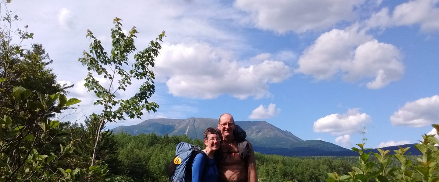
Southbound …

July 5, 2017

IMG_20170705_161032143
The day after climbing Katahdin, the mountain already looks a little far away!

So here we are, heading south on the AT, hips a little creaky, legs a little rubbery, but ready for more adventure and beauty!  Jay, with the wisdom of experience, has scheduled ten easy miles for us, from Katahdin Stream Campground to Abol Pines Campground, ending our recovery day with a lovely fish and chips dinner at the Abol Bridge Northern Restaurant!

We are both sore, and battling headaches from the exertion of climbing Katahdin.  The miles slowly pass with much natural beauty attempting to distract us from the pain of our bodies.  Little Niagara and Big Niagara Falls are awesome!  Water pours over a series of ledges, throwing up mist and froth, swirling at the bottom into a classic pool.  “If this were anywhere else in the lower 48 states,” I remark to Jay, “there would be a road to these falls, with crowds of people!  Instead, we have it all to ourselves.  This is incredible!”

July 6, 2017

Both Jay and I are still tired from Katahdin!  This is very surprising to me.  I really expected to feel better today, after taking an easy day yesterday and getting a delicious meal at the restaurant.  I guess climbing that mountain is not something one does on a whim!

We begin to meet many other southbounders today.  All are tired, yet a little giddy.  After all, they just conquered a trail that had to be painted onto rocks!  How tough could the next 2,180 miles be compared to that?

As I think of all the people hiking the AT, each with his or her own agenda, schedule, ideas, joys, fears, experiences, a young hiker named Homer puts it into words:  “There is only one path, the path you take.”

July 7-9, 2017

We enter the 100 Mile Wilderness!

20170706_084450

During this three days, we gradually recover our energy.  We also see many lakes and ponds, bogs, moss, trees, mountains.  Beauty is all around, it is our job to notice it.

We continue to meet more southbounders, beginning to put names with faces as we leapfrog with several small groups of hikers.

We hike, swim, eat, sleep, and get up to do it again!  The lakes and ponds are so shallow, that the water is actually warm, a real treat!  One day we see loons, another day we see mergansers.

On July 9, as I’m walking down the trail, I look up to see a marten peering at me from behind a tree trunk!  I stop, amazed and enthralled.  “Jay, look!” I whisper.  We watch as the marten runs up the tree trunk, peers at us again, makes a flying leap to another tree, then disappears into the green north woods.  Wow!

July 10, 2017

White Cap Mountain begins our day, the first mountain since Katahdin that is above tree-line.  My pack feels heavy, and I am very slow over rocks and roots.  The top is cold, windy, a little rainy.  We take a picture, then scurry down to the protection of tree-line!

This same day we also climb Hay Mountain, West Peak, and Gulf Hagas Mountain.  Yes, this is the AT. Either the trail goes up, or it goes down.  Yee-hah!

July 11-13, 2017

The trail continues to challenge us with bogs, boulders, roots, rocks, mud, granite, vertical scrambles and horizontal boardwalk balances!  A hiker named Mike describes the roots as looking like someone spilled a bowl of spaghetti across the ground.  When it rains, those roots are about as slippery as spaghetti also!

20170706_130012

The trail also continues to give beauty at every turn, with sunlit lakes, misty bogs, mountain peak views, and deep forest shade.  My pace has slowed, from a 45 minute mile to a 75 minute mile.  It takes all day just to go 10 miles.  If I think of how slowly I am hiking, I get discouraged.  But Jay says to keep enjoying this beauty, and he is right.  We are lucky to have enough time, enjoying the warm summer months in these north woods.

20170714_074732

July 14, 2017

We made it to Monson, Maine!  Hot showers! Clean clothes!  Resupply!  Restaurants!

IMG_20170714_162948930
Incredible food at the Spring Creek Bar-B-Que!

July 15, 2017

Monson is having it’s Summerfest this weekend.  What fun!

IMG_20170715_143504719
This is the “Anything Floats” Race, with three entries!  Homemade craft paddled across the Monson Pond.  Fun!

The day ends with fireworks at the ball field while the Spring Creek Bar-b-que Restaurant pipes patriotic tunes, including, “Proud to Be an American” and “The 1812 Overture”.  What a lovely end to our zero day!


For more pictures of  our adventures, please see our photo pages on the Menu!

Katahdin!

July 4, 2017

Katahdin!  The terminus of the AT for northbound hikers holds the beginning of adventure for southbounders!  For Jay and me, as flip-floppers, the climb up Katahdin marked the midpoint of our journey.

From Millinocket, Maine, the Appalachian Trail Lodge shuttled us to Baxter State Park, depositing us at the ranger station.  We parked our backpacks on the ranger’s front porch, stuffed a borrowed day pack with food and rain gear, and registered.  Finally, it was time to go!

The first mile of our journey was quite easy, with a wide trail, gentle tread, and scenic vistas of trees, rock, and moss.  Winding rock stairs meandered up the foot of the mountain, gaining elevation in four inch increments.  The mile ended at a stream with a Boy Scout-built bridge and a privy!  What a practical thing to put on this heavily used trail!

Continuing past the privy, the trail gave a little evil chuckle, and suddenly boulders began appearing as the gradient steepened.  Tangled bushes and thickets of pines pressed around us, forcing us to stay on the narrow stony track, conveniently marked with white AT blazes.  From knee-high to thigh-high, the boulders required climbing, scrambling, clambering, shinnying, and sometimes crawling.  “This isn’t so bad,” I remarked breathlessly.  “It’s a little steep, but I can do it.”

About the time I was thinking of lunch, we reached tree-line.  Suddenly, instead of a narrow path, the painted white blazes traversed the tops of a whole field of boulders.  These rocks were car-sized, and vertical.  My eyes traveled out, and up, and more up.  “Oh geeze,” I thought in sudden panic.  “What have I got myself into?  I don’t like climbing mountains!”

The clouds that had been hovering all morning suddenly descended to eye level, spitting a few raindrops, but mostly just obscuring the view with mist and fog.  That was fine by me.  What I couldn’t see, didn’t exist, which allowed me to focus energy and muscles on each individual boulder challenge, following Jay as he disappeared above me into the atmosphere.  An occasional piece of re-bar hammered into a rock face helped me climb, but I often felt that I could have used a whole ladder on most of those boulders.  Toes, fingertips, knees, thighs, even stomach and posterior came into use as I crept up the ridge.

Finally, after an eternity of granite, we reached what is known as the Tableland, a relatively flat mile on top of Katahdin.  The trail continued to boulder hop, but with smaller stones and more horizontally.  Fortunately for me, the clouds persisted, obscuring the view.  I was able to lie to myself, “See, you’ve done the hard part.  The top is probably just a few minutes of easy walking!”  Although my intellect knew the Tableland was slightly over a mile long, my gut was happy to accept the lie as we kept walking and walking and walking…

Just as I was about to give up completely, Jay said, “I see it!  We’re almost to the sign!”  Hopefully, I stopped, looking up, peering through the swirling mist.  No sign.  No celebrating people.  Just gray, blank cloud.  My shoulders sagged.  My eyes fell back down to the boulders, my feet relentlessly taking slow step by slow step.  I was sure Jay was right, but I was too tired to believe.

We climbed over a tiny hump, indistinguishable from the hundreds of tiny humps I’d already ascended during this last mile.  But there, through the mist, a shape loomed precipitously above us, dim blobs of color resolved to people taking pictures, and we were there!  The top!  Katahdin!!!

In honor of our nation’s birthday, we had brought patriotic wigs to wear for our picture by the famous sign.  Many people laughed and cheered as we donned our 4th of July head gear and posed.

Ten minutes passed as we ate a quick snack, preparing for the five miles downhill still ahead of us.  Just as we were finishing, the clouds abruptly rolled off the top of the mountain, revealing spectacular scenery below – lakes, mountains, trees, granite.  Nature’s glory at our feet!  The sign was mobbed as people rushed to get their picture with the view.  We settled for a picture of the view a few feet away from the sign.

20170704_142932
Nature’s glory below us!

And then it was time to descend.  Five miles, retracing the route we had so laboriously just climbed.  But now I could see our route!  It was amazing, looking at what I had climbed in blind ignorance.  The last piece of re-bar completely did me in.  As my toes felt for a hold on the rock, my eyes were inexorably drawn to the empty air between my legs.  I froze, shaking, as I clutched that piece of iron with a death grip.  Jay soothingly talked me down, helping me to focus on the problem of where to place each part of my body, instead of all the uninhabited expanse around my body!

We reached the ranger station just as day succumbed to darkness, having spent 12 hours climbing up and plunging down this mountain.  I couldn’t have completed Katahdin without Jay’s help.  I was tired, sore, and so glad to be on real dirt, not bare granite!  My sleeping bag had never felt so luxurious as we settled into our reserved campsite at Katahdin Stream Campground.  Aaaaah!