Lehigh Gap, Pennsylvania. When hikers talk of strenuous portions of the AT, this spot invariably is mentioned. I’ve been nervous about this site for weeks. I’ve tried to reassure myself. After all, the White Mountains of New Hampshire and the mountains in southern Maine were surely more extreme than a gap in Pennsylvania. How tough could it be?
Morning dawned clear and cold. 38 degrees Fahrenheit cold. BRR! I wore every stitch of clothing from my pack last night, and still wore an extra layer this morning as we began hiking.
The first three miles ran along the top of the ridge of Blue Mountain. The trail was a mixture of dirt, rocks, and grass. Quite nice in places!
Blue Mountain is part of an EPA Superfund Site, the result of nearly 70 years of zinc smelting operations in the nearby valley and town of Palmerton. Huge quantities of heavy metals were emitted throughout the area. Three thousand acres of revegetation with grasses, and the planting of 13,000 trees was completed in 2013. Jay and I were interested to see the healthy trees, about head high, growing along the ridge.
The fourth mile of our morning began as the trail took an abrupt dive over the edge of the ridge, heading straight down over cliffs and car-sized boulders to the Lehigh River below. In one mile, the trail loses 1,000 feet of elevation. One hiker described it as “thrilling on a windy day.” I was glad to have a day of gorgeous sun, blue sky, and just the merest kiss of a zephyr to keep us cool on the cliff. Nevertheless, as Jay paused often to enjoy the incredible views, I kept my eyes strictly upon the next rock to negotiate!
At the bottom, I was jubilant! The last “cliff” of our hike, with no hurt body parts! In actuality, the trail was mostly very steep, sometimes with rock stairs, and only two parts that required scrambling and climbing. I gave Jay an ecstatic hug, saying, “We did it! Woohoo! Pennsylvania, here we come!”
Sarah slithers and oozes over boulders, keeping her eyes steadfastly upon the rocks, not the spectacular view so far below.
For the last couple of days, Jay has been aware of a rash spreading across his right shoulder and ribs, looking suspiciously like poison ivy. Since Jay is very allergic, and always needs medical intervention to heal, we decided to take a detour to the town of Wind Gap, PA today.
A misty drizzle caused us to don rain gear as we hiked. To reach Wind Gap, we walked two miles on the AT from our campsite, then 1.5 miles on a road. Road walks are never much fun, but on a rainy day, with cars splashing puddles of muddy water across our legs, I was less than enamored with the morning. A half mile into our road walk brought us to a convenience store, where we decided to stop for a rest and a drink.
While I was buying our refreshments, a man approached. “Hi, are you a hiker?”
“Yes,” I replied. “My husband and I are hiking the AT.”
“How’s it going? Do you need money?” he asked.
I didn’t think we looked that down and out, but perhaps the last 2,000 miles was beginning to show! “No thank you. Although we wouldn’t turn down a ride to the doctor’s office,” I managed to say over my surprise.
“Oh, I’m not headed into town,” he said. “Is it anything serious?”
“No, my husband just has a bad case of poison ivy,” I explained. “It’s okay. We can walk the next mile.” (In the rain, my inner voice complained.)
The man drove off, and Jay and I began walking again. A few minutes later, he pulled up beside us! “I got down the road a ways, and was convicted by the Holy Spirit,” he told us. “I knew I had to go back.”
We enjoyed the ride in dry comfort. We learned that the man had been rescued from the World Trade Center on 9-11. The ride was very short, so we didn’t learn much more. We thanked him several times, and he headed off. Once again, the AT provided another adventure!
The doctor told Jay he had poison oak. He said he could tell the difference because poison oak made a clumpy rash instead of a spread out rash. He gave Jay a prescription for steroids to dry it up.
Jay’s bug pants fascinated the doctor. He said he treats sooo many people with Lyme disease, and he is going to start recommending the pants to his patients. (See my blog titled “Fashion versus Function”, written August 25, for a description of the pants.)
From the clinic, Jay and I walked to the grocery store for resupply, picked up his medicine from a nearby pharmacy, and ate lunch at a Chinese restaurant. The cook was very surprised to see us with our backpacks. “What are you doing still out on the trail?” he asked. “The season is over! It’s getting cold out there!” I was touched (and a bit amused) at his obvious concern.
The rain stopped as we were eating lunch, which made the road walk back to the AT much nicer. Full stomachs and the memory of kind people helped also!
Our mileage total was seven miles, with four and a half hours spent in town. We stopped near the Leroy Smith Shelter at 5:00 p.m.
We ate dinner, and I hung the food on a fabulous tree branch, perfectly placed to be easy access for me and difficult for questing critters. While Jay set up the tent, I went in search of water. The map indicated three springs here, all down hill from our camp site. The first two were dry. A half mile after setting out with empty water bottles, with dusk collecting under the trees, I was beginning to despair. A small sign nailed to a tree said, “Spring.” I turned off the trail, and found water gushing out of the ground! What a relief! Joyfully, with heavy water bottles, I headed the half mile back to our camp site. Jay met me halfway. He had already put up the tent AND laid out both sleeping pads, then came to find me in the evening twilight. What a guy! As I brushed my teeth in the dark, once again I felt so very blessed.
We crossed from New Jersey to Pennsylvania today! We are now on our last state, with approximately 200 miles left to hike. (Although, who’s counting?)
This sign is in the middle of the bridge crossing the Delaware River.
The crossing from New Jersey to Pennsylvania was actually quite dramatic. The Delaware River divides the two states, and the AT crosses this river using a bridge shared by Interstate 80. The 2,465 foot (almost half a mile) bridge has four lanes of speeding traffic and a sidewalk. Pedestrians are separated from cars and trucks by a waist-high concrete divider. Nevertheless, with trucks shaking the middle of the bridge, wind trying to pluck our packs off, and noise buffeting our ears, I admit to being scared. What a relief to reach the other side, and walk into the town of Delaware Water Gap, PA.
The barrier between us and traffic felt rather feeble!
We first met Grey Beard in Virginia. He is an 82 year old hiker with a goal to set the age record for a thru-hike of the Appalachian Trail. Over the course of the last 2,000 miles, we have met him several times. He always has a smile and time to stop and talk. He taught us to recognize chestnut trees during one chat. Another day, he gave us his philosophy of life, distilled into one sentence, “Do something you love and be happy.”
Graybeard talking with some day hikers.
This afternoon, just after we crossed a road, we saw a hiker approaching.
“Hey, how’s it going? Isn’t it a beautiful day?” Grey Beard greeted us with a wide smile.
“Wow! It’s great to see you!” I exclaimed. “It’s been a while. How is your hike going?”
“I’ve been doing a lot of slack packing. I made a date to finish the trail by October 26, which means I’ve got to get a move on. Yesterday I hiked 19 miles,” Grey Beard replied.
“Nineteen miles! That’s impressive! We only hiked 13 miles yesterday,” Jay laughed.
Grey Beard grinned and said, “You probably had more fun, though. I’m putting in long hours with this deadline looming.”
As we chatted, it began to rain. Grey Beard looked at the sky, then looked at his watch. “The weather forecast said the rain would come about now. I started hiking at 5:00 a.m., thinking I might finish before the rain. Did you see my van as you crossed that last road? I’ll be staying at a friend’s house tonight.”
I couldn’t help but be the tiniest bit envious. As we dug out rain gear, Grey Beard was headed to a warm van and a dry night at a friend’s house. We, on the other hand, hiked through off-and-on drizzle for another four miles to a campsite near Rattlesnake Spring. We ate dinner and set up the tent during a lull in the rain, brushed our teeth as the rain began again, then dove into our portable shelter. It’s evenings like this that have made me LOVE our dry tent! I reveled in the luxury of snuggling into a warm sleeping bag free of moisture, then falling asleep to a lullaby of pattering rain drops. Envy of Grey Beard’s dry night disappeared.
We probably won’t see Grey Beard again, since he is trying to finish by October 26. He won’t get any zero days, and he’ll do big miles. We’ll be slower, but hopefully healthier as we meander through Pennsylvania. We can live with getting out-hiked by an 82 year old!
Note: Grey Beard did finish his hike on October 26 at Harpers Ferry, WV, thus setting the age record for an Appalachian Trail thru-hike. You can read more about him on his website: http://www.greybeardadventurer.com/
Rain began our morning. There’s nothing quite like hearing the patter of drops on top of the tent, just inches from ones face, first thing in the morning.
By now, Jay and I have our rainy-day-campsite-pack-up down to a science. First, pack everything into our waterproof bags while still inside the tent. Put the bags into our packs. Put on rain gear. Then emerge from our dry haven into the dripping, watery forest. At this point, I always stand a moment and revel in the wonder of being dry inside my rain gear while fat drops of water plop on my head. We then take down the wet tent and pack it into Jay’s outer pack pocket. Next we retrieve our food bags and put them into the tops of our packs. Finally it’s time to set out down the trail, looking for a dry place to eat. The whole process takes about 30 minutes.
Today we were only eight-tenths mile from Pochuck Mtn. Shelter. When we arrived, the rain was streaming off my rain gear, beginning to trickle down my neck. Four hikers were packing up inside the shelter, eating breakfast, stuffing sleeping bags, etc. They were a bit startled to see two very wet hikers suddenly appear out of the mist.
“Hi!” I greeted them brightly. “We don’t want to drip all over you, but we haven’t had breakfast yet, and we were planning to eat it here, under cover from this precipitation!”
The good-natured hikers willingly consolidated their gear and gave us a dry corner of the shelter. What a treat, to eat breakfast without water drops plopping into my raisins! By the time we finished eating, the downpour had lessened to a small pattering, and I was ready to set off into the drizzle.
We hiked 15 miles today, through clearing skies, then lowering clouds and incredibly heavy humidity. Wallkill River National Wildlife Refuge was a treat – two miles of level grassy trail circumnavigating ponds and marsh where ducks and egrets happily enjoyed the weather.
From there the trail gradually climbed 1,300 feet in elevation to a tower at High Point State Park, the highest point in New Jersey at 1,803 feet. There is an obelisk built as a war memorial in 1930, about three-tenths mile off the AT. It was late afternoon, and I was reluctant to take the side trail. But a wooden viewing platform right on the AT, at 1,700 feet, gave an even more expansive view. Clouds hovered just above us, enabling us to enjoy a sweeping panorama of the surrounding countryside encompassing three states, New York, New Jersey, and Pennsylvania.
Though we were able to shed rain gear for the afternoon, our feet squelched wetly the whole day. Saturated socks began rubbing blisters. I was delighted to reach the High Point State Park Headquarters and call a shuttle to take us to a hostel, Mosey’s Place. What a treat, to end such a beautiful but wet day with dry clothes and a dry place to sleep. As I snuggled into the bunk bed at the hostel, and heard the rain begin again, I knew that I was a very lucky woman!
This morning we crossed from New York into New Jersey! We have now completed 12 of the 14 states which host the Appalachian Trail. Only two more states to go!
About lunch time, we arrived at the top of Wawayanda Mountain. We had encountered no hikers all morning, hiking through quiet forest. At the top of the mountain, a family was eating lunch. Jay and I decided to take our noon meal a little further, to a viewpoint. When we arrived at the turn-off to the view, through the trees we could hear a sizeable group of people laughing and talking. We decided not to crowd in on the party, and went on. Suddenly, the trail narrowed and dived over a rock ledge. We looked over the edge to see a whole stream of people coming up the mountainside! Unbeknownst to us, we had arrived at the Stairway to Heaven, an extremely popular day hike for New Jersey locals. A quiet lunch was definitely out of the question. We cheerfully opened our food bags on the rocky ledge, and prepared to enjoy the living torrent of humanity ascending the mountain.
We talked to many people as we ate lunch, then continued to talk as we descended the trail. Most of the hikers we met did not notice our packs, and assumed that we were day hikers like themselves. “How much further?” was a common question. But since we had ascended the opposite side of the mountain, we had no idea of the length of this stone staircase!
“You’ve got a bit of a ways to go,” I told one questing hiker. She laughed, and continued. But I thought of my answer, and realized it was a typical southernism. In the south, distance often is described in rather general terms. “A right far piece” is much longer than “a good ways”, which in turn is farther than “a bit”, with “spitting distance” being quite close.
The trail was so narrow, we often had to take turns as we descended, stepping off the trail to let ascending hikers pass. By the time we reached the bottom, we had probably seen over 200 people!
About halfway down, Jay mused, “If we’re descending the Stairway to Heaven, where do you think we will end up?”
Where did we end? In Pochuck Swamp, with Pochuck Suspension Bridge crossing Pochuck River. The bridge is an amazing bit of engineering, a huge suspension bridge set down in the middle of the swamp, just for crossing the river by foot! A large trail crew had torn up much of the boardwalk before the bridge. But it has been so dry lately, it was easy to walk beside that section of the boards. It was a truly lovely three miles, with long walkways winding past fall flowers, cattails gone to seed, rushes above our heads. I kind of hated for it to end! It was a beautiful section of New Jersey, like nothing else on the whole Appalachian Trail.
While hiking through the New York state, numerous trail towns with bus and train terminals lead to New York City. The temptation to visit lures many thruhikers off trail. Bowing to temptation coupled with tradition, we chose to ride a bus from Fort Montgomery to NYC for a fare of $14.50 each, one way.
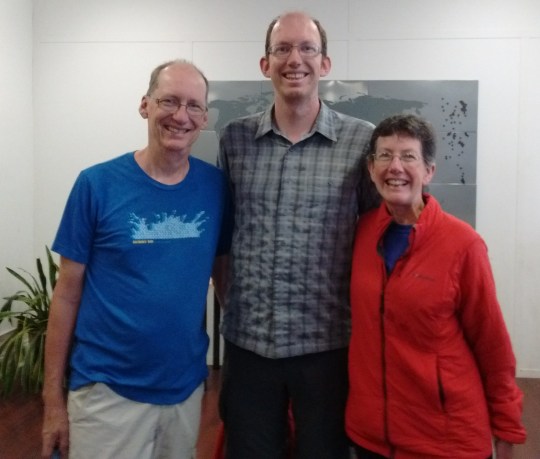
Our son flew in from Nevada on Friday, and the three of us happily spent the weekend seeing the sights.
It was quite a culture shock, riding crowded subways, walking through the bright lights of Times Square, eating Korean BBQ cooked in front of us. We found ourselves walking through Central Park more than once, just to quiet our souls and help assimilate all the sights and sounds.
Watching “The Lion King” was the highlight of the city experience. Costumes came alive through the skill of the actors, enhanced with extraordinary music. Such a transition, from busy New York City to African savannahs!
Regretfully we hugged our son good-bye as the weekend ended. However, relief was the over-riding feeling as we boarded the bus, headed back to the Appalachian Trail. New York City is a part of the AT thru-hike for many people, and we enjoyed our time, but we were also glad the time was limited!
Since Labor Day, we have only seen other hikers when the AT coincides with popular day hikes. Interactions with day hikers can be confusing. Many of these people, especially near big cities like New York, have never heard of the AT. They assume we are doing the same hike that they are. Misunderstandings result….
As we approached Fort Montgomery, New York, we stashed our packs behind a tree and took a short side trip (0.6 miles) up to Anthony’s Nose. After a day of solitude, we were surprised to find several day hikers enjoying the spectacular view of the Hudson River Valley.
The view from Anthony’s Nose, a local landmark.
On our way back down to the AT, we caught up with two ladies who were stopped in the trail. Their clean appearance and small packs indicated that they were day hikers.
One of them asked Sarah “Are you sure this is the way you came?”
Sarah, certain we were returning on the correct path, began enthusiastically pointing out trees and other features that she remembered from our ascent.
The day hikers were not convinced. “I don’t remember any of this!” one exclaimed.
We all continued walking. Sarah, warming to her new game, identified progressively more obscure land marks: “Oh look! There’s that purple flower….and I remember that fallen branch!” but the day hikers were no longer listening.
Their steps became increasingly tentative. I reminded Sarah that the way we had come might not be the way they had come. Upon over-hearing this, the ladies stopped, turned around, and took their first good look at us. Their expressions clouded as they took in our dirty socks, odd-looking bug pants, sweat stained shirts, and disheveled hair. We had no back packs. We were not credible looking.
One hiker asked “We came from our car, at the trail head. Where did you come from?”
I couldn’t resist. “Maine” I quipped.
As I tried to explain that we were hiking the AT, one threw up her arms in exasperation. “I think we’ll try the other way.”
I could only imagine what they were thinking as they made a wide arc around us and hurried back towards the view point.
Monument Mountain Motel, in Great Barrington, MA, is the cleanest place we have stayed on the whole AT. I wanted to follow the maid and learn her secrets for leaving bathroom tiles mirror bright, and carpets smelling of fresh air! Instead, we spent two zero days laying around, letting Jay’s hand and arm return to normal. What luxury!
We left Great Barrington this morning, courtesy of a trail angel shuttle named Joe, who we met in the supermarket. He returned us to the trail crossing at Blue Hill Rd, the very spot we had so precipitously left three days ago.
Joe, awesome trail angel, who shuttles hikers just for the fun of it!
(See our Trail Angel page for a little more about Joe.)
The sky was bright sapphire blue, the air hot and humid. I was glad to be walking again, and under leafy green shade. Six miles of hiking emptied our water bottles, making us look forward to the next water source, described as a spring at the bottom of a rocky cleft. On our way down, we met another couple coming up the hill.
“How’s the spring? Does it have good water?” one hiker asked. We were confused. Why was he asking us? The spring was behind him, wasn’t it?
The two hikers turned back, and with us, headed to the bottom of the hill, where an obvious cleft in the rock looked just as the trail guide reported. Close inspection showed a faint damp spot among the dead leaves clogging the very bottom of the cleft. I searched for a way down the rocks, to see if I could dig out the spring.
“Uhh, there was a snake on those rocks when we passed this spot earlier,” the hiker told me.
Forewarned, I moved even more slowly, and much more noisily, into the cleft, about ten feet below Jay and the other two hikers. As I dug, I could feel ice-cold moisture below the leaves and mud. By the time I had finished, the tiny seep held about a quart of muddy water.
Jay and I decided to keep hiking, leaving the limited liquid to the other two very thirsty hikers. Our trail guide predicted water just a couple miles away…
Four miles later, we had crossed only dry or impossibly mucky waterways. Reaching Hwy 7, we decided to look for a civilized water source, and after ten minutes of hot walking, we thankfully filled our bottles with water from a hose at a Jehovah’s Witness church. We were so grateful to see clear, clean water going into those bottles, and to drink as much as we needed!
September 19, 2017
We crossed the border from Massachusetts to Connecticut this morning! We have hiked 1,800 miles, with a bit less than 400 miles to go! What a milestone!
Last night never cooled, and we woke feeling a layer of sweat and grime covering our skin. Clouds covered the sky, acting as a prickly blanket, holding the heat against the land. We had been hiking about an hour when the trail turned to climb through Sages Ravine. The creek commenced to pool and drop, creating beautiful swimming holes. After passing at least five gorgeous pools, we couldn’t resist any longer. Off came our packs (and clothes), and we plunged in! Who cared that it was only 8:40 a.m. and the water was freezing cold? It felt wonderful after walking through muggy, sticky, oppressive air! Washing off the grunge gave us a new lease on the day. Our next mountain, Bear Mountain, was climbed with energy and good humor, even as we felt new sweat trickle down our necks!
Sarah contemplates a tempting swimming hole in Sages Ravine.
Our last landmark of the day was a pillar, nine feet high, called the Giant’s Thumb. A symphony of crickets and barred owls began singing as dusk fell just past the giant boulder. When I begin to think the trail is only heat and bugs and dirt, things like Sages Ravine and the Giant’s Thumb bring beauty back to the forefront of my consciousness!
Giant’s Thumb
September 21, 2017
The sun was a copper orb, pulsing in a brassy blue sea of heat. Most of the water sources we passed were tiny trickles of life-giving moisture. We heard Guinea Brook several minutes before we arrived at its edge. Several feet across, the brook poured over rocks and around boulders, dancing with sparkle and spray. We crossed the foot bridge, then took a brush-filled side trail behind a boulder the size of a small storage shed. This was the first large water source we had seen since the creek in Sages Ravine. Though the pool behind the boulder was not big enough for swimming, it had ample room for wading and bathing. I was delighted to get clean again, even if only for a few moments in this heat. Hurray for creeks and brooks!
September 22, 2017
Once again, the heat became a very real presence in the forest today. Though there were some lovely breezes whenever we topped a ridge, sweat beaded my face and dripped off my arms most of the day.
We passed the border between Connecticut and New York! We’ve hiked 11 states, with three to go!
As evening approached, we came to Ten Mile Campsite, where the Ten Mile River joins the Housatonic River. We pitched our tent in the gathering dusk, then walked to the river’s edge. A quick bath banished the sweat of the day, then we sat on rocks to dry and enjoy the evening. Fish jumped a few yards off shore. Water reflected pink tinged mare’s tails drifting across a darkening sky. Peace pervaded the scene, softly stealing into my soul, reminding me that I am blessed.
September 23, 2017
We ate breakfast on the shore of the Ten Mile River. A great blue heron slowly flapped huge wings, heading downstream toward the Housatonic River. The water gave us our last cool breeze of the day.
Near 3:00 p.m., as oppressive heat pressed into our skin, we approached the Appalachian Trail Metro-North Railroad Station. We met another hiker, Daniele, who offered to drive us to a nearby deli for a meal. We had planned on eating snacks at the Native Landscapes and Garden Center, which is right beside the trail. However, we were delighted to accept Daniele’s generous offer and have a full meal at Tony’s Deli, which even had a separate hiker menu! But first, we took advantage of the cold shower on the side of the Native Landscapes and Garden Center building. Words can’t describe how wonderful the few minutes of cascading cold water felt! And we smelled considerably better when we climbed into Daniele’s car!
(See our Trail Angel page for a little more about Daniele!)
September 24, 2017
The heat continued to rise. Though we camped on top of West Mountain last night, in hopes of cool breezes, sticky humidity pervaded our tent. At 9:00 this morning, we came upon Nuclear Lake. Blue water reflected blue sky, with a golden spot of heat riding high above. Every place touched by a sunbeam was at least ten degrees hotter than its neighboring shade. I took a plunge into the warm water, wearing all my clothes. Wet clothes as I hiked definitely helped combat the heat, at least for a few hours!
September 26, 2017
The highlight of yet another hot day came at its end. At 6:00 p.m., we were half a mile from our destination, Graymoor Spiritual Life Center. We stopped to check the map, and suddenly, over the hills and through the trees, chimes rang out. We listened, entranced, as electronic chimes from Graymoor’s bell tower played, echoing through the forest.
The Franciscan monks allow hikers to camp at their ball field, and provide a pavilion, a privy, garbage cans, and a cold shower. I had been looking forward to that cold shower for miles!
We pitched our tent and ate dinner in deepening dusk. Afterwards, the shower called me. I hung my flashlight on a hook and luxuriated in cool liquid. The chimes rang out, marking 8:00 p.m., as I brushed my teeth and watched the Big Dipper rise over the trees at the edge of the ball field. The peace of this place wrapped around me. Cold shower, music, starlight, and a comfortable place to sleep. What more could a woman ask for?
It’s another beautiful day on the trail! We hike past a pond, with brush overgrowing the path.
Jay is slightly ahead, and suddenly I hear him cry out.
“What’s wrong?” I’m immediately concerned.
“I think I’ve been stung on the hand,” Jay exclaims. “My hand just brushed the underside of a leaf, and I felt something like an electric shock. It hurts like crazy! Can you see if the stinger is still there?”
I peer at his hand. I can’t tell if I’m looking at a stinger or some hairs on the back of Jay’s finger. “Maybe it was a stinging nettle,” I suggest. “Here, let me give you an antiseptic wipe. Maybe if you sponge it off, it will feel better.”
Jay wipes his hand, but his expression says he’s still in pain. We continue on, as the trail begins to climb.
Ten minutes later, Jay tells me, “Something’s wrong. My eyes feel as if they’re about to pop out of my head. I can tell my heart rate is elevated.”
“Well, sit down!” I exclaim.
“There’s no comfortable place to sit,” Jay objects. I look around. He’s right, the ground is steeply sloped, and covered in the ubiquitous underbrush. But he shouldn’t keep walking if he’s having an allergic reaction.
We reach a slightly cleared place next to the trail, and Jay suddenly stops and sits, leaning up against his pack. His face is bright cherry red, with eyes completely bloodshot. I look at him, and my reactions go from concerned to outright scared. What is happening?
Jay takes his pulse. “My heart rate is 120,” he tells me. This is bad. His normal heart rate is in the 40s!
I don’t know what to do. Maybe if I could cool down his head, he would feel better? We just passed a spring a few moments ago. “I’m going to get you some cold water,” I tell him. “I’ll be right back.”
When I come back, Jay is still bright red. I hand him a wet buff. “Here, wipe off your face,” I order.
“Why? Jay asks.
“You look terrible. Maybe a cold cloth will help you feel better,” I tell him. (A reassuring bedside manner is not my strong point!)
Jay dutifully wipes his face and head, then takes his pulse again. It has gone down to 98. I’m glad to hear this, but still scared. “What do you think we should do?” I ask. “Maybe I should get more water?”
“Instead of running back for water, how about if you check to see whether you have any service on your phone? And how far away are we from the nearest road?” Jay asks reasonably.
Oh, duh. Why didn’t I think of that? I dig out my phone and look. No service, but I’m thinking the phone would probably work at the top of the hill. The nearest road is about two miles away, with a campground another half mile from that. I tell Jay this.
“I don’t think I should go anywhere with my heart racing like this,” Jay observes. “Maybe you should go see if your phone will work. Or go see if the campground has any Benadryl.”
“I don’t want to leave you just sitting by the trail,” I protest. “The next shelter is just one mile away. Maybe we should try to get you there. Or I could find a place to put up the tent. That would be better for you than just sitting here.”
“Is it cold this morning? I’m feeling chilled,” Jay asks.
I look at the thermometer on the back of my pack. “It’s 68 degrees. Not cold.” Nevertheless, Jay sits up and pulls out his sweater, jacket, and rain pants from his pack.
I now feel even more panicky. I’ve got to DO something! “Look, I’ll walk up the trail for just a couple of minutes, and see if I can spot a piece of ground flat enough to pitch the tent. I’ll be back in five minutes.”
I begin walking. Just as I see a bit of flat ground, I also see a hiker approaching. I greet him abruptly. “Oh, hi! Do you by any chance have any Benadryl with you? My husband just got stung.”
The hiker is a little taken aback by my obvious distress, but follows me to where Jay is still sitting. “Hey, how are you? Are you having any trouble breathing?” he asks in a deliberately calm voice. “When did this happen?”
The hiker’s unflustered manner helps to quiet my panic. His logical questions make my brain begin to work again. He confirms that we are a mile or less from the shelter, and suggests that it might be a more comfortable place to recover. He then continues down the trail. We never even learn his name, but I’m very grateful for his help.
Jay’s pulse has now receded into the 80s, and he thinks he might be able to try walking. I tell him about the flat piece of ground just a couple minutes ahead. Then I take his food and the tent to lighten his pack, and we walk very slowly onward. We pass the flat ground, and Jay says he thinks he can continue.
We get to the top of the hill, and sure enough, I have cell phone service. Jay sits on a rock as we try to decide the best course of action. Jay’s hand and forearm are swelling, the skin stretching tightly. I know that I want to be in a town right now, preferably with medicine for Jay. He echoes my thoughts as he says, “It would be good to be able to go to a walk-in clinic and see a doctor about this.” I look in our trail guide, and see a phone number for a local shuttle service. I call, and after explaining the situation, the shuttle driver agrees to meet us at the nearest paved road, about two miles from our location. We continue walking slowly, relieved to have made a decision and be progressing toward civilization!
We do make it to the town of Great Barrington, MA. The shuttle driver, appropriately named Trail Angel, drops us off at the emergency room of the hospital. The doctor tells Jay he is having a localized reaction, and prescribes Prednisone. The rest of the day is a denouement, as we go to the pharmacy, then ensconce ourselves in the comforts of the excellent Monument Mountain Motel.
We’ll take two days off, sitting out a rainy spell and watching Jay’s hand regain its normal shape. By Sunday, we’ll probably have recovered our enthusiasm for the trail.