For many sections of the Appalachian Trail, the path climbs to a ridge top, then stays high and follows that ridge for a good ways. Not so in southern New York state. Each day is a series of abrupt ups and downs, with brief moments on top sandwiched between steep ascents and descents. “It’s kind of like walking across a Ruffles potato chip,” Jay remarked our second day.
That kind of rough terrain lends itself to many picturesque names. Agony Grind, a vertical two tenths of a mile rock scramble, leads to The Lemon Squeezer, an ever narrowing cleft leading downwards. We encountered the Eastern Pinnacles, a series of skinny ups and downs, and Wildcat Rocks, a set of huge boulders obtruding from a tree-covered mountainside. As I labored over the landscape, I felt there should be more names to describe what hikers have to go through to get across this state. The following names will not be found on any map, except in my own imagination.
Pointy Rock Minefield – a section of trail covered in football-sized pointy rocks, jumbled together, with scarcely any dirt between. To walk upon this, one must choose footsteps carefully, balancing upon knife edges and points of rock.
Ankle Grabber – see description above. Then add slightly larger rocks, which tend to let feet slip into cracks and grab ankles with ferocious glee. Both Pointy Rock Minefield and Ankle Grabber were seen quite often during our hike across New York.
Knee Knocker Notch – Once achieving a ridge top, sometimes the trail would follow the ridge for maybe 25 yards before diving down through a notch. Standing on top, looking down the perpendicular rocks, my knees would begin to knock together in fear. It always looked higher from above! And often, when descending the short rocky cliff, I would end up knocking my knee upon a protruding lump of stone. Ouch!
The Cheese Grater – This was so named by Jay, after I tried to slow my precipitous slide down the side of a huge boulder, and scraped the inside of my elbow. The ‘raw meat’ look of my skin and the blood spots left on the granite were enough to earn that place its own name.
Endless Stone Sidewalks – The spines of the ridge tops were often exposed as smooth paths of rock. These went up, down, left, right, and I half expected to see a loop-de-loop sometimes. Though the smooth paths were a welcome change from Pointy Rock Minefields, their steep angles still took their toll from our leg muscles.
Toehold Teaser – Sometimes, when presented with a Pointy Rock Minefield, there would be a small cliff face running beside it. One could choose to walk above the minefield, sticking toes into ever-narrowing cracks, hoping to stay balanced until the trail turned back to dirt below.
Stair Step Swing – Often trail builders put stone steps down the mountainside to help one get off a ridge. This was wonderful, but sometimes the stones were made for giant legs. Boulders on either side of the steps invited me to use them as banisters and just swing my aching legs through the air, skipping the stairs entirely!
Progress through the state of New York was slow, with times of extreme physical exertion. But there were also times of fun and even playful times. A state definitely worth hiking!
While hiking through the New York state, numerous trail towns with bus and train terminals lead to New York City. The temptation to visit lures many thruhikers off trail. Bowing to temptation coupled with tradition, we chose to ride a bus from Fort Montgomery to NYC for a fare of $14.50 each, one way.
Our son flew in from Nevada on Friday, and the three of us happily spent the weekend seeing the sights.
It was quite a culture shock, riding crowded subways, walking through the bright lights of Times Square, eating Korean BBQ cooked in front of us. We found ourselves walking through Central Park more than once, just to quiet our souls and help assimilate all the sights and sounds.
Watching “The Lion King” was the highlight of the city experience. Costumes came alive through the skill of the actors, enhanced with extraordinary music. Such a transition, from busy New York City to African savannahs!
Regretfully we hugged our son good-bye as the weekend ended. However, relief was the over-riding feeling as we boarded the bus, headed back to the Appalachian Trail. New York City is a part of the AT thru-hike for many people, and we enjoyed our time, but we were also glad the time was limited!
Since Labor Day, we have only seen other hikers when the AT coincides with popular day hikes. Interactions with day hikers can be confusing. Many of these people, especially near big cities like New York, have never heard of the AT. They assume we are doing the same hike that they are. Misunderstandings result….
As we approached Fort Montgomery, New York, we stashed our packs behind a tree and took a short side trip (0.6 miles) up to Anthony’s Nose. After a day of solitude, we were surprised to find several day hikers enjoying the spectacular view of the Hudson River Valley.
The view from Anthony’s Nose, a local landmark.
On our way back down to the AT, we caught up with two ladies who were stopped in the trail. Their clean appearance and small packs indicated that they were day hikers.
One of them asked Sarah “Are you sure this is the way you came?”
Sarah, certain we were returning on the correct path, began enthusiastically pointing out trees and other features that she remembered from our ascent.
The day hikers were not convinced. “I don’t remember any of this!” one exclaimed.
We all continued walking. Sarah, warming to her new game, identified progressively more obscure land marks: “Oh look! There’s that purple flower….and I remember that fallen branch!” but the day hikers were no longer listening.
Their steps became increasingly tentative. I reminded Sarah that the way we had come might not be the way they had come. Upon over-hearing this, the ladies stopped, turned around, and took their first good look at us. Their expressions clouded as they took in our dirty socks, odd-looking bug pants, sweat stained shirts, and disheveled hair. We had no back packs. We were not credible looking.
One hiker asked “We came from our car, at the trail head. Where did you come from?”
I couldn’t resist. “Maine” I quipped.
As I tried to explain that we were hiking the AT, one threw up her arms in exasperation. “I think we’ll try the other way.”
I could only imagine what they were thinking as they made a wide arc around us and hurried back towards the view point.
Monument Mountain Motel, in Great Barrington, MA, is the cleanest place we have stayed on the whole AT. I wanted to follow the maid and learn her secrets for leaving bathroom tiles mirror bright, and carpets smelling of fresh air! Instead, we spent two zero days laying around, letting Jay’s hand and arm return to normal. What luxury!
We left Great Barrington this morning, courtesy of a trail angel shuttle named Joe, who we met in the supermarket. He returned us to the trail crossing at Blue Hill Rd, the very spot we had so precipitously left three days ago.
Joe, awesome trail angel, who shuttles hikers just for the fun of it!
(See our Trail Angel page for a little more about Joe.)
The sky was bright sapphire blue, the air hot and humid. I was glad to be walking again, and under leafy green shade. Six miles of hiking emptied our water bottles, making us look forward to the next water source, described as a spring at the bottom of a rocky cleft. On our way down, we met another couple coming up the hill.
“How’s the spring? Does it have good water?” one hiker asked. We were confused. Why was he asking us? The spring was behind him, wasn’t it?
The two hikers turned back, and with us, headed to the bottom of the hill, where an obvious cleft in the rock looked just as the trail guide reported. Close inspection showed a faint damp spot among the dead leaves clogging the very bottom of the cleft. I searched for a way down the rocks, to see if I could dig out the spring.
“Uhh, there was a snake on those rocks when we passed this spot earlier,” the hiker told me.
Forewarned, I moved even more slowly, and much more noisily, into the cleft, about ten feet below Jay and the other two hikers. As I dug, I could feel ice-cold moisture below the leaves and mud. By the time I had finished, the tiny seep held about a quart of muddy water.
Jay and I decided to keep hiking, leaving the limited liquid to the other two very thirsty hikers. Our trail guide predicted water just a couple miles away…
Four miles later, we had crossed only dry or impossibly mucky waterways. Reaching Hwy 7, we decided to look for a civilized water source, and after ten minutes of hot walking, we thankfully filled our bottles with water from a hose at a Jehovah’s Witness church. We were so grateful to see clear, clean water going into those bottles, and to drink as much as we needed!
September 19, 2017
We crossed the border from Massachusetts to Connecticut this morning! We have hiked 1,800 miles, with a bit less than 400 miles to go! What a milestone!
Last night never cooled, and we woke feeling a layer of sweat and grime covering our skin. Clouds covered the sky, acting as a prickly blanket, holding the heat against the land. We had been hiking about an hour when the trail turned to climb through Sages Ravine. The creek commenced to pool and drop, creating beautiful swimming holes. After passing at least five gorgeous pools, we couldn’t resist any longer. Off came our packs (and clothes), and we plunged in! Who cared that it was only 8:40 a.m. and the water was freezing cold? It felt wonderful after walking through muggy, sticky, oppressive air! Washing off the grunge gave us a new lease on the day. Our next mountain, Bear Mountain, was climbed with energy and good humor, even as we felt new sweat trickle down our necks!
Sarah contemplates a tempting swimming hole in Sages Ravine.
Our last landmark of the day was a pillar, nine feet high, called the Giant’s Thumb. A symphony of crickets and barred owls began singing as dusk fell just past the giant boulder. When I begin to think the trail is only heat and bugs and dirt, things like Sages Ravine and the Giant’s Thumb bring beauty back to the forefront of my consciousness!
Giant’s Thumb
September 21, 2017
The sun was a copper orb, pulsing in a brassy blue sea of heat. Most of the water sources we passed were tiny trickles of life-giving moisture. We heard Guinea Brook several minutes before we arrived at its edge. Several feet across, the brook poured over rocks and around boulders, dancing with sparkle and spray. We crossed the foot bridge, then took a brush-filled side trail behind a boulder the size of a small storage shed. This was the first large water source we had seen since the creek in Sages Ravine. Though the pool behind the boulder was not big enough for swimming, it had ample room for wading and bathing. I was delighted to get clean again, even if only for a few moments in this heat. Hurray for creeks and brooks!
September 22, 2017
Once again, the heat became a very real presence in the forest today. Though there were some lovely breezes whenever we topped a ridge, sweat beaded my face and dripped off my arms most of the day.
We passed the border between Connecticut and New York! We’ve hiked 11 states, with three to go!
As evening approached, we came to Ten Mile Campsite, where the Ten Mile River joins the Housatonic River. We pitched our tent in the gathering dusk, then walked to the river’s edge. A quick bath banished the sweat of the day, then we sat on rocks to dry and enjoy the evening. Fish jumped a few yards off shore. Water reflected pink tinged mare’s tails drifting across a darkening sky. Peace pervaded the scene, softly stealing into my soul, reminding me that I am blessed.
September 23, 2017
We ate breakfast on the shore of the Ten Mile River. A great blue heron slowly flapped huge wings, heading downstream toward the Housatonic River. The water gave us our last cool breeze of the day.
Near 3:00 p.m., as oppressive heat pressed into our skin, we approached the Appalachian Trail Metro-North Railroad Station. We met another hiker, Daniele, who offered to drive us to a nearby deli for a meal. We had planned on eating snacks at the Native Landscapes and Garden Center, which is right beside the trail. However, we were delighted to accept Daniele’s generous offer and have a full meal at Tony’s Deli, which even had a separate hiker menu! But first, we took advantage of the cold shower on the side of the Native Landscapes and Garden Center building. Words can’t describe how wonderful the few minutes of cascading cold water felt! And we smelled considerably better when we climbed into Daniele’s car!
(See our Trail Angel page for a little more about Daniele!)
September 24, 2017
The heat continued to rise. Though we camped on top of West Mountain last night, in hopes of cool breezes, sticky humidity pervaded our tent. At 9:00 this morning, we came upon Nuclear Lake. Blue water reflected blue sky, with a golden spot of heat riding high above. Every place touched by a sunbeam was at least ten degrees hotter than its neighboring shade. I took a plunge into the warm water, wearing all my clothes. Wet clothes as I hiked definitely helped combat the heat, at least for a few hours!
September 26, 2017
The highlight of yet another hot day came at its end. At 6:00 p.m., we were half a mile from our destination, Graymoor Spiritual Life Center. We stopped to check the map, and suddenly, over the hills and through the trees, chimes rang out. We listened, entranced, as electronic chimes from Graymoor’s bell tower played, echoing through the forest.
The Franciscan monks allow hikers to camp at their ball field, and provide a pavilion, a privy, garbage cans, and a cold shower. I had been looking forward to that cold shower for miles!
We pitched our tent and ate dinner in deepening dusk. Afterwards, the shower called me. I hung my flashlight on a hook and luxuriated in cool liquid. The chimes rang out, marking 8:00 p.m., as I brushed my teeth and watched the Big Dipper rise over the trees at the edge of the ball field. The peace of this place wrapped around me. Cold shower, music, starlight, and a comfortable place to sleep. What more could a woman ask for?
It’s another beautiful day on the trail! We hike past a pond, with brush overgrowing the path.
Jay is slightly ahead, and suddenly I hear him cry out.
“What’s wrong?” I’m immediately concerned.
“I think I’ve been stung on the hand,” Jay exclaims. “My hand just brushed the underside of a leaf, and I felt something like an electric shock. It hurts like crazy! Can you see if the stinger is still there?”
I peer at his hand. I can’t tell if I’m looking at a stinger or some hairs on the back of Jay’s finger. “Maybe it was a stinging nettle,” I suggest. “Here, let me give you an antiseptic wipe. Maybe if you sponge it off, it will feel better.”
Jay wipes his hand, but his expression says he’s still in pain. We continue on, as the trail begins to climb.
Ten minutes later, Jay tells me, “Something’s wrong. My eyes feel as if they’re about to pop out of my head. I can tell my heart rate is elevated.”
“Well, sit down!” I exclaim.
“There’s no comfortable place to sit,” Jay objects. I look around. He’s right, the ground is steeply sloped, and covered in the ubiquitous underbrush. But he shouldn’t keep walking if he’s having an allergic reaction.
We reach a slightly cleared place next to the trail, and Jay suddenly stops and sits, leaning up against his pack. His face is bright cherry red, with eyes completely bloodshot. I look at him, and my reactions go from concerned to outright scared. What is happening?
Jay takes his pulse. “My heart rate is 120,” he tells me. This is bad. His normal heart rate is in the 40s!
I don’t know what to do. Maybe if I could cool down his head, he would feel better? We just passed a spring a few moments ago. “I’m going to get you some cold water,” I tell him. “I’ll be right back.”
When I come back, Jay is still bright red. I hand him a wet buff. “Here, wipe off your face,” I order.
“Why? Jay asks.
“You look terrible. Maybe a cold cloth will help you feel better,” I tell him. (A reassuring bedside manner is not my strong point!)
Jay dutifully wipes his face and head, then takes his pulse again. It has gone down to 98. I’m glad to hear this, but still scared. “What do you think we should do?” I ask. “Maybe I should get more water?”
“Instead of running back for water, how about if you check to see whether you have any service on your phone? And how far away are we from the nearest road?” Jay asks reasonably.
Oh, duh. Why didn’t I think of that? I dig out my phone and look. No service, but I’m thinking the phone would probably work at the top of the hill. The nearest road is about two miles away, with a campground another half mile from that. I tell Jay this.
“I don’t think I should go anywhere with my heart racing like this,” Jay observes. “Maybe you should go see if your phone will work. Or go see if the campground has any Benadryl.”
“I don’t want to leave you just sitting by the trail,” I protest. “The next shelter is just one mile away. Maybe we should try to get you there. Or I could find a place to put up the tent. That would be better for you than just sitting here.”
“Is it cold this morning? I’m feeling chilled,” Jay asks.
I look at the thermometer on the back of my pack. “It’s 68 degrees. Not cold.” Nevertheless, Jay sits up and pulls out his sweater, jacket, and rain pants from his pack.
I now feel even more panicky. I’ve got to DO something! “Look, I’ll walk up the trail for just a couple of minutes, and see if I can spot a piece of ground flat enough to pitch the tent. I’ll be back in five minutes.”
I begin walking. Just as I see a bit of flat ground, I also see a hiker approaching. I greet him abruptly. “Oh, hi! Do you by any chance have any Benadryl with you? My husband just got stung.”
The hiker is a little taken aback by my obvious distress, but follows me to where Jay is still sitting. “Hey, how are you? Are you having any trouble breathing?” he asks in a deliberately calm voice. “When did this happen?”
The hiker’s unflustered manner helps to quiet my panic. His logical questions make my brain begin to work again. He confirms that we are a mile or less from the shelter, and suggests that it might be a more comfortable place to recover. He then continues down the trail. We never even learn his name, but I’m very grateful for his help.
Jay’s pulse has now receded into the 80s, and he thinks he might be able to try walking. I tell him about the flat piece of ground just a couple minutes ahead. Then I take his food and the tent to lighten his pack, and we walk very slowly onward. We pass the flat ground, and Jay says he thinks he can continue.
We get to the top of the hill, and sure enough, I have cell phone service. Jay sits on a rock as we try to decide the best course of action. Jay’s hand and forearm are swelling, the skin stretching tightly. I know that I want to be in a town right now, preferably with medicine for Jay. He echoes my thoughts as he says, “It would be good to be able to go to a walk-in clinic and see a doctor about this.” I look in our trail guide, and see a phone number for a local shuttle service. I call, and after explaining the situation, the shuttle driver agrees to meet us at the nearest paved road, about two miles from our location. We continue walking slowly, relieved to have made a decision and be progressing toward civilization!
We do make it to the town of Great Barrington, MA. The shuttle driver, appropriately named Trail Angel, drops us off at the emergency room of the hospital. The doctor tells Jay he is having a localized reaction, and prescribes Prednisone. The rest of the day is a denouement, as we go to the pharmacy, then ensconce ourselves in the comforts of the excellent Monument Mountain Motel.
We’ll take two days off, sitting out a rainy spell and watching Jay’s hand regain its normal shape. By Sunday, we’ll probably have recovered our enthusiasm for the trail.
How far should one go when leaving the trail to “find a tree”? I tend to err on the side of visibility. Jay, on the other hand, can disappear into the underbrush, effectively finding concealment when answering a call of nature. But perhaps he should tell the beginning of this story in his own words…
The forest in the Berkshires is beautiful in early September. Fall is beginning. There are splashes of red in the hardwood canopy. Acorns rain down from high in the oaks as squirrels busily prepare for winter. Sarah stops to “take care of business,” so I continue alone south on the trail as it winds unpredictably through the trees. After a few minutes, I stop to wait for Sarah. I set my pack down a few feet off the trail, grab my toilet paper, and walk into the forest to try and be productive during my wait. I push through the understory. Rocks and fallen trees make for awkward progress.
I am not in the best of moods. I have been dieting for the last week. This has made me a little grouchy and impatient. After finishing my chore, I grumpily turn to make my way back to the trail. A spider web in my face is my first warning. This is not the way I came. I change direction slightly and continue. More webs. For the first time, I pause and think about my situation. Visibility is good through the forest, but the terrain is featureless, and a tangle of shrubs and plants hides the trail from any distance greater than four or five feet. Unfortunately, I did not take notice of the actual cardinal direction the trail was heading when I left it. It is sunny… but clouds are moving in. I continue on, annoyed at the thought of wasting time, awkwardly climbing over and around downed trees and brush. I change directions a few times, until I finally admit to myself … I have no idea where the trail is.
Trying to suppress a growing sense of panic, I think of what I should do. I should sit down. Listen for Sarah, and call to her so that she can guide me back with her reply. But I am impatient. The adrenaline coursing through my veins compels me to keep moving. I don’t want to call out …. that would be embarrassing, and I know my voice carries poorly.
I begin walking in a search pattern. I turn so my shadow is directly to my left and stumble for 100 paces. No trail. I turn directly away from the sun and clamber 120 paces. Again, no trail. I continue this square, outward spiral. I know eventually I will find the trail if I can keep the spiral pattern accurate. But what if I lose track of my paces? What if my course varies too much around the many obstacles? What if I break my leg? What if the clouds cover the sun? All I have is what I am wearing and a roll of toilet paper. No cell phone. No raincoat.
It becomes excruciating to stick to my search pattern. Each time I finally reach the end of one direction and fail to find the trail, I have to turn left, knowing if the trail is actually to the right, it will be a long time before I get to walk in that direction. As I stumble, I muse at how fast my situation has changed. I recall reports of others who have died from merely stepping off the trail, and I begin to understand how it could happen. I marvel at how hard it is to travel in one direction through the forest without a trail. Then, a faint owl-like sound. I stop, but the sound does not continue. I resume my noisy travel until I hear another sound. I stop and wait. I hear my name! Eternally grateful, I abandon my grid and tromp towards Sarah. What a relief. She guides me back to the trail. My normal life resumes.
… Normal life resumes, eh? Well, perhaps, but we had to debrief as we continued together. It sounded a bit like this …
“Are you okay?” I asked anxiously.
“I am now,” Jay answered with a huge smile.
“I was worried. It’s been over 30 minutes! You never take that much time!” I couldn’t figure out what had just happened.
“Why did you wait so long to call for me?” Jay asked.
“I’ve been calling for at least 10 minutes! Couldn’t you hear me? I thought maybe you had fallen, or been snake bit!” I was still confused.
“I couldn’t find the trail,” Jay explained. “I didn’t hear you call until your last shout. Why didn’t you use the whistle on my pack? Your voice sounds like a barred owl in the woods.”
“Whistle? Oh, right. I guess I should have used it. I didn’t even think of it!” Embarrassment joined the jumble of emotions flooding through me.
“Are we on the trail now?” Jay asked.
“No,” I pointed. “It’s over there a ways. I’ve been looking for you through the woods.”
“Why did you leave the trail?” Jay sounded surprised. “What if we both got lost?”
“It’s okay,” I was quick to reassure. “I’ve been paralleling the trail. The packs are just over here.”
We picked up our packs, and Jay looked around. “Do you know which way to go?” His eyes reflected inner uncertainty.
“This way,” I gestured ahead. “There’s a spring just down the trail. Ummm, let’s keep within sight of each other for the rest of the day, all right?”
The underbrush can make the trail hard to see sometimes.
The trail snakes around like a game of Chutes and Ladders, so that sometimes I wonder if we’re going backwards or forwards!
September 1, 2017
Whimsical rock sculptures along the trail near White Rocks viewpoint causes us to pause in appreciation. Someone had a lot of time on their hands! It makes me think of building with blocks when our son was very young. What fun!
September 4, 2017
Yesterday Jay and I hiked to the town of Manchester Center, and enjoyed sitting out a day of pouring rain in the comfort of an old-fashioned guest house called Sutton’s Place. Today we had planned to take a day of rest, but the weather forecast called for sun today and more rain tomorrow. So we decided to slack pack 17 miles, from the other side of Stratton Mountain back to Manchester Center.
We were picked up by a shuttle at 6:00 a.m., driven on small back roads for 45 minutes around Stratton Mountain, and let off at the AT trailhead. The sun rose while we were in the car, a huge orange ball of golden fire, glowing through the trees!
The top of Stratton Mountain was still in the clouds when we reached it, three miles later. Wind gusted above the tree tops, blowing foggy shreds past the lookout tower. The view from that tower is famous for inspiring the creation of both the Long Trail and the Appalachian Trail. But today, no inspiration was to be had from the view!
The top of Stratton Mountain.
The view is a little gray today!
There is also a caretaker’s cabin on top of Stratton Mountain. Jay and I met the caretakers, Jeanne and Hugh, in 2011 when Jay first thru-hiked the AT. We were delighted to meet them again. Jay told Jeanne how she had educated him about the Bicknell Thrush. I think she was charmed that he remembered so vividly, for she invited us into their tiny cabin, “just to see what it is like.” It was a cozy space, an original “tiny house”. I felt honored to get to see it! Jeanne and Hugh have been caretakers on top of the mountain since the 1960s. They feel that their job is to protect the mountain and educate hikers. They do a great job!
September 6, 2017
After taking a zero day in the town of Manchester Center, VT, and watching the rain pour down, we begin hiking today in a ‘hard mist’, the kind of rain that soaks in sooner than one would think! It is now that I truly appreciate the shelters along the Appalachian Trail. We take an early lunch at Story Spring Shelter, then an early dinner at Kid Gore Shelter. After feeling the rain hitting our hoods all day, it is a relief to sit inside a dry shelter, and watch the rain soak the ground outside! Also, it’s nice to be able to eat without fat water drops splashing upon ones raisins or chocolate bar!
September 7, 2017
Tonight we chose a very scenic campsite, overlooking the town of Bennington, VT. Evening-tinged blue sky arched directly over us, while out in the valley, we could see a thunderstorm raging over the town. About the time we were settled inside our tent, the edge of the storm caught our airy perch. Lightning flashed just a few miles away. Wind battered our tent in a frenzy, tearing out one tent stake! Tent fabric whipped around my head as the tent pole fell across my body.
I cowered beneath the pelting raindrops until Jay shouted in my ear, “I’ll hold the tent pole while you go outside and pound the stake back in.”
I wasn’t sure how I got elected to plunge into the rain, except that the stake was on my side of the tent. Too shell-shocked to argue, I obediently unzipped the tent, submitted the upper half of my body to a bombardment of dagger-like precipitation, and grabbed the tent stake as the wind tried to whip it into the bushes. I used the panicked force of adrenaline to shove that stake deep into the grass and dirt, then wriggled backwards into the dry ‘safety’ of our abode. Whew!
We lay and listened as the rain and wind slowly moved down the valley, and I finally fell asleep to the gentle patter of water drops as the storm subsided.
September 8, 2017
We’ve been hiking in mixed rain and sun for three days now. Lots and lots of mud!
Great salamander and toad weather!
Three days of wet feet are beginning to cause problems. Though our feet have many calluses, soggy socks rub the tops of our toes, causing oozing sores and blisters. I think of the soldiers in the jungles of Vietnam, and wonder how they coped. Perhaps wet feet were not a priority on their list of problems. The sores on our feet, however, are getting to be too extensive to ignore. Tonight we use antiseptic wipes to clean our feet, and tomorrow we’ll wrap our toes in duct tape and band-aids! The true solution, however, will be some days of sunshine!
September 9-10, 2017
The weather begins to dry out today, hooray!
We climb to the top of Greylock Mtn, tallest mountain in Massachusetts. The sky is dramatic, clouds playing hide and seek with the sun. A war memorial, a beautiful tower with a spiral staircase, graces the top of Greylock. I must admit, more than half the fun of the memorial is climbing the stairs, around and around and around!
We stay on top of Greylock, at the Bascom Lodge, for the night, enjoying a hot shower, fresh clean sheets, and a chance to dry the mud off our shoes!
Breakfast is fun, discussing hiking and diet with two other hikers, Mary and Jane. When it is time to leave, Jay discovers that he is missing his hat. We look everywhere, but with no result. This is serious, as the wind is cold outside, and a hat is essential. Thankfully, Mary and her son, Kevin, come to our rescue, giving Jay an extra hat they had packed. Once again, trail angels work their magic on the AT! (Please see our Trail Angels page in the menu for a little more on this part of the story.)
The climb down Greylock is beautiful, with blue sky and sunshine! I can see the mud drying as we walk upon it!
We cross a corn field, then find wild apple trees littering the trail with ripe apples. We can’t resist, and collect about a dozen. Massachusetts wild apples taste much more delicious than Nevada wild apples! With fresh fruit in the back of my pack, we climb Cheshire Cobbles, a lovely, gently graded, loop trail which shares the AT. We stop and sit on the granite boulders, eating apples and enjoying a beautiful view!
September 11, 2016
The incredibly gorgeous weather continues with a beautiful sunrise through the trees.
It’s too cold to eat breakfast when we first get up. We decide to walk for a while. After about two miles, we are rewarded with the most beautiful breakfast spot, a quiet view on Gore Pond, still waters reflecting azure sky and fall trees.
September 12, 2017
Once again it is too cold to eat breakfast when we wake. We hike about an hour, and come to a trail angel’s house, The Cookie Lady. She sells boiled eggs from her farm, as well as sodas and candy bars to passing hikers. She also gives away fresh-made cookies. We eat boiled eggs and oatmeal-chocolate chip cookies for breakfast this morning. But the best part of the meal is the beautiful setting – food for our soul!
September 14, 2017
Salamanders and frogs begin to be seen on the trail again. We know this heralds a change from sunshine to wet weather ahead. Fortunately, we’re a day away from the town of Great Barrington, MA. Perhaps we’ll get lucky, and have our resupply and rest day as it rains!
“I wish I could have backpacked the AT,” a senior citizen friend told me. “But it’s too late for me.”
“It’s never too late,” I responded. “Jay and I met a man named Graybeard, age 82, who is setting the age record for thru-hiking the AT this year.”
“I could never carry the weight of a big pack now,” my friend lamented. “And I couldn’t stay out that long, weeks and weeks of sleeping outside!”
“Hmmm, well, Jay and I almost never carry more than four days of food, and we get a real bed and a shower at least once a week! And my backpack only weighs about 20 pounds,” I laughed.
“20 pounds! That’s not possible! And only four days of food? You’re not really backpacking,” my friend accused.
Since entering Vermont, and rediscovering sloped (not vertical) trails with dirt (not rocks), our trek has become easier in many ways. But come walk with me, and judge for yourself…
The weather is cloudy, with temperatures in the 50s as we climb a total of about 2,000 feet in elevation going up and over several humps in the terrain, then ascending and descending Quimby Mountain. The top of the mountain doesn’t have much of a view, but the air feels fresh, and daylight filters more strongly through the smaller trees near the summit. Huge boulder erratics, left from the last ice age, dot the mountainside as we head down.
At the bottom of the mountain, I am delighted to see a lovely new boardwalk, leading us across a flower-strewn bog. Orange jewel weed, purple joe-pye weed, white and yellow daisies, and tiny sapphire bluets are tangled together in an awesome autumnal display of color!
Thundering Falls feeds the southern end of the bog, and I stand in enchantment for a few minutes, enjoying the play of roaring water and spraying mist. No camera can catch the joy of such a moment!
A mile and a half later we round a corner and see Kent Pond, with green grass running down to the edge of glassy, calm water. A side trail leads us another half mile to the small town of Killington, where we have planned to resupply. At the convenience store/deli, we order food for dinner (marinated summer vegetable salad and tri-tip for me), buy trail food for two more days, then eye the Killington Motel. Hmmm, it IS almost time to stop hiking for the day, and a hot shower sounds wonderful!
The next morning, after eating a bountiful hot breakfast at the motel, we hike the blue-blazed side trail back to the AT. A lingering dawn mist rises from Kent Pond. It seems a magical place as we orient ourselves and head south again.
The trail leads us around Deer Leap Mountain, through an old growth forest. We enjoy the gently sloping path as it climbs a ridge, then traverses across the side of the mountain.
Three miles later, the 270-mile Long Trail joins the AT. We will now be meeting Long Trail hikers headed north, as well as AT thru-hikers.
One mile later, the AT crosses VT Hwy 4. As we hesitate at the trailhead, a red and white bus pulls up and opens its doors. Obviously, this is another AT adventure calling us! We board the bus, giving the driver $1 each, then ride 8.5 miles into the town of Rutland, getting there just in time for lunch at a Burger King! We enjoy the fun of an unexpected meal of fast food when just a few minutes ago we were surrounded by forest. At the end of our meal, we realize that we have no idea where or when to catch the bus back to the trail! Fortunately, my cell phone holds the answer with its eternal connection to the internet. We consult, and realize that we have just missed the bus! The next one will be in an hour. So, what does a thru-hiker do with an unexpected hour in an unexpected town? Wander around and see the sights? Not us! We stay put, and eat a second lunch! (Oh, my stomach is sooo happy!)
We finally pry ourselves away from this source of easy food, and catch the bus, arriving back at the trail 2.5 hours after leaving. The hike up Pico Mountain, then Killington Mountain (2,000 feet elevation gain), fueled with two lunches and lots of caffeine, is painless! Pine trees put springy needles across part of the trail, making me feel as if I am walking on a trampoline. More flowers dot the trail, especially orange jewel weed. We even come across one slope of a different variety of jewel weed – bright yellow! A recently uprooted tree holds dirt in its rootball, making an eight-foot wall of rich black dirt, with jewel weed growing at its base, and raspberry bushes on its top!
We reach the Cooper Lodge Shelter on top of Killington Mountain at 7:15 p.m., with just enough daylight to put up our tent and brush our teeth before tumbling into our sleeping bags. I realize, as I hang our food bags, that we never ate dinner! I guess those two lunches in town were enough fuel for the rest of the day!
So there you have it, in two days on the trail, we have climbed over 4,000 feet in elevation, seen four mountains, enjoyed millions of wild flowers and trees, AND scored a lovely hot shower, a soft bed one night, and an unexpected meal of fast food! Are we backpacking? Yes, for we carry all we need upon our backs, and we continue hiking, no matter what distractions slow us down! We’re not out here to see how much pain our bodies can endure. We’re here to enjoy the forest, to have fun in nature. I know hiking the AT now is easier than 30 years ago. There is much more support for the hikers, and the trail is much better marked and maintained. But we still walk through the forest, and we still carry gear. Yes, we are backpackers!
Jay and I have felt uniquely blessed to see hiker beginnings at both ends of the Appalachian Trail. In February, we were NOBOs (North Bound), with approximately 80 other eager hikers. (3,112 NOBOs participated in the voluntary registration with the Appalachian Trail Conservancy. About 80 of them began hiking during the week that we started.) Then in July, we became Flipflop SOBOs (South Bound), climbing Katahdin and heading south with roughly 55 hikers that week. (A total of 387 registered with the ATC.)
Hiking south, the difficult terrain of Maine and New Hampshire presents south bound hikers with unique challenges, beginning with the arduous climb of Katahdin, then immediately slogging through bogs and rocks in the 100 Mile Wilderness, followed by vertical trails through mountains of granite! It has been a pleasure to share these challenges with some engaging personalities and exceptional hikers.
We have also enjoyed re-meeting north bound hikers that we had last seen in southern Appalachia. What a treat, to suddenly see a familiar face approaching through the woods! Henry, a fast-hiking engineer, was the first NOBO re-acquaintance. After almost 2,000 miles, he still reveled in every day of his hike. In mid-July, we met two hikers who recognized us, though the last 1,000 miles had changed them beyond recognition. Dakota had lost weight, slimming down to a trim hiker shape, while Cruise Control had gained muscle, bulking up from a slender weed to a sleek physique! After that, it seemed we recognized hikers nearly every day until mid-August before the stream of familiar faces slowed to a trickle.
Today, at a trail angel’s house, we met Mowgli, last seen in Shenandoah National Park. His companion back then, Dante, was no longer with him. “Dante had things happen,” Mowgli informed us. “Like, one time I told him the plant was poison nettles. He said it was just poison ivy, and he wasn’t allergic. Then he grabbed a bunch and rubbed it all over his hands. … It was nettles all right. Anyway, he finally had to get off trail when he got drunk one night and ate a rock. That sent him to the hospital.”
(For more about this trail angel house, see our page of Trail Angels on our menu.)
Mowgli eats left over macaroni with meatballs on the porch of a trail angel’s house. The resident cat relaxes beside him.
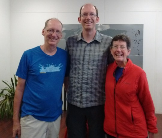
Yesterday, entering the trees after resupplying in Norwich, VT, we were delighted to see Specs, a young man with whom we spent a zero day at Doe River Hostel, near Roan Mountain, TN. We stopped to talk for a good while, catching up on each other’s lives. Specs has lost 65 pounds while hiking, and is looking great! We shared jokes and stories, including Specs telling us about getting bluff charged by a bear in Shenandoah National Park. He has enjoyed support from his parents and sister while on the trail, feeling that his adventure has been part of a family affair. What fun!
Specs and Jay trade jokes and stories.
Meeting all these NOBOs, while still hiking south with SOBOs, has reminded me that a large part of the AT experience revolves around each person’s unique hike. One never knows what or who is around the next bend in the trail!
On the drive from Pennsylvania to Maine in July, my mother sent along a book about Lyme disease, which I read, first dutifully, then avidly, with a touch of terror. This book prompted further research on the internet, and I was horrified to learn that, according to the Center for Disease Control, Maine has one of the highest incidences per capita of Lyme disease. A doctoral student who hiked the AT and collected ticks in 2014 recommended wearing permethrin treated bug-net pants and a long-sleeved shirt to protect oneself. (“Touched by Lyme”, www.lymedisease.org) We decided to buy the bug-net pants and shirt from REI, and wear them while at low altitudes in Maine.
The seat of the bug-net pants quickly succumbed to sharp rocks and long reaches with our legs. So one night I took my pocket knife, ripped the net legs off the shredded pants, and hand-basted them onto our shorts. Voila! Durable bug-net pants!
Attached to our shorts, they were much more comfortable. Basted with needle and thread, they didn’t come off easily. So we continued wearing them even at higher altitudes, and enjoyed the added benefit of protection from mosquitoes. We received many comments from other hikers.
“That’s one of the scariest sights I’ve seen,” one hiker told Jay.
“Don’t hate me because I’m beautiful,” Jay responded, laughing.
“I would have paid $1,000 for a pair of those in Pennsylvania”, sighed one hiker enviously.
Another hiker, Mowgli, commented, “Hey, I like your skeeter beaters!” (Jay thought maybe they should be dubbed Tick Licker Knickers!)
Many locals in Hanover liked the pants also. One woman told us, “That is pure genius! Next spring, when I start my garden, I’ll be wearing a pair of those!”
Another lady at a lodge confronted me, “I’ve been watching you walk around, and trying to decide, are you wearing those pants for fashion or function?”
I couldn’t resist, I struck a pose. “Oh yes, fashion is my middle name, especially on the trail,” I laughed.
Although many hikers have told us of finding ticks, we have not seen any since donning this outfit. With Lyme disease increasing across the United States, our attire may be the wave of the future!