Walking on Water

May 4, 2018

The wind shook our one room shelter last night, waking me twice with its fierce determination to get inside. Sturdy construction thwarted the gale, and Jay and I slept peacefully.

This morning we took the shuttle to Neenach Cafe and Market, where we bought delicious giant breakfast burritos, called “piglets”, and food to get us to Tehachapi. We were grateful for the shuttle up and down Highway 138, an extremely busy, rather dangerous road. Hikertown is not a place I would want to linger, but I did appreciate the help this strategically placed hostel offered.

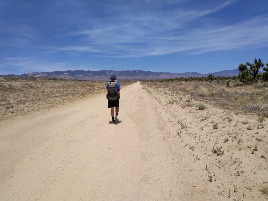
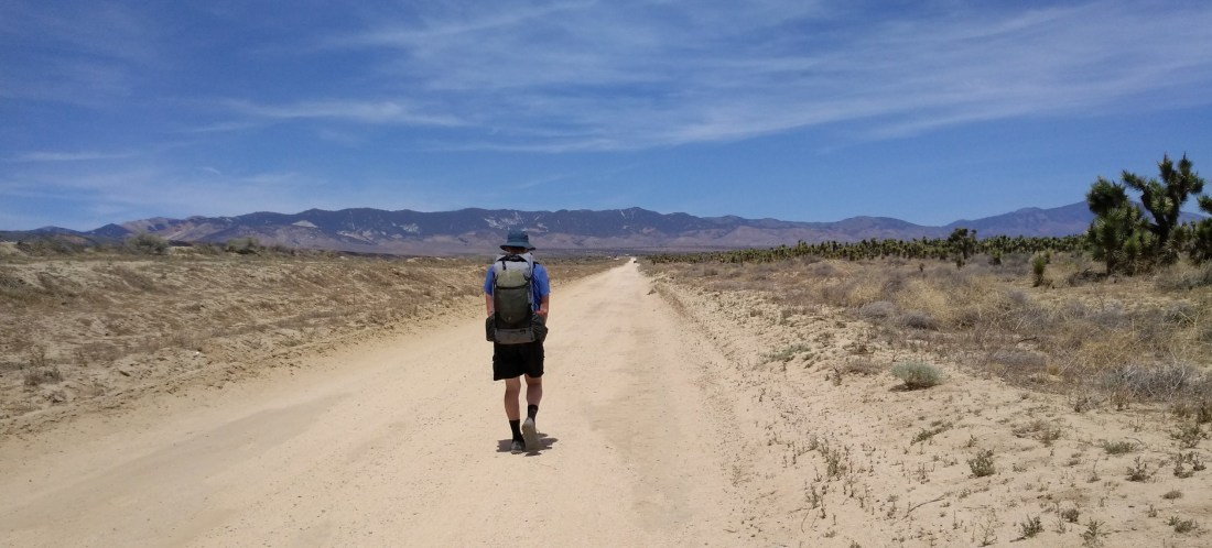
The PCT crosses the western tip of the Mojave Desert, following the Los Angeles Aqueduct through Antelope Valley for much of the day. This valley is known and sometimes dreaded by PCT hikers for its unobstructed wind and high temperatures. Many hikers choose to cross the valley at night, to avoid sun exposure. Today, however, temperatures are in the 70’s, perfect for a gentle stroll through the desert. As the picture shows, we have 17 miles of very flat walking ahead of us!

20180503_175215_resized585267491.jpg
We’ve left the San Gabriel Mountains, and now have to cross a small corner of the Mohave Desert before climbing into the Tehachapi Mountains.

The Los Angeles Aqueduct brings water from the Owens Valley, on the eastern side of the Sierra Nevada Mountains, to Los Angeles. First completed in 1913, with 233 miles of pipes and channels, the well-engineered design allows water to move by gravity alone. There are many opinions concerning depriving Owens Valley of water in order to facilitate the growth of Los Angeles. I, being a lowly hiker, have no political opinions. Walking beside a piece of living history did interest me, however.

img_20180504_1140569541182710157.jpg
My first sight of the aqueduct surprised me with open water!

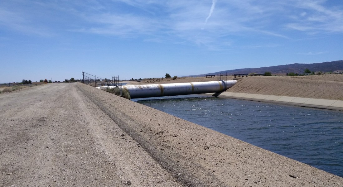
Soon the trail made a 90 degree turn, following the aqueduct in the form of a giant pipe half buried in dirt and sand.

img_20180504_114853009362888035.jpg
A single raven sits atop the pipe full of water, while we traverse the dirt road beside it.

Many hikers complain of the boredom of this day’s hike. I admit, I wouldn’t want to cross this valley every day. But after days of winding through hills and mountains, the novelty of flat and straight entertained me for hours. This picture shows Joshua trees on Jay’s right.

img_20180504_1245474431897354392.jpg
Jay maintains that a successful thru-hiker must have a high tolerance for monotony. I agree, and add that it’s fun to find the entertainment factor in said monotony!

A few days ago, a local man had told Jay and me stories of his childhood, driving across the desert with his father, getting water through access ports in the aqueduct. He described the awe of peering down into the black moving water, fishing for liquid with a water bottle tied to a string.

After a few miles, the round pipe we had been following disappeared completely underground, replaced by a concrete road. I was disappointed to find the access ports firmly locked with no-nonsense official padlocks. Modern day mistrust can remove a bit of the wonder from life. My imagination, however, enjoyed free reign as I walked above all those gallons of flowing water.

img_20180504_1336138281798437640.jpg
Access boxes to the water below were spaced at regular intervals along the aqueduct.

People do live in Antelope Valley, and signs of habitation gave me another thing to watch as we passed at walking pace.

We saw fences, a few cattle, and even some houses in the first five miles of the walk.

And so the day continued. We were grateful for beautiful weather. In the afternoon, the wind began to pick up a bit, but remained much gentler than last night’s gale!

I noticed bird tracks in the sandy dirt, and wondered which bird had run across the path. The footprints were too large for quail. Perhaps a roadrunner? Maybe a swaggering raven? (Upon looking it up later, I learned that roadrunner tracks form an X shape, while ravens have more of a classic bird print. I probably saw raven tracks.)

img_20180504_1419245861294392036.jpg
For the most part, solitude reigned.

As we neared the foothills of the Tehachapi Mountains, we saw solar farms, more properly known as photovoltaic power stations, on our right, and windmills ahead.

img_20180504_1821464821560227369.jpg
Evening brought welcome shadows to our walk.

The day ended at Cottonwood Creek, where a faucet taps into the aqueduct. We also found a 55 gallon blue barrel full of water, provided by Bob from Hikertown. Gratefully, we filled our bottles, then crossed the dry creek to pitch our tent on a flat sandbar while the sunset misted the sky with pink and peach colors.

Contentment

May 2, 2017

This morning brought the delight of a hot shower, delicious breakfast, and Jay feeling much better after a sound night’s sleep. The Rock Inn had provided just the medicine needed!

It was with reluctance that we left this haven of warmth and friendliness to face the inhospitable wind once again as we walked two miles back to the PCT. Clouds still hugged the mountain tops, which was where the PCT quickly took us.

Near noon, the clouds lifted, revealing blue sky and sunshine! When we saw two hikers, Cheetoh and Ruby, eating lunch in the lee of a rock escarpment, we decided to join them. We enjoyed the conversation as much as the food, once again trading hiker stories. The end of lunch was marked by a western tanager, first sighted by Cheetoh. We all paused, captivated with its bright colors of yellow body, black wings, and red head. These birds have my all time approval, because not only are they beautiful, but during breeding season, they eat many insects, including wasps!

Lifting clouds reveal azure sky – at least for a few moments!

Soon after we began hiking again, the clouds returned, making our sunny lunch just a memory.

Water today came from a spring at Upper Shake Campground. Trail crews have put a great deal of work into this portion of the PCT, creating a lovely detour to fetch life-giving liquid! Live oaks and Coulter pines became more numerous, paving the trail with cushiony pine needles peppered with rolling acorns.

20180502_135713_resized1341895608.jpg
Pollen (male) cones on a Coulter pine

Near the end of the day, we came across this hiker-made sign. Seeing miles marked in kilometers reinforced the knowledge that we shared the PCT with many people from other countries.

img_20180502_180831293113387524.jpg
800 kilometers = 497 miles

We pitched our tent a half mile south of Sawmill Campground, once again choosing solitude over the companionship of other hikers. Temperatures had dropped precipitously since our sunny lunch, and I crawled into my sleeping bag wearing all the clothes from my pack. I admit to harboring a few longing memories of last night’s comfort at The Rock Inn. However, as I reflected upon western tanagers, pollen cones from Coulter pines, and acorn signposts, serene tranquility filled my heart. (My nose, on the other hand, remained cold!) 🙂

May 3, 2018

Early in our hike today we came across another hiker-made signpost. Five hundred miles seemed like a lot until I did the math and realized that we still had 2,150 miles to go!

500 miles! Worth celebrating!

A man offered us water and mints from his car as we crossed a dirt road. He was running support for another hiker, but had come prepared to help anyone he met. We ate the mints with gratitude and thanks. I’m now embarrassed to admit, I have forgotten this trail angel’s name.

An unexpected trail angel!

Live oaks and pines continued to line the trail, bathing us in beauty. The sunshine brought rising temperatures. With a mostly downhill slant to our path, miles flew by!

Blue skies and sunshine filter through the canopy of oaks and pines, with green ground cover delighting the eyes!

“Enjoy the trees,” Jay warned. “We’ll be hitting Antelope Valley this evening, and it will be a while before we see such lush vegetation again.”

Our first good look at Antelope Valley, notorious for wind and high temperatures.

As the afternoon progressed, the ubiquitous wind began to strengthen. Chamise chaparral and dry grasses became the major life forms around us. Though we had not planned to reach Antelope Valley today, our light packs and the easy trail kept urging us forward.

Nearing the valley floor, our oak and pine cover was left behind.

Just on the other side of Highway 138, a sizeable piece of property has been turned into a hiker hostel. The owner, Richard, and the caretaker, Bob, are happy to have hikers take shelter here for a donation of $10 per person. They provide a shuttle to Neenach Cafe and Market, which is owned by Richard, but we arrived just as the last shuttle was returning.

Hikers are welcome to pitch their tent on the bare dirt anywhere on the property. There are many small buildings with beds available on a first come, first served basis. One bathroom serves all hikers (about 30 that night). The wind, which was rapidly approaching gale force on the sweeping valley floor, convinced Jay and me to take shelter in a room. Not too clean, but it was private, with walls sturdy enough to block the wind, which was all I asked.

A sprawl of small rooms house either none-to-clean beds, or a jumble of junk.

20180504_080200_resized1256233311.jpg
Hikertown
img_20180503_190525750_hdr1704050103.jpg
Another view of this hiker hostel.