Only 28 Miles…

April 21, 2018

I staggered away from Cajon Pass with nine pounds of liquid in my backpack – four liters of water and a pint of sweet tea! According to the map, the next reliable water was 28 miles away, at Grassy Hollow Visitors Center, just past the turn off for the town of Wrightwood, CA.

Usually, a liter of water will last me five to six miles. But today, the sun beat upon our heads as the trail followed ridge after ridge without a smidgen of shade. I drank two liters in the first five miles.

Fortunately, at Swarthout Canyon, trail angels kept a water cache filled with gallon jugs of water. Jay and I gratefully filled our empty liters, then sat in the shade of a California sycamore tree for an hour as the heat of the day passed. We talked with another PCT hiker named Papa Bear. The three of us were amazed to learn that our homes in Nevada are only ten miles apart!

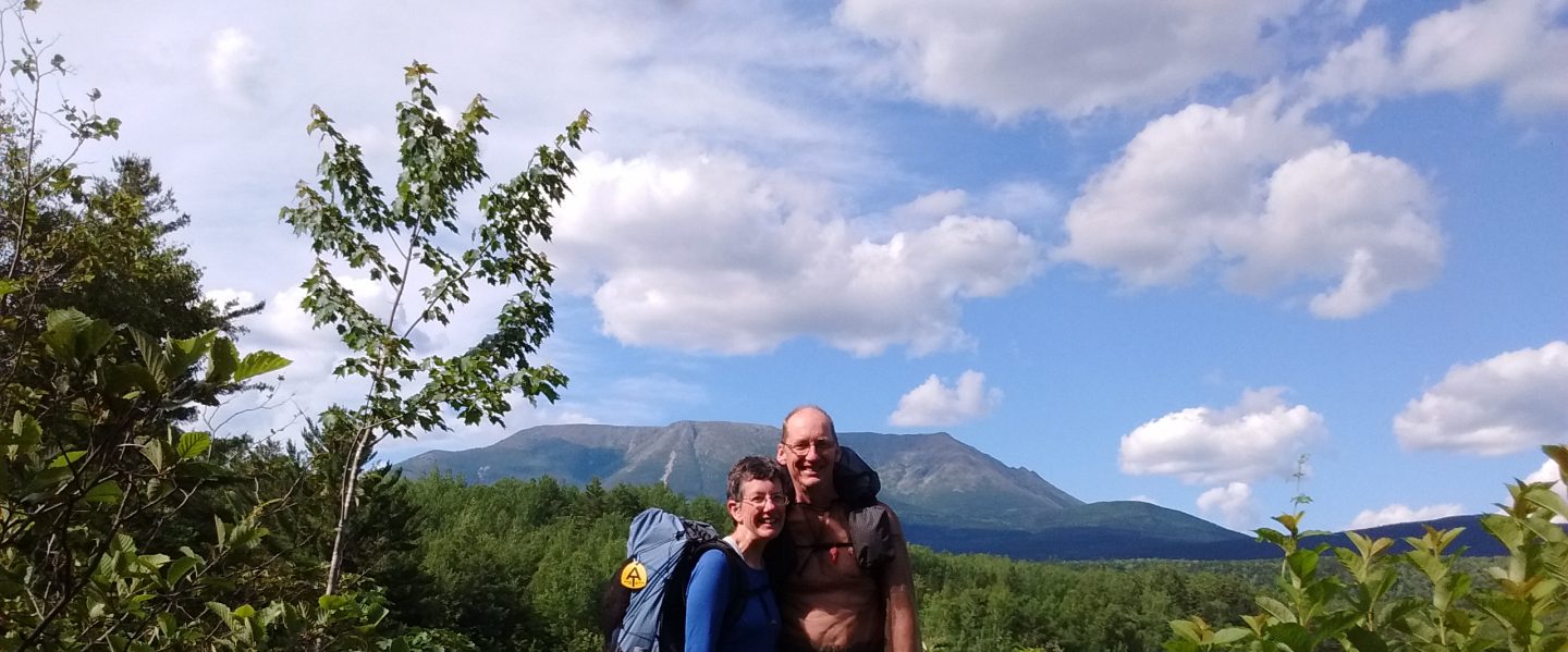
One thousand feet higher and several miles later we set up camp on the shoulder of a mountain. The sun glowed orange fire, spreading its glory across the evening sky. I knew I was blessed to be out here at such a time.

April 22, 2018

Golden beams of light woke us as the sun lingered on the horizon, scattering colors across the landscape.

A spotted towhee sat on a branch, his feathers glowing in the sunlight. His head tilted towards the sky, and he let out a call, “tweeeeeeee!”

Later, as we were hiking, a northern flicker took wing from the top of a giant pine, gliding across a cleft between two mountain sides. The red shafts of its wing feathers glowed orange in the morning light.

At lunch, I shared my pint of sweet tea with Jay. Such a treat on a hot day! Our packs were getting lighter as we drank the pounds of water we’d been carrying.

We hiked for much of the day through an old burn. Burned pineapples dotted the landscape. Wait, what??? No, these were the bodies of yucca plants, with leaves singed off, only a tuft poking from each top.

Burned pineapples? No, just singed yucca!

In one cleft, many large trees had been burned from trunk to tree top. New growth was sprouting along the branches, giving each limb a slight fuzzy green covering.

Burned trees showing new growth along branches.

Jay and I were curious, what kind of tree were these? We examined the new pine needles, but were no wiser.

“If only we could see a cone, that would tell us!” I exclaimed in frustration. With charred ground underfoot, a pine cone seemed unlikely.

We kept hiking, and came around another corner, finding more of the same trees, slightly less burned. Eagerly I scanned the ground, and felt as if I had won the lottery when I spied an unburned cone! Jay and I looked at it, seeing the distinctive feature of exserted trident-shaped bracts, or “mouse tails”, disappearing into each cone scale. “Douglas fir!” Jay exclaimed. He looked it up, and found that this area grows a variety called bigcone Douglas-fir. We were amazed and delighted to have the mystery solved.

April 23, 2018

Today was a town day. We reached Hwy 2 at 7:30 a.m. The first car to pass stopped to give us a ride! Kyle, an enthusiastic hiker, kindly dropped us at the grocery store in downtown Wrightwood, CA. After repeatedly thanking him, we eagerly went inside to buy breakfast.

The town of Wrightwood was one of the best organized hiker towns I’d ever seen. The grocery store had umbrella-shaded tables at which hikers could eat and organize their resupplies. Next to the tables were charging stations for phones and other electronics. Just down the street, the hardware store was a cross between an outdoor equipment store and a place to buy tools, paint, etc. Behind the store was a back deck where hikers could sit and chat. The checkout counter had a list of a dozen locals who would host hikers for a night. We talked to a few hikers and some locals. We considered trying to stay the night with a host family, but finally decided to keep hiking.

Next to the hardware store was the post office. Jay and I picked up new shoes we had ordered on line, then headed back to the grocery store.

We bought food for the next section of our hike, then bought lunch from the deli inside the store. Many people stopped to talk, and it was quite a while before we were ready to leave.

Just as we were saying goodbye and heading towards the street, two men who had been quietly eating lunch called out, “Heading back to the trail? If you have 15 minutes to spare, we can take you when we finish eating.”

Jay and I didn’t need a second invitation! We happily sat down again, and got to know our new trail angels. Brad and Steve were very friendly, and kept us laughing with jokes about hiking. When Jay told them that we were such slow hikers, we had been passed by a worm while hiking the Appalachian Trail, Brad responded thoughtfully, “It’s all in your perspective. You know what the snail said when he boarded the turtle’s back?”

“I don’t have a clue!” I confessed.

“Wheeeee!” Brad grinned. And, still laughing, we climbed into their car for a ride back to the PCT.

Wheee!

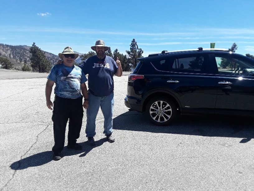
Thank you so very much, Brad and Steve!

Wind Shy

April 18, 2018

“Let’s take it a bit easier today.” Jay and I agreed. After hiking until dusk yesterday, setting up camp early sounded wonderful.

A few steps down the trail, Jay pointed out a great blue heron. I watched, enchanted, as it wheeled overhead and flew off, great wings flapping slowly.

About a mile later, we crossed a road and were greeted by two hikers in a camper van.

“I know it’s early, but would you like a soda?” 2taps asked. Jman introduced himself from inside the van. We chatted for a few minutes, talking hikes while Jay and I shared a Mountain Dew. Properly buzzed on caffeine and sugar, and happy from meeting two friendly hikers, we wished them good hiking and continued.

Jman and 2taps dispensing trail magic

We walked over and between rounded hillsides dotted with old burned tree branches and the new growth of bush poppies in bloom.

The trail crossed under Cedar Springs Dam, then climbed above Silverwood Lake. We enjoyed the view of blue water and sandy beaches for several miles, mostly high above, once dipping very near the water.

Silverwood Lake

As afternoon progressed, the wind began to rise. At 4:30 p.m., we stopped to get water from a creek and assess our position. We had hiked about 15 miles today, and it was time to find a campsite. However, a wind storm was forecast for tonight and all of tomorrow. Ever since our adventure coming down from Fuller’s Ridge, I had no desire to walk through another gale. (See my post, ‘Wind!’) But I liked even less the thought of a long night with wind beating against our tent.

“The trail will be headed uphill from here. It might be hard to find a sheltered campsite,” Jay counseled. “Tomorrow the wind might be worse.”

“I don’t see much shelter here. Let’s go on while there’s still daylight,” I urged. “I’d rather be hiking than worrying about wind ripping the tent. If we see a good spot, we can stop.”

We knew it was possible that we might have to hike another 13 miles to the Best Western hotel at I-15, at Cajon Pass. At our pace, we’d arrive at midnight. With memories of our ordeal down Fuller’s Ridge, we decided to hike a bit smarter this time. We pulled Larabars and dark chocolate bars out of our food bags. This evening’s hike would be fueled with carbohydrates, eaten once per hour. We also agreed to stop once every 30 minutes for water.

On we forged. Unlike our last storm adventure, this time the trail sometimes followed the lee side of a ridge, giving us an occasional respite from the cold, battering wind. Dark descended, and we kept climbing, using our flashlights. Stars peeked from above. The familiar constellations of Orion, Taurus, and the Pleides brought comfort.

I began to lag behind a bit, legs protesting against the long day of use. Suddenly, in the dark, I noticed Jay ahead of me, standing very still, flashlight focused on the ground ahead. He turned and smiled as I cautiously approached.

“You’re just in time to see the end of it,” he remarked. Puzzled, I looked at his flashlight beam, and glimpsed a couple of inches of shiny scales disappearing into the undergrowth.

“A snake?” I guessed. Jay nodded. “Was it big?”

“Probably about four feet. It was crossing the trail. It didn’t seem bothered by my light. It wasn’t a rattlesnake. It had black and white bands.”

Later we looked up snakes of southern California and concluded that Jay had been privileged to see a king snake, so-called due to their resistance to rattlesnake venom, and their ability to dine upon other snakes.

About 9:00 p.m., we noticed the wind was growing softer. By now we were 400 feet below the top of our climb. It was tempting to continue, to see the lights of the freeway below. However, when we saw a flat sandy space near a few sheltering bushes, we decided to stop for the night, while we were still on the lee side. My feet and legs had been aching for a few miles, and Jay admitted he was beginning to feel his tendons protesting.

We set up camp, weighting the tent stakes with rocks, gladly crawling into our fabric home. Train whistles blew through Cajon Pass, just a few miles away. Wind alternately whined and roared through power lines high above us, but only tendrils from the largest gusts reached our tent.

I lay, warm, stretching tired muscles, happy, but unable to stop shivering. What was wrong? Perhaps it was the last four hours of carbohydrates I had been consuming. Great for an athletic event, but not so good for relaxing. Jay was also wide awake. Perhaps some cheese would give our stomachs something to do. We ate a few ounces, and sure enough, the shivering began to abate. I gratefully let tense muscles go, quickly falling asleep after hiking 24.8 miles.

April 19, 2018

A glorious sunrise brought us awake. We packed up in the rising wind, happy in the knowledge that breakfast was just 4.5 miles away at the hotel.

A few minutes up the trail, we met two gold prospectors unloading their truck. They were surprised to see us. “My gosh, did you sleep up here?”

We, in turn, were intrigued with their hobby. Hard to imagine getting up before sunrise just for the fun of hauling shovels and bins to the desert in hopes of finding gold. Wishing them “good luck,” we hiked on.

Gold prospectors

The whole force of the wind met us at the summit. An incredible scene of eroded sandstone cliffs leading down to a far away highway stopped us in wonder.

Jay cautiously looks over the edge. Amazing!

The trail snaked around the cliffs, eventually diving over the edge. I was delighted to be hiking this in daylight, even with wind pushing us back and forth. I felt we had hiked into an exotic postcard.

The last mile followed a creek flowing between cliffs, out the mouth of Crowder Canyon. Beauty surrounded us with sparkling water, gray cliffs, level path, and breakfast, showers, and a bed awaiting.