We spent the stormy weekend (June 9-10) writing blog posts, watching water pour outof the sky, and laughing at Clementine, the cat, whenever she expressed her disgust at the wet weather. I felt cosseted, getting rescued by Jay’s parents and enjoying their hospitality.
However, the PCT continued to sing its siren song. Since the snow was too deep in the Cascades, we decided to spend a week hiking from Seiad Valley to Ashland, giving the snow more time to melt.
The trail began by ascending out of the Klamath River drainage. Poison oak grew abundantly, reaching across the trail, climbing shoulder high, caressing our legs and packs. Toiling uphill, I suddenly felt something crawling along my neck, just at the hair line. I reached up … and raked out a tick!
“Oh, yuck!” I exclaimed.
“Looks like we’ve traded snow and mosquitoes for ticks and poison oak,” Jay observed. “Maybe you’d better check my back and neck.”
We camped on a flat shelf 1,000 feet above the Klamath River. The sinking sun sent light between the tree trunks to illuminate our tent.
June 12, 2018
I’ve become accustomed to 1,000 foot climbs on the PCT. But I have to admit, it’s been a while since we’ve had a really big climb. This morning the trail took us 3,500 feet above last night’s airy campsite.
What’s it like, gaining that much altitude in a morning? Our hike goes a bit like this:
Begin hiking. Stop to negotiate a downed tree. Continue climbing.
Stop to watch the last two feet of a black snake disappear into the bushes. Keep climbing.
Notice that the ceanothus is outcompeting the poison oak. Cheer, and keep climbing.
Stop to admire a view of the Klamath River winding through the Seiad Valley. Keep climbing.
Stop to watch a quarter-sized toad hop up the bank. Keep climbing.
Notice your water bottle is almost empty. Keep climbing.
See a tiny sign, “H2O”. Gladly turn off the trail to get water from an ice cold spring. Enjoy the break while the water bottles slowly fill. Then keep climbing.
Stop while another snake slithers across the trail. Admire its bright scales in rectangular patterns. Keep climbing.
Stop to photograph a whole slew of wild flowers. Keep climbing.
(From top to bottom, unknown purple wildflower, Indian paintbrush, yellow leaf iris, plumed Solomon’s seal, penstemon.)
Listen to a spotted towhee exuberantly fill the morning with it’s flat “tweeee” song. Keep climbing.
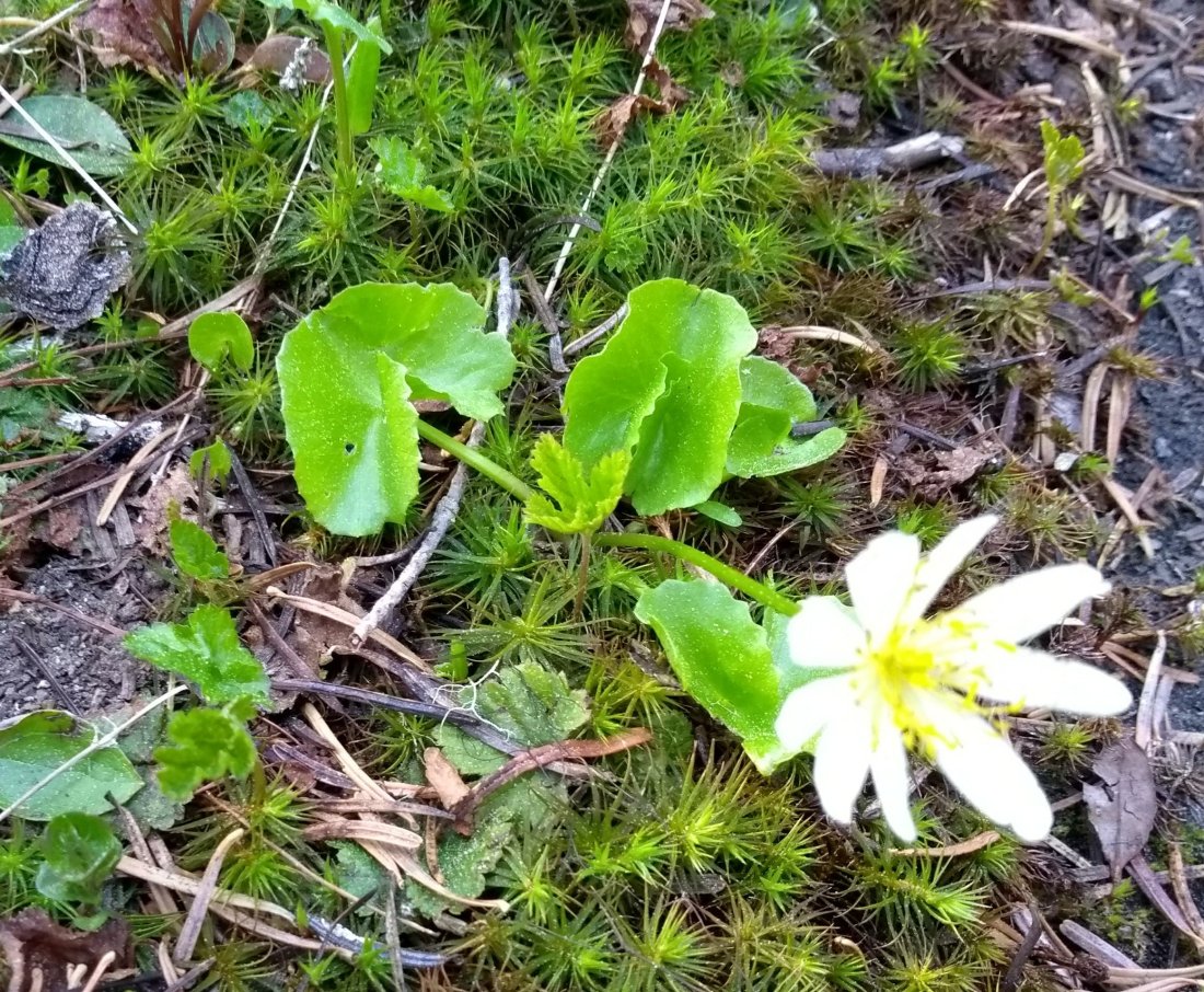
Find a shady tree for lunch. Discover a flower beneath the tree, pink with white picotee edging. Look it up and learn its name – cliff maids. Keep climbing.
About two hours after lunch, finally reach the top of the climb! More wildflowers, a rattlesnake, and fabulous views are the reward.
(blue star tulip, bear grass, spreading phlox)
Indian paintbrush in the foreground, Mt Shasta in the background!
Near the end of the day, we hiked through a section of burned forest. This was one of the many fire damaged sections of the PCT closed last year. We were glad to see it open, thanks to the hard work of trail crews.
June 13, 2018
The lovely thing about a huge climb is being on top. The spine of the Siskiyou Mtns holds our path today. Flowers galore! Bird songs everywhere! Sunshine, cool breeze, blue sky, tall evergreens! The world is a wondrous place, and today I am devoutly thankful to be here, surrounded by nature!
(bleeding hearts, Columbia windflower, cliff maids, larkspur, arrowleaf balsamroot, unknown flowers bordering the path, burned lodgepole pine, currant)
Fabulous views!
(I must give Jay credit for the alliterative title and many of the wildflower names.)
Mosquitoes reigned this morning, swarming us each time we stopped moving.
“They’re our own personal cheerleaders, urging us to greater feats of endurance,” Jay joked.
About a mile above Elk Lake we came to an old burn, and the mosquitoes left us as the breeze played among barren tree trunks.
“Let’s eat breakfast,” Jay proposed. “I know we’re planning to eat a meal at Elk Lake Resort, but I could easily eat twice.”
We happily ate our much delayed morning meal, then ambled downhill to Elk Lake Resort and ordered the mountain scramble – eggs, sausage, vegetables – yum! We also picked up a resupply box, the first one we have mailed on this hike.
Our final chore at the resort was to check the weather. Elk Lake employees helpfully looked up the forecast, and told us snow was predicted for Friday night through Sunday evening! Yikes! Jay and I looked at each other.
“Can we make it to McKenzie Pass by Friday evening?” I asked. “It’s about 30 miles.”
“I think we can do it,” Jay sounded confident. “We’ve got two days of beautiful weather. If there isn’t too much snow, the days are long enough now to make big miles if we push ourselves. Then we could hitch hike to the town of Sisters from McKenzie Pass and sit out the snow in a motel.”
From Elk Lake Resort, the PCT headed uphill for three miles, climbing 1,000 feet to the top of Koosah Mountain. I was delighted to find a clear trail the whole way, with captivating views of Mt. Bachelor, Broken Top, and South Sister.
Okay, there was a little snow on top of Koosah Mountain, but I was sure it would disappear as we headed downhill.
We were still enjoying views of the surrounding mountains on the downhill side of Koosah Mountain. However, I noticed more snow drifts appearing. Hmmm.
The more altitude we lost, the deeper the snow became. This was exactly opposite of what we had been experiencing for the last three days. I watched in disbelief as the snow morphed from patchy drifts to an unbroken blanket, four feet deep in places. Not a single footprint marred the surface, not even animal paw prints!
No matter how hard I tried, I couldn’t keep up with Jay. My feet slipped, slid, I tumbled sideways, and watched with discouragement as Jay got further and further ahead.
‘I can do this,’ I told myself. ‘There are blazes on trees, and I can follow Jay’s footprints.’
I kept walking, but suddenly realized that I had lost Jay’s footprints. I looked around – no blazes in sight. I looked behind me – only my own footprints. I heard a buzzing whistle ahead of me. ‘Jay must be using his pack whistle to call me,’ I thought. I forged onward. Then I heard the whistle behind me. I stopped, confused. Another whistle sounded to my right. What was going on?
“Jaaay!” I called in distress.
“I’m right here,” came the calm reply. “Just behind this tree.”
I took two steps, and there he was! What a relief! “I thought I heard your whistle.” I ran and hugged him.
“No, it’s the call of the varied thrush. These tall hemlocks are great habitat for them.” Jay sounded relaxed. “Do you need a rest?”
“No, I’m okay now that we’re together. I’ll try to keep up,” I replied.
“You know I’ll wait for you. It’s important to go your own pace in this stuff. The last thing we want is for one of us to get hurt and lose our mobility,” Jay warned.
We kept hiking. When we reached Sisters Mirror Lake, I realized we had only gone 1.5 miles in two hours. My feet were soaking wet, and my emotions moved from discouragement to the smallest feelings of desperation. ‘I’ve just got to keep my concentration,’ I thought. ‘Keep my eyes on my feet, watch out for hidden traps. I can do this!’
Suddenly a hiker appeared, heading toward us! ‘Great! Maybe he has come all the way from McKenzie Pass! We can find out if this snow continues, and at least we’ll have tracks to follow now!’
The backpacker, Mike, stopped to chat, amazed at seeing other hikers. I was disappointed to learn that he had come from the Mirror Lakes Trail, which turned off the PCT in just another half mile. Mike had hiked this area a good bit, though, and he had several observations to make about our plans.
“The trail gets pretty flat ahead,” Jay told him. “I remember from 2012, hiking for about five miles across a huge meadow called Wickiup Plains. I wonder if the snow will be melted off that yet?”
“It’s hard to say,” Mike replied. “You’ve got approximately 17 miles of trail paralleling the Three Sisters. There’s going to be a lot of snow in that back country. Probably even more than here. South Sister has eight glaciers on it. And I’m not at all sure that McKenzie Pass is even open yet. You might have to hike another day to Santiam Pass before you can get to the town of Sisters.”
Wishing us good luck, Mike continued on. Jay and I kept walking, now following Mike’s footsteps. The snow was getting softer as the afternoon progressed, and I found myself falling through, “post holing”, often. When we reached the turn off for the Mirror Lakes Trailhead, Jay stopped.
“We need to think about this,” he sounded serious. “If the snow pack stays this deep and continuous, the bad weather is going to catch us.”
I was startled. I had been focused entirely upon each step, trying not to fall, trying to keep up with Jay, I hadn’t even considered the fact that we had other options besides our earlier chosen course. ‘This is one reason I love this guy,’ I thought. ‘He’s always thinking ahead, and he doesn’t let ego get in the way of practicality. It’s also why I never play chess with him.’
We discussed the options for several minutes. Jay was sure we would be okay as long as neither of us got hurt. But we knew from experience how quickly a slip and fall could happen. And it scared me to think of heading into more snow, with no people, no support system except ourselves. If we took the Mirror Lakes Trail, we would be able to follow Mike’s footsteps all the way to the road, and then hitchhike to the town of Bend. I hated to give up, but if McKenzie Pass really was still closed, that made the next road even further away.
“We’ve been handed an escape route on a silver platter,” Jay concluded. “It would be stupid not to take it.”
So we turned off the PCT, following what turned out to be a very popular trail. More footprints joined Mike’s, and I became confident that getting to town wouldn’t be too hard with this much evidence of humans around.
Human footprints in the deep snow made following the Mirror Lakes Trail almost easy!
Gradually, as we descended in altitude and turned away from South Sister, the snow lessened. By the time we set up camp at the base of Kokostic Butte, there was a good bit of dry ground between the drifts. We went to sleep to the sound of frogs singing in a nearby pond.
June 8, 2018
Morning brought a few mosquitoes, a couple of bird songs, and only 1.5 miles to the road! Bright blue sky with warm sun made a mockery of the snowy forecast. This was June, the beginning of summer!
We reached the trailhead to find only Mike’s car in the parking lot. Undaunted, we applied sunscreen, and set out walking down the road. It was 29 miles to Bend, but we were sure we’d get a ride soon.
Three hours later, perhaps 200 cars had passed us. I was beginning to give up hope of a ride, and thinking we would have to walk the whole 29 miles, when suddenly, a small car stopped ahead of us, half-way off the road! I ran up to it, to find three young men in the car. “Do you need a ride?” the front passenger asked.
“Well, yes, but do you have room for both of us?” I asked doubtfully.
“Oh, sure, no problem! You can put your packs in the trunk.” The driver got out to rearrange their own day packs in the back of the car. We dutifully stowed ours, then squeezed into the back seat with the third young man. Oh, the luxury of riding!
“Thank you so very much!” I told them. “We thought we were going to have to walk the whole way!”
The three young men were from Corvallis, and had just climbed South Sister. They told us that they had seen way too much snow, but a beautiful view on top. These wonderful trail angels dropped us in downtown Bend, refusing our offer of gas money.
It was noon on Friday, and we were in Bend. “We did it!” Jay grinned. “Let’s find a hotel.”
I looked at my phone, and saw a message from Jay’s parents. “Maybe we don’t need a hotel,” I told him. “Your parents want to come get us! Looks like we get to spend the weekend in Eugene! I guess we’ll have some time to figure out where to go next.”
Two years ago I read a book which changed my life. Though I never aspired to become a runner, Born to Run, by Christopher McDougall, gave me a different way of walking which cured the extreme back pain I suffered due to a herniated disc. The book also led to many other changes in my life. (For more information on this, see Jay’s blog post, “What are we doing differently this time?” from our Appalachian Trail 2017 hike.)
The feet of a long distance hiker are constantly changing. They bear the weight of body and pack for countless steps, thousands of miles. One’s shoes must be flexible to adapt with one’s feet. When I began hiking the PCT, I wore Altra Timps, which fit my feet at the time. But after 650 miles, my feet cringed each morning as I shoved them into my shoes. Last year on the Appalachian Trail I wore New Balance MT10v4, all 2,200 miles. Unfortunately, New Balance discontinued that model. But with my feet rebelling over Altras, I decided to try a different New Balance minimal shoe, the MT10v1. It has no arch and very little padding, giving one’s feet a unique ground feel. Jay decided to try them, also.
“They’re so light, it’s like wearing house slippers,” Jay marveled.
“I prefer to think of them as modern day moccasins,” I laughed. “It’s the closest I’ll ever come to hiking barefoot!”
“Yes! Strap-on calluses!” Jay agreed.
Our feet informed us of each small item on the trail!
Our new shoes added a novel dimension to the trail. Hemlock and fir needles covered the path in a thin woven layer, like a yoga mat which blunts the outlines but lets one feel every dimple and bump in the ground. Small pine cones and hemlock cones gave a satisfying crispy crunch as we stepped upon them, reminding me of the sound of Rice Krispies. Twigs had a bouncy “crik-crack”, reminiscent of carrot sticks which had lain in my lunch bag for two days. Clumps of usnea, or beard lichen, felt like marshmallows squishing under my toes. And when we reached a snow bank, the crunch of ice crystals sliding and compacting beneath my feet made me think of teeth crushing peppermint pieces. Fun!
The path in Oregon is quite different from the trail tread in southern California. We had transitioned from dry sand and dirt to needle-carpeted ground. Due to the large amount of hikers on the southern portion of the PCT, it was usually easy to tell which way to go – one only had to follow the sandy path that had the most footprints. Here, we have hiked over 24 hours without seeing another person. There is one set of footprints ahead of us on this trail, which show up faintly sometimes when we cross a snow drift. This isolation has set me wondering about finding our way.
What happens when a tree covers the trail? What if we get so much snow we can’t see the path? Of course, we have GPS, but what if we need it for several miles and the battery gets drained? What are the markers here?
One tree isn’t too bad, but a grove of downed trees could make the trail very hard to see!
On the Appalachian Trail, there are white blazes painted along the whole 2,200 miles. “There are blazes here, also,” Jay reminded me. “They’re a bit older than painted rectangles. Look for axe marks in a specific pattern, much like the small letter ‘i’ on the tree trunks.”
“Oh, right!” I exclaimed. “I remember seeing those when I was a kid!” And naturally, as soon as I began looking, I saw many.
Sometimes, when the trail took a small curve, the blaze was marked to one side of the tree trunk. And occasionally we saw a double blaze, marking a complete change of direction, such as on a switchback.
We began running into more snow drifts, especially whenever the trail switched to a north-facing slope and rose above 5,500 feet. I started to see the blazes as necessary, not just comforting.
Sometimes a cut log also signaled the presence of the trail.
A couple of times we saw very old Pacific Crest Trail markers.
About once a day, a modern PCT marker would appear.
We continued to be charmed with nature, especially whenever the trail dropped below 5,500 feet. The Pacific wren sang, sounding as if he were having a party all by himself in the top of the tree. A red-breasted nuthatch called, “yank, yank”. Every time we stopped for a meal, a gray jay came by to check us out. He would look around with an opportunistic eye, then fly off to wait until we were finished with our repast. At lunch near Desane Lake, we saw a hooded merganser fishing for his own midday meal. In the early morning and late afternoon, a Swainson’s thrush serenaded us with beautiful flute-like melodies echoing through the forest.
We hiked through an old burn area, dotted with stark trunks towering above optimistic new growth.
Usnea, or beard lichen, adorned many trees, waving gently in the breeze and giving notice of the excellent air quality in these mountains.
We also saw many examples of a striking orange and black fungus.
I close this post with flowers, the jewels of the forest.
white trilliumyellow violetsbleeding heartsan alpine white marsh-marigold (I think) and purple shooting stars
There is no denying, the last two weeks of May saw us living in the lap of luxury. Double bed, hot running water, unlimited food within arm’s reach, dry shelter in the rain – all the trappings of civilization, which so many people take for granted. Our basic needs were being met with abundance!
On our last day in Eugene, we attended church with Jay’s parents. A massive pipe organ sent shock waves through my system, delighting me as the organist skillfully wove melodies and counter melodies. A visiting young men’s choir, singing glorious acapella harmonies, lifted me with transcending joy.
The afternoon saw us at King Estate Vineyard, indulging in a cheese and fruit plate along with lovely Pinot noir wine. I think this meal went a bit beyond just meeting one’s basic needs!
After satisfying our stomachs, a fascinating tour of the vineyard gave me food for thought as I satisfied curiosity about a new subject.
Family – sharing with each other, laughing and talking and telling stories, knowing we belonged together – this was the true highlight of yesterday.
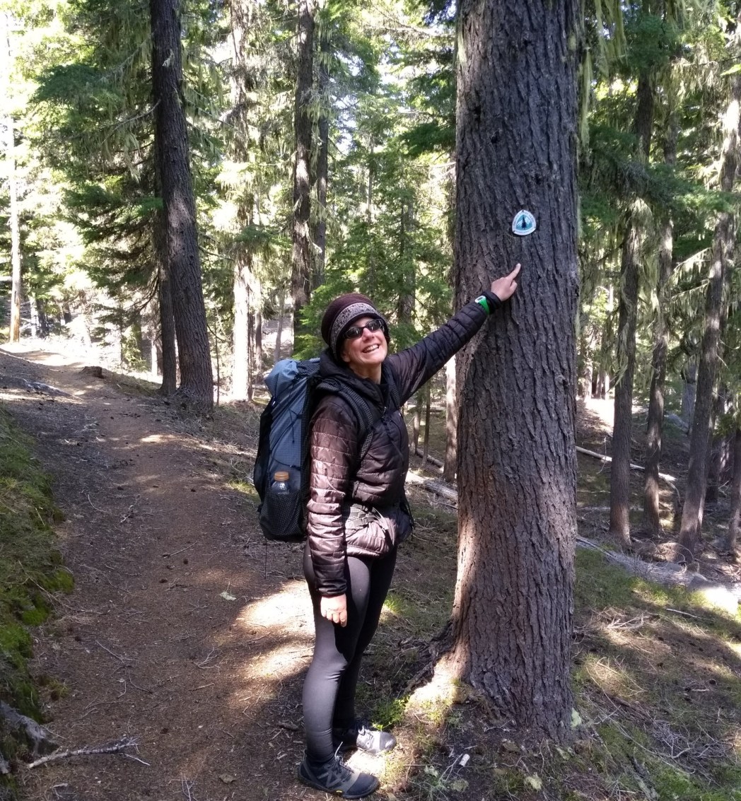
And so today, we have returned to what some would consider a stark existence – the Pacific Crest Trail. Jay’s sister and brother-in-law dropped us off at Willamette Pass. Happy hugs were exchanged, and I blithely shouldered my pack, eager for more adventure!
Sarah and Jay at Willamette Pass
Towering hemlocks muffled our footsteps as we entered the forest. Silence reigned as sunbeams lanced through deep shade, outlining a tree trunk here, spotlighting a wildflower there. A sense of dislocation permeated my being.
“It’s as if we’ve been snatched from Tatooine (Luke Skywalker’s desert home) and plumped down on Endor (forest home of the Ewoks in Star Wars),” Jay joked.
We hiked for three miles, enjoying our new habitat. A flower known as vanilla leaf posed next to a tree trunk, while pink trillium called good morning from beside the trail.
The rhythm of hiking began to lull me with familiarity, until suddenly I topped a rise to see … WATER! Astonishment coursed through my body. Even though my brain knew that lakes dominate much of the Cascades, actually seeing rippling blue water caused a disruption in my subconscious. The desert of southern California felt very far away.
Lower Rosary Lake with the Pulpit in the background.
By evening, my left Achilles tendon ached, and my pack had mysteriously gained weight throughout the day. As we lay out our dinner, I laughed over the contrast from yesterday. Our trail food could be classified as nourishing, but never sumptuous. The forest, with its quiet beauty, was so very different from the soul-thrilling music of Sunday morning. And yet, happiness pervaded my inmost being.
“Sometimes it seems that we humans need a return to the basics in order to be healthy,” Jay mused. “My brain wasn’t designed to stay at the top of Maslow’s hierarchy all the time. Maybe that’s why it’s a pyramid. We spend most of our time at the bottom – satisfying basic needs.”
Raisins, nuts, cheese, chocolate, and sardines.
I looked at Jay and smiled. Food, shelter, beauty, and a loved one. For what more could I ask? Maybe we hadn’t tumbled too far down Maslow’s hierarchy after all.
The Pacific Crest Trail traverses some very harsh environments, from baking desert valleys to frozen alpine mountain tops. These austere conditions often force hikers to push their bodily limits. Though Jay and I have been very lucky with the weather, we, too, have felt the extremes of this environment. Regularly carrying several pounds of water, often hiking over 15 miles per day, enduring pitiless sun, getting buffeted with gale-force wind – it all adds up. We knew that we needed a break, a complete rest, not just one zero day doing chores.
Ten days ago, while talking with his parents on the phone, Jay learned that they were concerned over their cat-sitting arrangements for an upcoming trip. He volunteered us to watch over a very cute, strong-minded kitty cat.
May 14-18, 2018
So, from Inyokern, CA, we took a bus to Gardnerville, NV. This also allowed us to see the eastern edge of the Sierra Nevada Mtns as we traveled up Hwy 395. Miles of snowy peaks accompanied our travel!
We picked up our car and spent the night with a friend in Gardnerville, had dinner with our son and his girlfriend in Reno the next day, then drove on to Eugene, where we settled in with Clementine, the aforementioned cat.
May 19-31, 2018
And so we have been enjoying civilization for the past two weeks. We’ve slept a lot. I caught up on this blog. We’ve taken short walks to Delta Ponds, on the Willamette River. Eugene is beautiful in the spring! The flowers flaunt their beauty for the world to see, while birds enjoy the water.
We’ve enjoyed cooking and eating the kind of food one can’t get on the trail or even in a restaurant!
Breakfast – hot tea, blueberries, salad, eggs over-easy, and paleo pancakes!
A typical dinner included baked fish with chard and lemon accompanied by a salad of mixed greens, cabbage, cauliflower, onion, red peppers, avocado, and goat cheese.
A friend of my mother-in-law invited me to swim each morning. We also spent one whole day visiting two old friends.
And we’ve worked at making friends with Clementine.
The first few days, she very obviously missed ‘her’ people. She would jump up beside me on the couch and ask to be petted. But when I obliged, she would only tolerate a few moments of stroking, then her tail would begin to twitch and she would jump down, sitting with her back to me, tail lashing furiously. I could imagine her thinking, ‘Can’t this human do anything? She doesn’t even know how to pet me correctly!’
One day while I was typing on the computer, Clementine seemed determined to snuggle, climbing all the way into my lap. I petted her, and the teeniest purr started deep within, only to be quelled instantly. Encouraged, I kept stroking. Clementine closed her eyes, still not completely relaxed, but heading that way. My eyes wandered to the computer, thoughts returning to my interrupted blog. One hand kept petting the cat while the other hand began surreptitiously typing. Clementine’s eyes flew open, legs coiling beneath her. With a bound she left my lap and stalked across the floor, tail quivering with indignation! I could imagine her thinking, ‘How dare she! The cheek of that woman, to think she could pet me and type at the same time! That’s it, I’m done with her!’
One thing Clementine did love from the beginning was to be outside with us. As I sat in the sun on the back deck, the cat would wind around my legs. I would reach down with her grooming comb, and Clementine held still while I pulled loose hair from her fur.
Clementine getting groomed while watching a bird.
After ten days of caregiving, Clementine was beginning to accept us. She put her paw on Jay’s chest when he sang to her, a sure sign of approval. And yesterday she let loose with a full, continuous purr while sitting on my lap – at least for a few moments!
What next?
We will return to the PCT in a couple of days. We’ve enjoyed our time off trail, and it has been lovely to know that the snow continues to melt in the high mountains!
When we started in March, we agreed that we would be hiking from March through October. We still hold to that goal. I’m looking forward to quiet nights and sun-kissed days.
Since we are already in Oregon, we have decided to return to the PCT at Willamette Pass, mile 1,908. We will hike north, to Canada. We think it will take us about two months. Then in August, we will find transportation from Canada back to Walker Pass, and start hiking north again, hoping to finish the high Sierras during August and then hike through the rest of California and Oregon in September and October. It will be very interesting to see whether we can finish the whole PCT in one go, hiking at our slow pace. We will strive to keep the idea of pilgrimage in our hike, seeking to learn from our journey, not just check off miles. I hope the readers of this blog will continue to enjoy reading of our trek, chopped up as it might be. I know I’m looking forward to seeing the trail again!
P.S. I will continue to take notes and try to post blogs regularly. There are fewer towns along the PCT in northern Oregon and Washington than there were in the first 650 miles, so there will probably be a lag of a week or ten days between each time I get a chance to post. I’ll keep writing as I hike!
I opened bleary eyes reluctantly to a peaceful dawn. After the fierce wind yesterday and last night, I wanted to turn over and bury my head in my pillow, drifting into another few hours of blessed sleep. Only I didn’t have a pillow. And miles of trail were waiting to be hiked.
A water cache at Bird Spring Pass gave us enough water for the day. Once again I found myself thinking grateful thoughts to the unknown trail angels who hauled water up dirt roads just for the love of it!
Gopher, from London, was already getting water when I arrived. He looked much more cheerful and wide awake than I felt.
“Where did you spend the night?” I asked, wondering if he had found better shelter than a flattened tent.
Gopher gestured to the nearby Joshua trees shading the water cache. “I sort of burrowed into a group of those tree-thingies a few yards down the slope.”
“Joshua trees,” I said.
“Oh, are those Joshua trees? Well, now I know!” Gopher looked pleased. “What about you? Did you find shelter?”
“Not really,” I shook my head. “We cowboy camped on top of our tent, amid the cow patties down in the valley. When the wind quit around 11:30 p.m., we set up the tent.”
“Cow patties? So those things are from cows?” Gopher smiled. “I wasn’t sure. But such big poop! I was hoping it was cows!”
“Yes,” I laughed. “The cows were across the valley, where it was a bit sheltered from the wind, but too steep for us.”
We parted with calls of “See you down the trail.” I felt more cheerful, though I knew only a good long nap would completely restore my equilibrium.
We saw several bushes with bright yellow, waxy blooms. Once again Jay deployed the California Wildflower app, and we were rewarded with the shrub’s name – California flannelbush. I’m afraid, in my sleep-deprived state, that all I could think of was comfortable flannel pajamas! But the information on the wildflower app warned us that hairs on the leaves could cause a rash. Best to be admired from a distance!
From the top of our first big climb of the day, Jay saw a flock of Clark’s nutcrackers, making their loud calls to each other.
I enjoyed seeing rocky rims on a ridge as we climbed.
I sighted one more flower today, the arrow-leaf balsam root. This flower grows in the Sierra Nevada mountains near our home in Nevada. Sighting it for the first time today made me feel like our hike was truly bringing us closer to home.
Much of the day was spent on top of ridges, with little shelter from vagrant stray breezes, bringing cold temperatures across the land. When dinner time rolled around, we were determined to eat without a chilly puff of air sliding down our necks. We settled upon a solid outcrop of stone, higher than our heads. Sitting at its base, we had a perfect view of two round boulders still in the sunlight. Black lizards evidently made this their home. A couple of lizards did pushups before chasing each other up and down the rock. It amazed me, watching them run straight up a vertical surface. One even clung upside down to an overhang for a brief second. I never knew how many lizards were there, as we witnessed numerous chases, several sun warming sessions with pushups, and even one brief mating. The finale was a three way chase, large lizards charging across the boulders at dizzying speeds! Exciting stuff for dinner entertainment!
May 13, 2018
“Good morning! It’s a town day!” Jay whispered, grinning at me in the dawn light. I stuck my nose out of my sleeping bag. Brrr! I snuggled against Jay, seeking a bit of warmth, delaying the morning chill for a few precious moments.
Though we only had about seven miles to hike before reaching Walker Pass, I was determined to enjoy the sights as we hiked. Flowers outdid themselves!
The Bigelow tickweed – a rather ugly name for a beautiful flower!
Once again Jay’s California Wildflower app came into use, and we discovered one of the flowers bore our name!
The Bigelow’s tickseed – a rather ugly name for a beautiful flower!
Not only did individual flowers abound, but whole hillsides were covered with blooms!
When we finally reached Walker Pass Campground, a day hiker offered us a ride to the nearest town, Inyokern. Pavel and his dog, Roxie, were great company! Pavel had immigrated to the United States with his family when he was ten. He still had a charming Russian accent. I couldn’t resist asking him about a Russian idiom I had read once, “…something about a crayfish whistling on a mountaintop?”
Pavel laughed. “Yes, it is a real idiom, though a bit old-fashioned. And perhaps it is a lobster. But yes, something with claws. ‘That will happen when a lobster whistles from a mountain top.’ A bit like the English idiom of ‘when pigs fly’.”
Walker Pass Campground – a fortuitous meeting place for getting a ride from a trail angel!
Pavel dropped us off at the only burger joint in Inyokern, where we ate a delicious lunch of bacon burgers and french fries (instead of trail food – sardines and raisins!).
We then checked into the only hotel in Inyokern. Sitting on the bed after our showers, Jay and I looked at each other. We’d made it! 650 miles! It’s been quite an adventure, with only 2,000 miles to go!
Birds! After two days of wind, the weather has calmed, and birds are everywhere! Just before lunch I saw a spotted towhee, sitting on a bare branch, giving out both its calls, first the nasal “tweeee”, then the squeaky door hinge “creeee?” While eating lunch we were entertained with the flittings of several goldfinches. This afternoon a bird with a bright blue body and black wings darted from the side of the trail, nearly under my feet, winging its way to hide in a tree. Perhaps a blue grosbeak? With only a second to see it, I couldn’t nail its identity. In the late afternoon, a bird gave me about two minutes of unobstructed observation time, sitting on a bare tree branch, turning back and forth in the slanting sunlight. Gray body and wings, white eye stripes, a single spot on a gray chest, and white tips to each tail feather – even with all that, I’m still not exactly sure of its identity. Perhaps a sparrow?
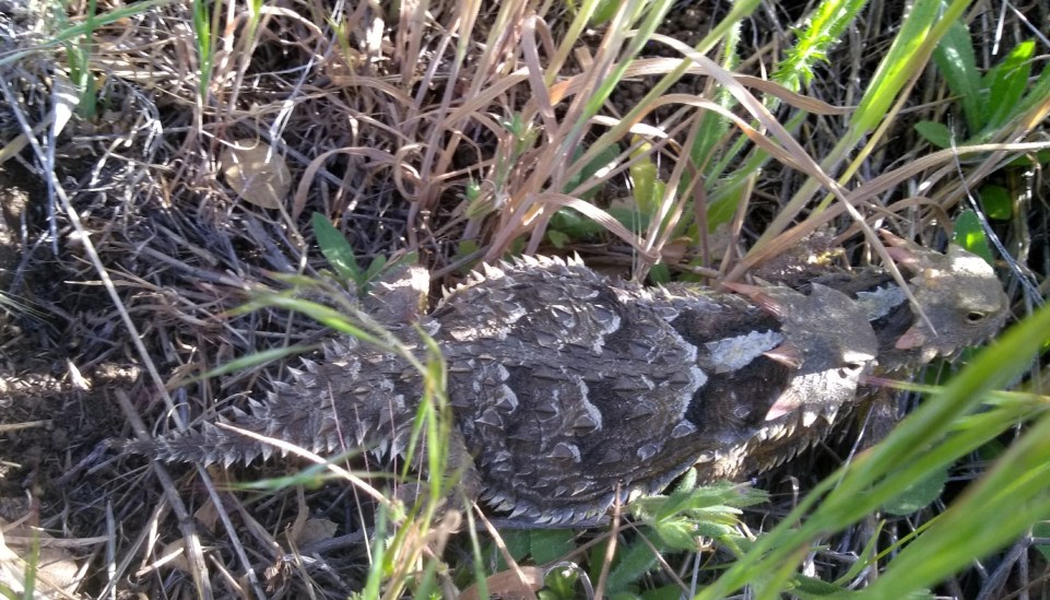
Most of the morning we hiked through high desert scrub with bushes and junipers. Warm sunshine brought out the horned lizards, so many I lost count. I remember an elementary school friend telling me that lizards squirted blood from their eyes. This sounded so strange, I refused to believe my friend. Much to my amazement, when reading Wikipedia about these ‘horny toads’, it says 8 of the 22 species can squirt blood from the corners of their eyes when threatened! Evidently the blood tastes nasty to canine and feline predators, perhaps due to the lizards’ diet of venomous harvester ants.
The spines on its back are modified reptile scales, while the horns on its head are true horns with bone cores.Easy to see that its first defense is camouflage!
We met a total of five PCT hikers headed south today. Pain and Panic had skipped from Tehachapi to Kennedy Meadows to avoid several days of wind, and were thoroughly enjoying being ‘southbounders’. “This way, we aren’t camping with a large group of hikers,” Panic explained. “Most of the northbounders are so focused on getting their miles in, they don’t even have time to say hello! At first we thought y’all were section hikers because you stopped to talk with us. We’ve met so many nice people since we flipped!”
We met Noodles and Long Skirt in the early evening. We talked for a few moments, but lengthening shadows pushed us both on to begin searching for a campsite.
Grady was the final hiker we met, happily covering miles with a ground-eating stride. Once again we stopped to talk, trading information about water sources.
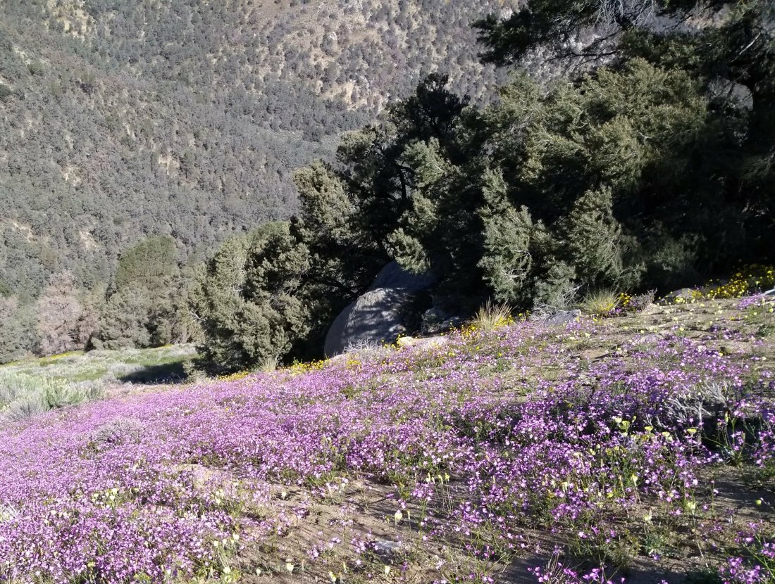
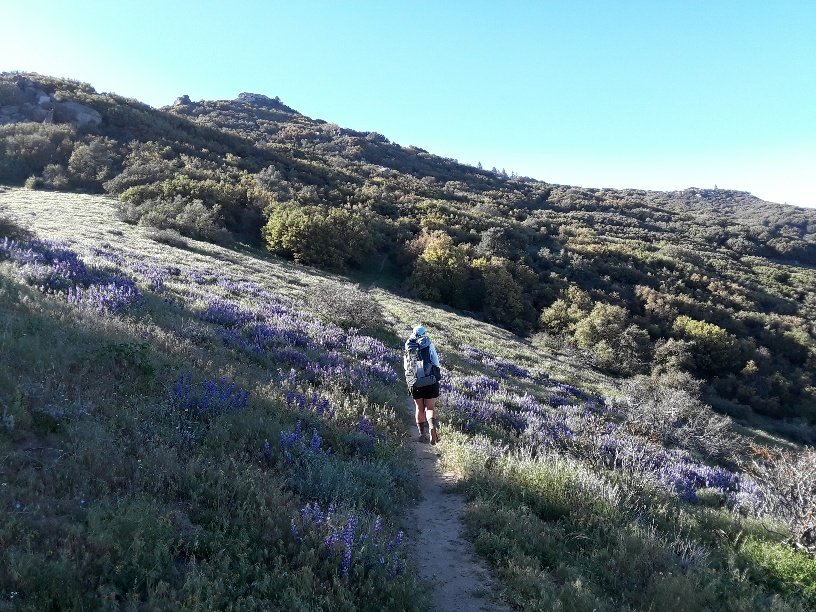
This afternoon, as the vegetation changed from high desert scrub to live oaks and pines, we walked across several hillsides covered in purple lupines. The scent of warm grape cool-aid surrounded us. What an experience, to be enveloped in scent and purple beauty! Jay used a flower app called California Wildflowers to find the name of these aromatic beauties.
Walking through grape soda lupines!
May 10, 2018
The soft sand of decomposed granite on the trail provided a perfect canvas for morning visitor tracks. Quail tracks raced along in wavering lines, scuttling from side to side. Soft furry rabbit footprints crossed the trail. Deer hoofs left exclamation points down the middle of the path. Tiny mouse tracks skittered back and forth several times. Squirrels left deep claw marks on the tips of their footprints as they bounded along. Though we were early, this trail had already seen many morning visitors.
Birds continued to be abundant on this beautiful day. A spotted towhee put its heart and soul into its morning melody. I watched, entranced, as it settled upon a branch and put back its head, throat swelling. What glorious aria was about to grace the air? “Tweeeee!” Harsh and buzzy, the loud nasal trill issued forth. Not exactly melodic, but sung with such enthusiasm, one couldn’t help laughing in delight.
Near lunch time, Jay and I caught up with a PCT hiker from Germany, Chris. Just as the three of us came to a dirt road, a slowly moving vehicle pulled up and stopped.
“Do you need some water?” a man called. Steve got out and offered us cookies, cheese, and water. He and his friend, Larry, were checking out trail heads, preparing to bring a group of young people on a backpack trip in a few days. We talked about trails, enjoying the instant bond of fellow hikers. Before they left, they took our garbage, which was even better than the cookies and cheese, in my estimation! (Chris, however, was most grateful for the cookies!)
Chris, Steve, and Jay talk while Larry looks on from the car. Thank you so very much!
The wind returned this afternoon, buffeting us a bit as the trail followed an exposed ridge line. At 7:00 p.m., we left the trail, following a faint track onto the lee side of the ridge, seeking shelter from the insistent breeze. Jay finally found a hollow surrounded by pines and sand dunes. We set up our tent with the wind building in the treetops. Much of the night the wind howled across the top of our hollow, occasionally reaching down to shake the tent. I was grateful for the shelter!
May 11, 2018
We woke to birdsong and sunshine. The wind continued above our hollow, but gentler with the new day. Jay and I couldn’t resist taking pictures of more grape soda lupine in the early morning light.
Here’s a closeup of this lovely flower.
We also saw a lizard with spots and stripes!
The wind gained force as the day progressed. It was tough to find shelter when stopping for a rest or meal. Lunch was eaten with my back firmly towards the wind, hood pulled over my head. We passed Gopher, a PCT hiker from London, eating lunch while crouched behind a boulder. “Epic wind,” he shouted cheerfully.
By early evening, forceful gusts were sending me staggering across the trail, buffeting me back and forth. At 5:00 p.m., Jay pointed to a small herd of cows in the grass and bushes on the steep slope below us. “Cows aren’t stupid,” he observed. “If all the cows are gathered here, this is probably the best shelter we’re going to find for a while. Let’s eat dinner.”
Cows mark the most sheltered spot for dining!
After dinner we continued, searching for a flat, sheltered spot. We headed downhill across a giant bowl below Bird Spring Pass. At 8:00 p.m., we gave up on shelter, spread our tent flat, weighting it with rocks, and rolled out our sleeping bags on top. Alternately today the wind had roused in me anger, fear, and self-pity. By now, I was simply tired of it.
“I just hope the cows stay on their side of the valley,” I mumbled as I flopped onto my bag.
At 11:30 p.m., the wind abated. Jay woke me, wanting to put up the tent. I was so sleep-fogged, I could barely stand upright, and was not much use in pitching the tent. But I gladly crawled inside once it was erect, and knew nothing else until the dawn.
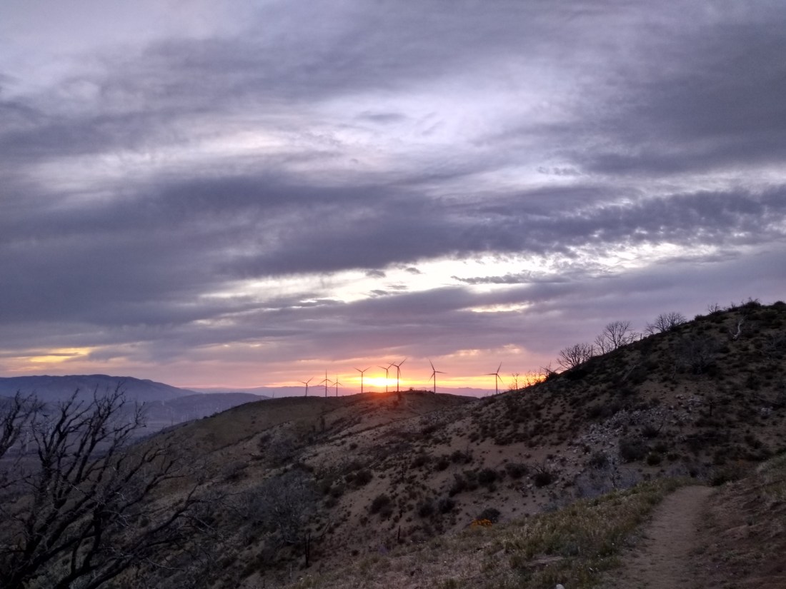
The wind woke us at 4:30 a.m., whistling in the pre-dawn dark, shaking our tent like a mischievous puppy begging us to come out and play. Acquiescing to the inevitable, we packed and started walking. Our reward for this ridiculously early start was a gorgeous sunrise.
Wind turbines accent the morning glory of sunrise and clouds.
Once again flowers brought exquisite loveliness to our hike. As the sun took its first steps above the horizon, blooms glowed with unearthly flourescence, absorbing dawn ultraviolet light only to emit it in vibrant color. Forward progress slowed as I strove to capture some of this ephemeral splendor.
A hiker named Phoenix, from Switzerland, overtook me, long legs working to make short work of the miles.
“Good morning,” I greeted him. “Aren’t these flowers glorious? I feel as if I am hiking inside a rainbow.”
Phoenix paused, contemplating this visual imagery. “Yes, beautiful. But here there is the smell also. That makes here more nice than a rainbow.”
Walking through a rainbow of color
At 9:30 a.m., Jay and I reached Tehachapi Willow Springs Rd. Here there was a list of 40 trail angels who reportedly delight in ferrying dirty, smelly thru-hikers to their town.
The list also contained the phone number for the local bus. I called the bus, asking if it ran on a Sunday, and was informed that it would come by Hwy 58 at 1:30 p.m.
“Hwy 58 is not a regular stop for the bus,” the dispatch lady told me. “You’ll have to call and request a special stop if you are going to be there.”
Jay and I looked at each other – could we cover 8.2 miles in three and a half hours? We had already hiked 7.5 miles this morning. “Let’s give it a try!” We agreed.
And so we set out. No lollygagging, no ‘comfortable pace’, no stopping for flower pictures. Now was the time to see what our bodies could accomplish when pushed. Up and down hills, over grasslands, past wind turbines, we barely paused to drink, staying focused on this self-imposed goal. At 1:00 p.m., we triumphantly reached the overpass, a bridge in the middle of nowhere, existing only to let cars enter the highway from Cameron Canyon Rd, a seldom traveled country lane.
I called the bus station again, to be told that there was a problem with the bus, and it would not be arriving until 5:15 p.m. Oh my gosh! All that hurrying, and now we had four hours of waiting in hot sunshine on the side of a highway interchange. Hitch hiking from the bridge didn’t seem too practical, and hitch hiking on the highway itself was quite dangerous, not to mention probably illegal.
Jay noticed a sign attached to a fence, advertising yet another phone number for a trail angel. Without much hope, we called it. Within a few minutes, a text came back, “Your request has gone out to 40 trail angels.” All we could do was wait.
Jay wandered off to answer a call of nature in the privacy of some bushes. I sat on baking gravel beside our packs.
An old car pulled up, and two men with gray hair and long beards called out, “Do you need a ride to town?”
“Sure,” I called back. “Do you have room for me and my husband?”
The two men got out of the car and began rearranging a plethora of stuff in the back seat. “I think we can fit you both in,” one said.
Jay appeared at my side. “I just got a text,” he whispered to me. “It says ‘Dave’ is on his way here, and to not take any other rides. We can’t go with these guys.”
I gave Jay a panicked glance, then turned to the two helpful locals. “Uh, excuse me,” I began apologetically. “My husband just got a text that someone is coming from Tehachapi to pick us up. I guess we better wait for him. But thank you so very much for offering us a ride. It is incredibly kind of you!”
The two men good-naturedly stopped rearranging their belongings and climbed back inside their car. With calls of “happy hiking” and “thank you so much”, we parted. Once again Jay and I were alone on the empty road.
I was digging through my pack for a snack when another car pulled up, and a tall man called out, “Do you need a ride?” This trail angel had been helping hikers at Tehachapi Willow Springs Rd, and decided to swing by the highway before going home. Once again we explained about the text from ‘Dave’. “Are you sure he’ll arrive?” The man climbed out of his car. “I’ll just wait with you, to make sure.”
We chatted for about 10 minutes, until yet another car pulled off the highway. This time ‘Dave’ was inside, and we happily piled our packs in his trunk. I know I have said it often, but once again, I was truly amazed at the willingness of perfect strangers to help us with transportation.
Arriving at the Best Western in Tehachapi, we gratefully took showers, washed clothes, and refueled our bodies. It had been 50 miles since our last shower, and 83 miles since we’d had dirt-free clothes. The luxury of cleanliness was not something we took for granted.
May 7, 2018
Zero day! The last time we spent a whole day in town was 225 miles ago, at Cajon Pass! Our goal today was to pick up forwarded mail at the post office, and resupply at a grocery store. The post office, on the edge of town, required a 1.6 mile hike across railroad tracks and back over Highway 58. Once there, a long line greeted us.
“I’ll wait outside,” Jay decided, generously offering to hold my empty pack while I joined the queue. By the time I had picked up our mail, three different people had offered us rides back across town!
Candice was ready to leave at the same time as us, so we piled into her car.
“This is so nice of you,” I told her. “I’m grateful to skip walking across the highway and railroad tracks again!”
“Yes, thank you very much,” Jay agreed. “It’s amazing how many people want to help hikers in this town.”
“My husband and I are having a contest to see who can give the most hikers a ride this season,” Candice laughed. “I’ll need to take your picture when I drop you at the grocery store, to prove the numbers I am claiming.”
Candice, Sarah, and Jay in the town of Tehachapi.
May 8, 2018
During breakfast at the hotel this morning, some other hikers shared the phone number of a trail angel willing to give rides from Tehachapi back to the trailhead. We called Daniel, and he graciously agreed to pick us up at 10:00 a.m., after he had dropped off another carload of hikers.
During the drive, we discovered that Daniel was Robert’s brother, and the owner of the extremely comfortable campsite where we had gorged on spaghetti two nights ago! What a wondrous world we live in!
Daniel, trail angel and awesome person!
I hated to say goodbye to such a nice person, but the call of the trail pulled us onward.
From Hwy 58, the trail headed uphill in a series of long switchbacks. Junipers and Joshua trees provided sporadic shade.
Someone turned this group of Joshua trees into a lovely rest area.
Near the top of the climb, jutting rocks accented the scenery.
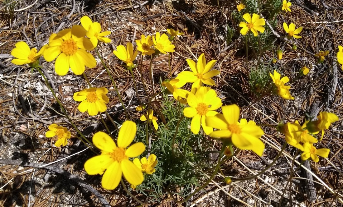
Flowers continued to enchant.
After climbing over 2,000 feet in the course of 12.7 miles, I was glad to see evening shadows bringing the peace of a campsite. We camped under a live oak tree on the edge of a meadow, with a ridge of wind turbines just beyond. Once again an owl sounded a lullaby as I fell asleep.
A living stick greeted me from atop my pack this morning.
There are over 3,000 species of stick insects, ranging in length from one half inch to 12 inches. I didn’t even know walking sticks could be white! This one was about 4 inches long.
We partook of breakfast in the shade of a juniper tree while a meadowlark serenaded the morning.
Juniper tree – easy to identify with the characteristic blue berries, which many birds eat.
Numerous Joshua trees dotted the landscape. This one sported fruit, the first I had seen, and stimulated my curiosity about this unusual plant. Wikipedia informed me that the leaves, fruit and flowers were used by the Cahuilla Native Americans, and early ranchers used the trunks and branches for fence posts and fuel. Also, it is theorized that the now extinct giant Shasta ground sloth was a key to the spread of the Joshua tree, as the leaves and fruits have been found in ground sloth dung. (Side note: The giant Shasta ground sloth went extinct 13,000 years ago. Dung has survived that long??? Hikers, remember this next time you are burying your waste. The desert preserves!)
We worked for our miles today, climbing 2,000 feet of elevation, then dropping down to a stream in Tylerhorse Canyon, then climbing another 2,000 feet to end on a mountain top. Fatigued muscles protested, but wildflowers carpeted the desert, birds sang much of the day, and grace and beauty abounded.
We reached Tylerhorse Canyon at lunch time, sharing the shade of a juniper tree with a bold scrub jay.
Scrub jays are known to have a very precise memory for food caches of seeds and berries. I’m sure this one was disappointed when we didn’t share our lunch!
At the base of the canyon, we met two sets of volunteers from ACE (American Conservation Experience) which partners with the PCTA (Pacific Crest Trail Association). These young people will be repairing trails for six months as volunteers! All I can say is a very humble, “Thank you!”
Louisa and Brady kindly pose for my camera.Arthur, Zack, and Kinsey pause to graciously answer my questions.
The climb out of Tylerhorse Canyon, in the heat of the afternoon, began to take its toll. I found myself counting the switchbacks, and feeling extremely grateful that the trail did have switchbacks, instead of going straight up!
Along with counting each time the trail turned upon itself, I had to keep stopping for moments of beauty. Flowers continued to delight!
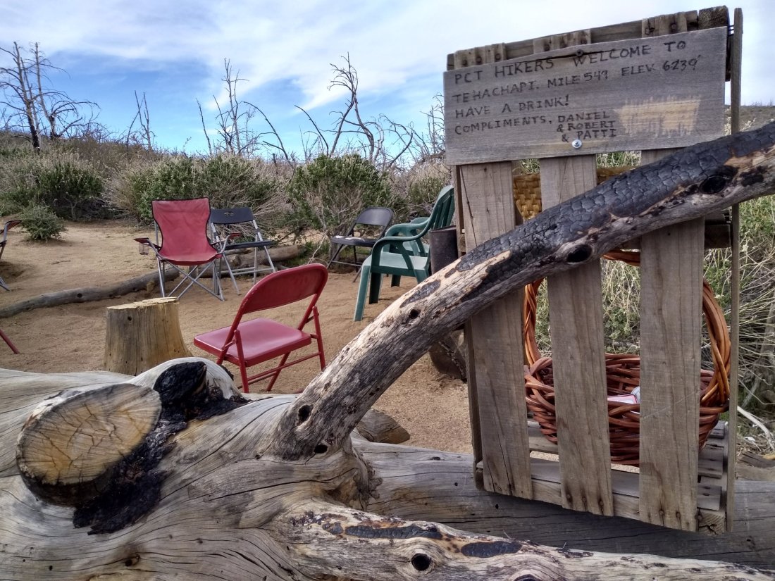
We reached our final mountain top just at dinner time. My weary legs rejoiced when I came upon a charming campsite/hiker home with folding chairs, plank counters, garbage can, and a water cache. A welcome sign from Daniel, Robert, and Patti instructed hikers to “Have a drink!”
Jay and I sat down, marveling at all this luxury, including a beautiful view! I had just put a tin of sardines upon the chair beside me, when a truck pulled up.
Bounding out of the vehicle, a bearded man startled us with the question, “You must be Sarah and Jay. You’re not planning to eat those sardines for dinner, are you?”
How did he know our names? What was going on?
It turned out that Robert and Patti lived on this mountain, and made a habit of sharing their dinner with lucky PCT hikers at Daniel’s campsite. They also followed a few PCT blogs each year, and had chosen mine as one to follow! As they unloaded still steaming spaghetti and utensils from their truck, they told us they had been expecting us today, based upon our progress so far. I was overwhelmed with amazement and gratitude to this generous couple! After a long though beautiful day, this impromptu feast and fascinating conversation made the tough miles seem a distant memory!
“This is my mother’s recipe,” Robert explained as he spooned heavenly smelling sauce from a giant pot. “I’m from a large family, and my mother always made a huge batch. My siblings and I have tried cutting the recipe in half, but it only tastes right when it’s made with her proportions.”
As we ate (and swooned over the delectable spaghetti), Robert and Patti gave us a short historical perspective about the land through which we’d been hiking.
“We’ve been hiking past a great many windmills,” Jay observed.
“Oh yes, those ‘wind turbines,’ as my granddaughter scrupulously calls them, have been big business. Some years ago, quite a few of my neighbors leased options on their land to the wind turbine companies. Nothing ever got built up here. If the companies had asked, we could have told them that the winds are too variable on this mountain top. They never asked, though.” Robert laughed.
Patti and Robert told us about the fires, one in 2007, another in 2012. “You should have seen the dense pinyon pines up here,” Robert reminiscenced. “We harvested pinyon nuts every year. Some of those trees were 300 years old. The fire destroyed everything, including our house. We rebuilt, with the help of our family.”
I mentioned the ACE volunteers I had seen at the bottom of Tylerhorse Canyon.
“Oh, good, I’m glad to hear that section is being repaired! I’ve told the PCTA about it more than once,” Robert smiled.
“What happened? It’s pretty sketchy down there.” I leaned forward in anticipation of another story.
“Last August there was a flash flood. We got seven inches of rain in one hour here at home! You can imagine the amount of run off the canyon collected! There was a LOT of water sluicing through that constricted channel. Hikers told us they couldn’t even find the trail down there. It’s good to have it restored.”
We sat and ate and talked and ate some more. Time flew as evening shadows lengthened. I didn’t want this magical visit to end!
“Will you be camping here tonight?” Robert finally asked.
“It looks like we still have an hour of daylight. We should probably walk a bit further, just to give our stomachs time to digest.” Jay patted his midriff gingerly. “I was hoping there might be a small campsite down the mountain a ways.”
Robert glanced doubtfully at Patti. “It gets pretty steep once you drop off the top.” He thought a moment, then his face brightened. “Actually, about halfway down, there is a bit of meadow where the ridge extends out a ways. There might be a piece of flat ground for you.”
“Perfect!” Jay exclaimed.
Regretfully, we gave Patti and Robert hugs, took a quick picture, and watched them drive away before shouldering our packs. What an incredible encounter!
Patti and Robert – trail angels!
As we hiked through the last of the evening, spotted towhees called from trees and bushes. For the first time, I connected the sound of the squeaky-door-hinge-call to the towhee. Birds have so many sounds! It’s hard to keep them straight. I also saw three rabbits slipping into the brush as we passed. This mountain held an abundance of life!
The wind shook our one room shelter last night, waking me twice with its fierce determination to get inside. Sturdy construction thwarted the gale, and Jay and I slept peacefully.
This morning we took the shuttle to Neenach Cafe and Market, where we bought delicious giant breakfast burritos, called “piglets”, and food to get us to Tehachapi. We were grateful for the shuttle up and down Highway 138, an extremely busy, rather dangerous road. Hikertown is not a place I would want to linger, but I did appreciate the help this strategically placed hostel offered.
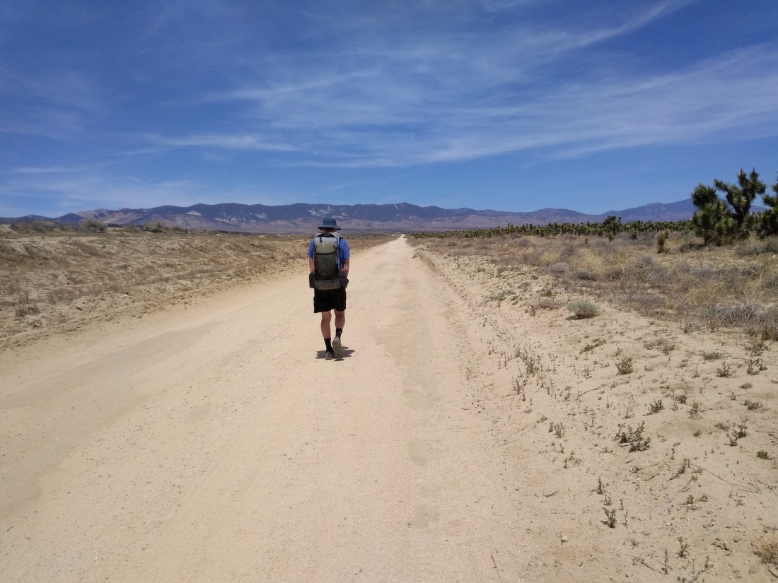
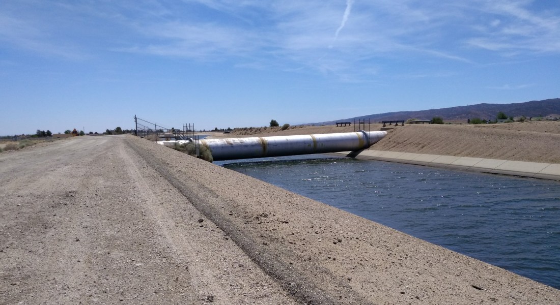
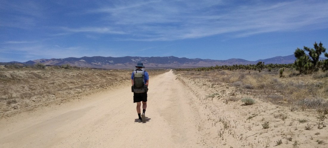
The PCT crosses the western tip of the Mojave Desert, following the Los Angeles Aqueduct through Antelope Valley for much of the day. This valley is known and sometimes dreaded by PCT hikers for its unobstructed wind and high temperatures. Many hikers choose to cross the valley at night, to avoid sun exposure. Today, however, temperatures are in the 70’s, perfect for a gentle stroll through the desert. As the picture shows, we have 17 miles of very flat walking ahead of us!
We’ve left the San Gabriel Mountains, and now have to cross a small corner of the Mohave Desert before climbing into the Tehachapi Mountains.
The Los Angeles Aqueduct brings water from the Owens Valley, on the eastern side of the Sierra Nevada Mountains, to Los Angeles. First completed in 1913, with 233 miles of pipes and channels, the well-engineered design allows water to move by gravity alone. There are many opinions concerning depriving Owens Valley of water in order to facilitate the growth of Los Angeles. I, being a lowly hiker, have no political opinions. Walking beside a piece of living history did interest me, however.
My first sight of the aqueduct surprised me with open water!
Soon the trail made a 90 degree turn, following the aqueduct in the form of a giant pipe half buried in dirt and sand.
A single raven sits atop the pipe full of water, while we traverse the dirt road beside it.
Many hikers complain of the boredom of this day’s hike. I admit, I wouldn’t want to cross this valley every day. But after days of winding through hills and mountains, the novelty of flat and straight entertained me for hours. This picture shows Joshua trees on Jay’s right.
Jay maintains that a successful thru-hiker must have a high tolerance for monotony. I agree, and add that it’s fun to find the entertainment factor in said monotony!
A few days ago, a local man had told Jay and me stories of his childhood, driving across the desert with his father, getting water through access ports in the aqueduct. He described the awe of peering down into the black moving water, fishing for liquid with a water bottle tied to a string.
After a few miles, the round pipe we had been following disappeared completely underground, replaced by a concrete road. I was disappointed to find the access ports firmly locked with no-nonsense official padlocks. Modern day mistrust can remove a bit of the wonder from life. My imagination, however, enjoyed free reign as I walked above all those gallons of flowing water.
Access boxes to the water below were spaced at regular intervals along the aqueduct.
People do live in Antelope Valley, and signs of habitation gave me another thing to watch as we passed at walking pace.
We saw fences, a few cattle, and even some houses in the first five miles of the walk.
And so the day continued. We were grateful for beautiful weather. In the afternoon, the wind began to pick up a bit, but remained much gentler than last night’s gale!
I noticed bird tracks in the sandy dirt, and wondered which bird had run across the path. The footprints were too large for quail. Perhaps a roadrunner? Maybe a swaggering raven? (Upon looking it up later, I learned that roadrunner tracks form an X shape, while ravens have more of a classic bird print. I probably saw raven tracks.)
For the most part, solitude reigned.
As we neared the foothills of the Tehachapi Mountains, we saw solar farms, more properly known as photovoltaic power stations, on our right, and windmills ahead.
Evening brought welcome shadows to our walk.
The day ended at Cottonwood Creek, where a faucet taps into the aqueduct. We also found a 55 gallon blue barrel full of water, provided by Bob from Hikertown. Gratefully, we filled our bottles, then crossed the dry creek to pitch our tent on a flat sandbar while the sunset misted the sky with pink and peach colors.