August 3, 2018
A short video of lupines on the knife edge of Goat Rocks.
Tenacity
August 3, 2018
A short video of lupines on the knife edge of Goat Rocks.
Tenacity
July 31 – August 4, 2018
The sun beat hotly upon my hat, and a scant half inch of water sloshed in my virtually empty bottle. A trail intersection came into sight, with Jay waiting for me at the sign. “Shall we get water here?”
“Yes! The map says Cascade Creek is just a quarter mile down the Round the Mountain Trail.” I gave a little skip of relief, already envisioning pouring half a liter of clear, cold water into my dusty throat.
We turned off the PCT, walking along the edge of Horseshoe Meadow. I could hear the creek gurgling ahead. Rounding a clump of trees, the much anticipated water came into view – a surging, splashing stream of brown silty mud!

Cascade Creek with Mt Adams in the background
“Oh!” I exclaimed, my shoulders sagging in disappointment. “We can’t drink this! It must be coming from a glacier on Mt Adams.” I consulted the map. “The next water source is Riley Creek, 4.5 miles away. It looks like it comes from Mt Adams also. What if all the creeks are full of glacial silt?”
“Maybe, if we collect a liter and let it sit, the mud will settle, and we can decant the top part into another bottle.” Jay, ever the practical problem solver, didn’t seem phased by this set back. “I could use some sitting time. We’ve been hiking for a while!”
We sat, enjoying the beauty of sunlight and meadow. After ten minutes, the upper half of the liter was definitely a lighter brown than the lower half. We decided to go ahead and decant it, treat it with Aquamira, and see if more of the mud settled out as we walked.
We continued hiking, and happily found clear cold water in a tributary of Riley Creek. Our silty liquid was poured onto thirsty plants, and we refilled with much more palatable water.
Over the next 66 miles, we would see many types of water sources. Here are just a few pictures.

Crystal clear water flows through a flower strewn meadow.

This pounding waterfall liberally sprayed me while crossing at its base.

There’s nothing quite like dipping water from a melting snow field!
We also had the privilege of dipping water from Lava Springs, an achingly cold pool emerging from the bottom of an ancient black lava flow. I didn’t get a picture because I was too busy picking blueberries and joking with Scott and Teri, two PCT hikers we had met several times.
As we climbed higher into the mountains, scenery enchanted!


After days, weeks, months of sunshine, on Friday we awoke to lowering clouds, spitting just enough rain to coat leaves with glistening water drops. We donned rain gear and began hiking, leaving the morning’s first footprints on the trail.

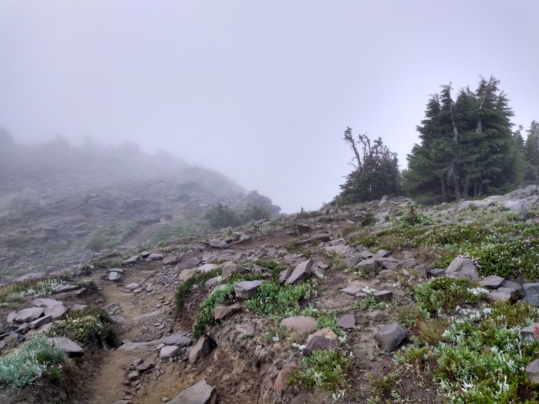
We climbed into the clouds.

We crossed a very large snow field which went from flat …

… to rather steep!
At the top of the snow field, we met Lazarus from Cambridge, England, and Sonia from Seattle, WA. Sonia was a bit nervous about our route, climbing 1600 feet into Goat Rocks, walking along the top of a ridge known infamously as “the knife edge”. The wind had picked up a bit, turning rainy mist into horizontal mist.
“I don’t have to do this,” Sonia said. “Unlike the younger hikers out here, I have nothing to prove.”
In the end, Sonia decided to continue, the other three of us assuring her that we would all stick together.
I thought about her words as we climbed onto the ridge top. I was no young kid, needing to prove myself to the world. But I did need to challenge myself, facing once again my fear of heights, slowly whittling away at the acrophobia that plagued me at inopportune times. I needed to walk the knife edge for myself, no one else.

The knife edge of Goat Rocks …

… continues …

… this is one long challenge!
Jay stopped to photograph polkadotted pussypaws, an elaborately ornamental flower in this stark rock landscape!

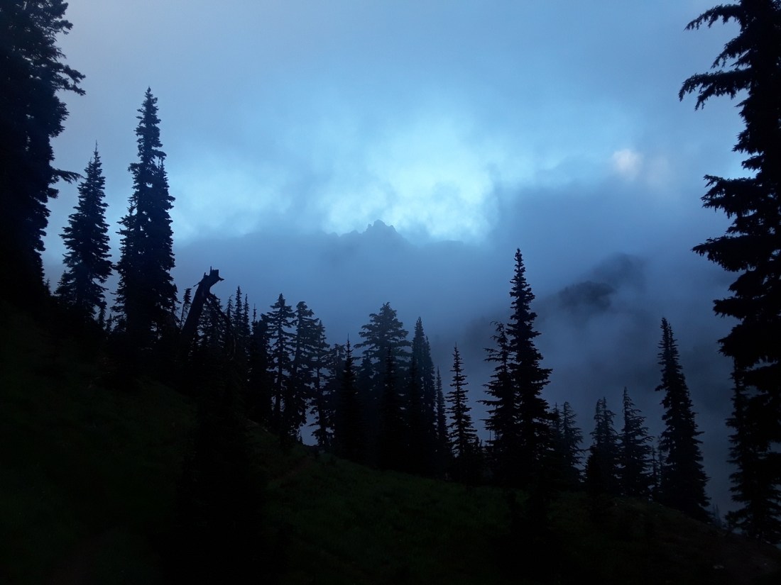
After several miles of ridge walking through fog and mist, it was such a relief to finally descend below the clouds. The landscape opened, with sunshine chasing shadows in an extravagant game of tag.

My three companions pulled ahead, becoming tiny dots upon the earth.
We stopped for lunch, enjoying a last moment of camaraderie, talking of ourselves as the “fearless foursome”, the “Goat Rocks Gang”. We had encouraged and helped each other for several miles, and felt a bit celebratory.
Ten miles from our early morning beginning, we reached Tieton Pass, to be met with a wall of green florescent tape and a sign informing us of a fire closure, necessitating a nine mile detour down the Clear Fork Trail to Hwy 12. Our adventurous day was not over yet!

Sonia and Jay look at the map to orient themselves with the fire closure and alternate route.
The Clear Fork Trail sloped steeply downhill from the PCT, and was often overgrown. Yet the loveliness of this little used trail began to give Jay and me a second wind as we were challenged with obstacles and charmed with beauty.


There were several log crossings.
We ate blueberries, huckleberries, salmonberries, and – wait! Were those black salmonberries? Jay and I had never seen such a berry!


We found two flowers completely new to us also.

Woodland pinedrops, from the Indian pipe family, often grow to be four feet high.

Pipsissewa, also known as umbellate wintergreen, was scattered through the forest.

Salmonberries grew next to yet another log crossing, causing Jay to pause and pick a few.

Some of the downed trees were incredibly large!
On Saturday, near the end of our detour, we met two members of a fire crew, heading into the forest in search of a lightning strike reported by a helicopter. We chatted for a few moments. I was in awe of all the heavy equipment they had to carry. They warned us that there was a forest-wide ban on fires. Since we were in the midst of a detour to avoid a forest fire, the fire ban made sense to us. Wishing them good luck, we continued on.

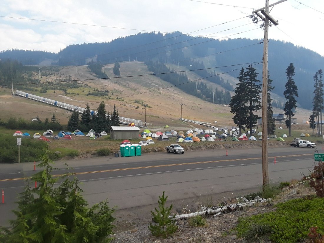
When we reached Hwy 12, we were lucky enough to get a ride to White Pass, where we planned to take a zero day. We were amazed to see a whole fire command center set up.
And so the summer continues. We hike. Firefighters chase smoke and flames. And beauty continues to bloom in the forest, whether people are there or not.
July 29, 2018
Dawn comes quickly in the summer, waking us at a ridiculously early hour. Forest Service Road 23, which would lead us to the town of Trout Lake, 17 miles away, had no cars and no phone service. Philosophically, we began walking, and were rewarded with a spectacular sunrise from behind nearby Mt Adams.

The second car to pass us on this seldom used road was going away from town, but stopped anyway. The couple were taking hiking friends to the trailhead, and assured us that they would pick us up on their way back!
They dropped us at Trout Lake Grocery, wishing us good hiking. Jay and I walked around the corner to eat breakfast at the only cafe in town, then asked at the grocery for lodging options.
The cashier kindly pointed to the wall which sported a list of five places. “I know for a fact that the first two are already full,” she told us.
I began phoning, and was delighted to make a reservation at Trout Lake Cozy Cabins.
“Check in time is 3:00 p.m.” I was told as I made the reservation. I looked at my watch. We still had six hours!
“Hmmm,” I was thinking fast. “We need to buy supplies, but after that, is there a shady place on your property where we could wait?”
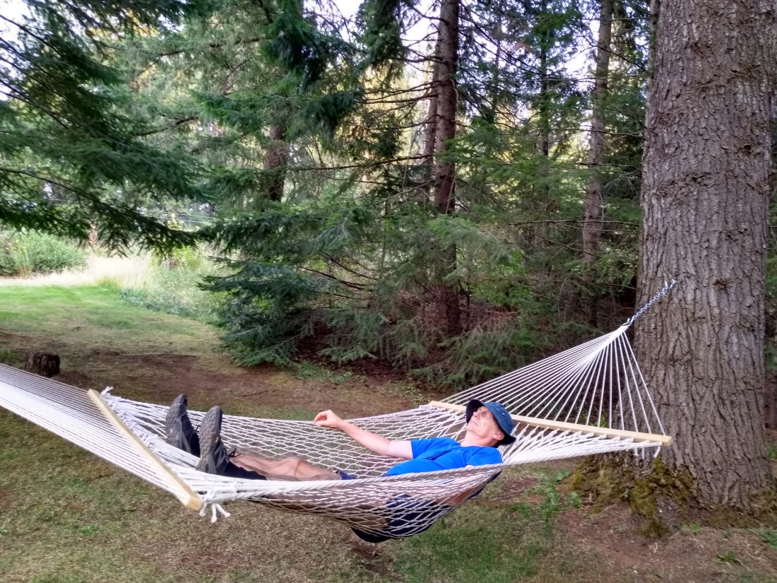
“Oh sure,” the lady on the phone assented. “We’ve got tables and a hammock. And we could probably let you check in a bit early, once the cabin is cleaned.”
I grinned. She knew just what a tired hiker needed!
We bought food for the next week, then began loading our packs at a table beside the grocery. Scott and Teri, PCT hikers we had met two days ago, arrived, having hiked five miles to the road and gotten a ride from a local trail angel. We traded hellos, glad to see familiar faces. As we shouldered our packs, the cashier came out of the store.
“Did you find a place to stay?” she asked.
“Yes, thank you. We made a reservation at the cabins a mile away.” I smiled as I adjusted my hip belt.
“You’re not walking there, are you?” She looked concerned.
I paused, unsure of what to say. How else could we get to our destination?
“There’s a trail angel inside. I’ll just tell him to take you!” She turned and whisked away.
A few minutes later a man came out of the store and lowered the tailgate of his truck. What could we say? “Thank you,” seemed inadequate.
A couple minutes of pleasant conversation brought us to Trout Lake Cozy Cabins, a lovely place with gorgeous cabins nestled between shady trees and beautiful flowers.
Knowing we would have wait time, we had succumbed to temptation and bought a locally made huckleberry pie to keep us company.

A maid kindly loaned us dishes so we didn’t have to eat hiker-style, with our hands.

Just as we began eating, a man approached, carrying a quarter of a chocolate cake.
“We’re packing up to leave. We’ve had a family reunion here this weekend. I was wondering if you would like some of our birthday cake?”
Who could resist an introduction like that? We enjoyed talking to Jeff for a few minutes, telling him about our adventure, hearing of hikes he had taken in the past.
As he stood to go back to packing his car, he asked, “Look, we’ve got a whole watermelon. Could you use it?”
“Sure!” My mouth watered at the thought of one of my favorite summer foods. “We can always share it with other hikers. Let me walk back with you so you don’t have to make two trips.”
Back at his cabin, Jeff introduced me to Yvonne and Samantha. They asked more questions about our hike, while Jeff handed me the watermelon. Then he came out with a whole armful of groceries! “Maybe you could use these sandwich makings?”

A few minutes later, Jeff’s grown son came over with more food! He sat and talked with us, asking questions about our hike and telling us of his favorite outdoor adventures. Such friendly, generous people!
When he left, Jay looked at the bounty spread before us. “It’s as if we sat down at a magic table!”

So began two days of rest, with delicious food, friendly people, and a very comfortable place to stay!

July 25-28, 2018
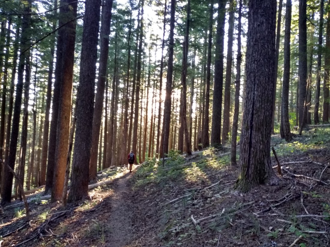
Jay and I were privileged to walk through sections of old growth forest during the last several days. The girth and height of the trees are incredible!


A forest is more than trees, though. Here are a few pictures of other sights from our days of walking.


July 24-28, 2018
I closed my eyes as I placed the blackberry in my mouth and slowly bit down. Sun warmed juice flooded my mouth with intense flavor. My eyes popped open. “Oh my gosh!” I gasped. “Jay, these are incredible!”
“Mhmm,” Jay nodded, his mouth full, hand reaching for more berries.
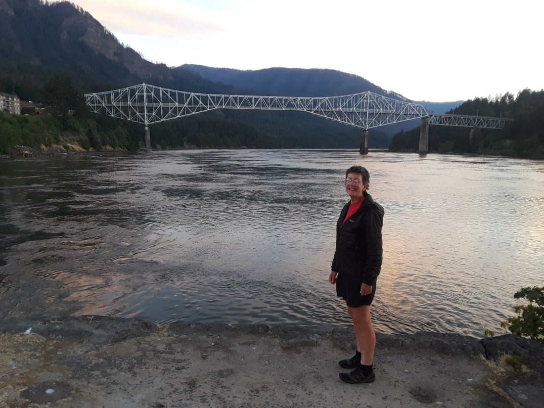
A bank of blackberries had greeted us as we crossed the Bridge of the Gods. Little did I know, the next few days would bring a smorgasbord of berries!

Two weeks ago, the forest was adorned with flowers everywhere – and mosquitoes to match! Insects (including mosquitoes) having done their job of pollination, now many flowers have gone to seed, producing berries for mammals and birds. I was delighted to participate in the harvest!


One can learn a great deal about edible plants from the internet. However, it is very easy to make a mistake when harvesting wild foods. I urge anyone who wants to begin to pick wild berries, make sure to accompany an experienced forager on your first several times!
July 24, 2018
Dawn sent questing sunbeams to tap open my eyelids while a tiny breeze rippled the tent and whispered in my ear, “Today’s the day! Five hundred miles of trail await!”
I opened my eyes and looked at Jay. He was still sleeping, with orange foam plugs sticking prominently from his ears. I grinned. A hedge separated our tent from an active railroad. Thanks to spending five years of my childhood next to a railroad, the screech of steel wheels on rails had been a soothing lullaby for me last night.
Moving quietly, I packed my gear, putting it in the car. By the time I had finished my morning ablutions in the Marine Park Campground bath house, Jay was awake and packing.
We drove to White Salmon, WA, where we left our car in storage. Our plan had been to walk to Hood River and take a bus to Cascade Locks where the PCT crossed the Columbia River. But the bridge connecting White Salmon, WA to Hood River, OR, didn’t allow pedestrians. So we stuck out our thumbs and hitchhiked.
Larry picked us up, and offered us a ride all the way to Cascade Locks!
“My wife and I spent five years sailing around the world. It takes a special kind of relationship to share an adventure in such close quarters. I guess you two know that.” Larry smiled, memories shining in his eyes.
Larry and his wife work together as a boat forensic team. His passion now is paddling a surfski on the Columbia River. What an interesting life!
Thanks to Larry’s kindness, 45 minutes after leaving our car, we were ready to step onto the Bridge of the Gods, heading back to our own adventure. My time of idly swinging on the gate was over. Adventure called!


July 23, 2018
The Cascade Mountains, part of the Pacific Ring of Fire, form a steep, rugged, often snow-covered barrier along 700 miles of the western “backbone” of North America. From Mt Lassen in northern California to the confluence of the Nicola and Thompson rivers in British Columbia, these mountains have been forming for the last 7 million years.
The Columbia River breaches these mountains in a grand east to west sweep. Eight hundred years ago, a landslide of gigantic proportions temporarily dammed the river here. The Native Americans have a story of being able to cross this huge river, dry shod, upon the “Bridge of the Gods”. The landslide dammed the river for quite some time before eventually succumbing to the relentless workings of water and gravity prevailing over rock and stone, collapsing the ancient Bridge of the Gods.
Epic rapids formed here, making an abundant fisheries for the Native Americans. Though the Cascade Rapids were drowned when Bonneville Dam was constructed, several native tribes still use fishing platforms when salmon and steelhead are running.

Pioneers, fur trappers, and explorers used the Columbia River in the early 1800s. They found the Cascade Rapids to be a great hindrance, requiring an arduous five mile portage. A historical sign describes it better than I could.


Eventually a canal with locks was built. The project took 21 years, and the locks were used for 42 years before being replaced by the railroad. A historical sternwheeler offers tourists a dinner cruise. The railroad is also still quite active, carrying countless boxcars of goods along a river that has been a gateway through the Cascade Mountains for thousands of years.

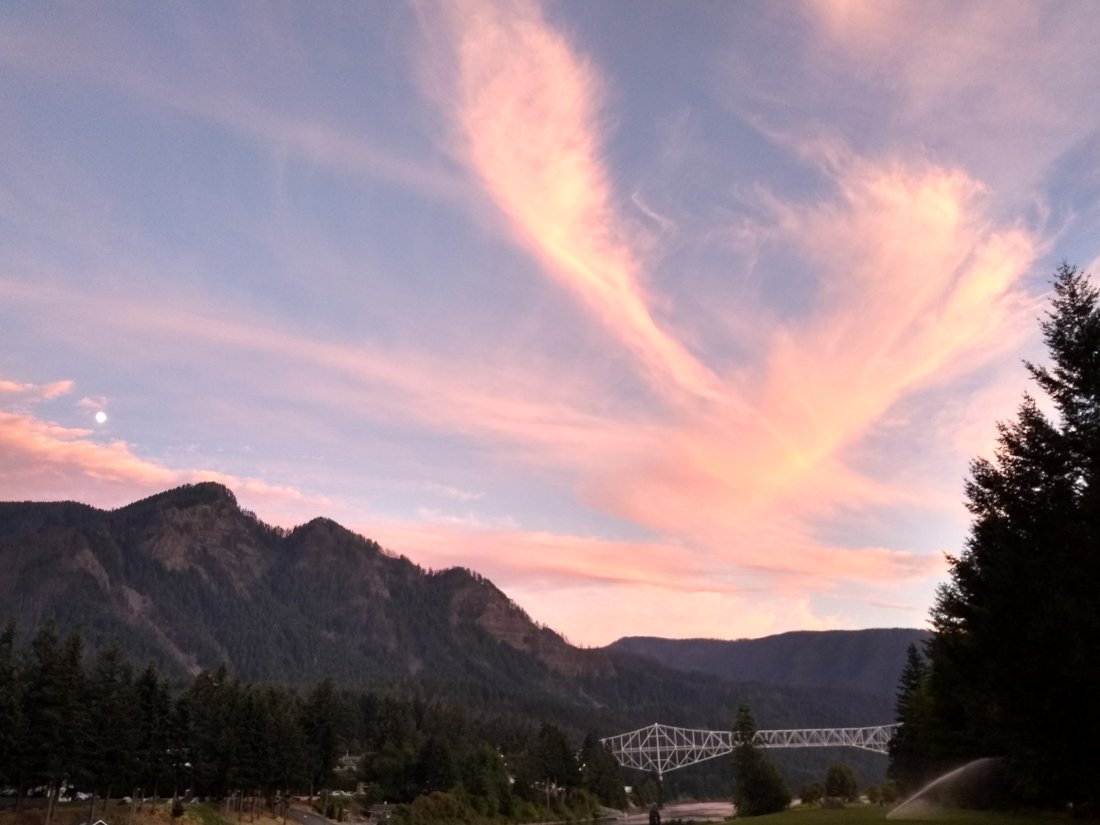
The PCT crosses a modern bridge, still called Bridge of the Gods, here at Cascade Locks. After almost two weeks off, Jay and I will start hiking north from here tomorrow.
I’m looking forward to our re-entry into forests and mountains. But it was good to take some time today to reflect upon this place where ancient natural forces met in an awesome display of power.


July 6, 2018
The downed tree effectively obscured the trail for several yards, draping green branches across the path in tangled extravagance.
As we edged around its top, Jay exclaimed, “Look at these cones!” He brushed the tips with an exploring finger. “They’re soft! And look! The cones are growing upright, even though the tree is laying on its side. What kind of tree is this?”

Leaving Jay to identify the tree, I walked the length of the trunk. Looking back from the root ball, I was startled at how far away Jay appeared. This was one tall tree!

“It’s a Pacific silver fir! It can spend up to a century of its life as a sapling, but eventually it will outcompete the Douglas fir and hemlocks to become the dominant tree species. The cones grow upright at the very tops of the tree, and they disintegrate up there, they don’t fall to the ground.” Jay caught up to me, phone in hand.
“That explains why I haven’t seen bunches of cones laying around!” I shared a grin with Jay, happy in newfound knowledge.
The trail clung to the ridges most of the day, contouring back and forth across the tops of the mountain arms, only gaining and dropping a few hundred feet. On the windward sides, fresh breezes cooled our faces and effectively banished our winged escort. But on the lee sides of the ridges, swarms of enthusiastic blood suckers vied for our attention, urging us to increase our pace again and again.
Mid-afternoon brought us to the shoulder of Cowhorn Mountain. We met a group of four hikers and one dog who had just climbed to the peak. “It’s great!” One woman assured us. “Definitely worth the climb!”
I eyed the knife-edged ridges above and shook my head. “You’re braver than I am!”
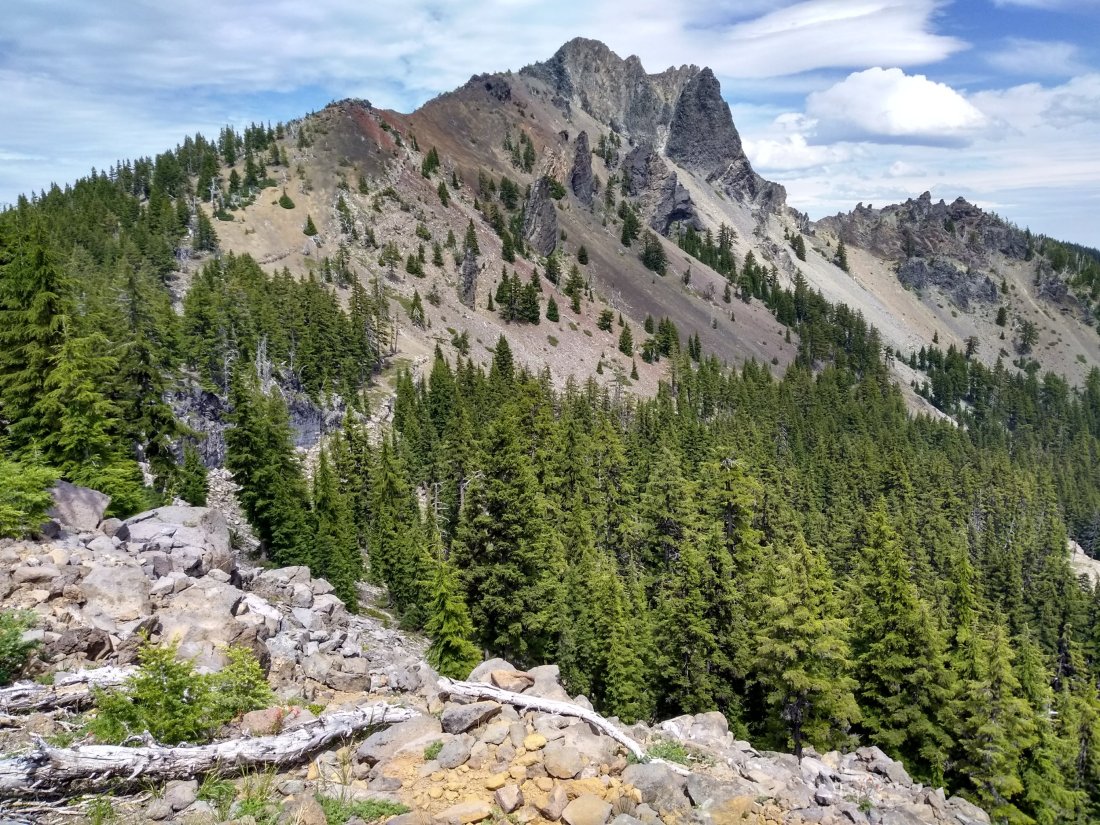
After contouring around Cowhorn Mountain, Jay and I stopped to consult the map. Ahead of us, the trail dropped about 1,000 feet in elevation, zigzagging downward towards a series of small lakes and ponds. Definitely mosquito territory.
I looked across the breezy ridge where we sat. “I know it’s early, but what about stopping here for the day? This wind feels lovely, and we have hiked 12 miles already.”
Jay grinned at me. “I’m in no hurry to meet the swarms waiting for us below. This looks good to me.”
July 7, 2018
As we descended into dense, well-watered greenery, winged denizens swarmed to meet us. Already clothed in rain gear and insect repellent, I gritted my teeth and batted at our admirers.
Bird songs echoed through the tree tops. I knew the haunting flute-like call of the Swainson’s thrush, but another common call was a mystery to me. The bird sounded as if it was saying, “Mc-BE-du! Mc-BE-du!”
“Listen!” Jay turned to me. “Can you hear our theme song?” Mimicking the pitch of the mystery bird, he called, “Mos-QUI-to! Mos-QUI-to!”
(Later, in the luxury of unlimited electricity and internet, Jay found the call, finally identifying the olive-sided flycatcher. I also learned that the Swainson’s thrush is sometimes called the mosquito thrush for its voracious insect appetite.)
Here are two sites if you’d like more information about these birds. Jay and I especially enjoyed the recordings of the songs in these sites.
https://www.allaboutbirds.org/guide/Swainsons_Thrush/overview
https://www.audubon.org/field-guide/bird/olive-sided-flycatcher
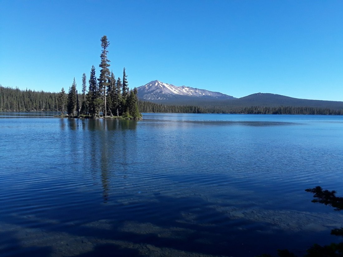
Six miles of racing the mosquitoes brought us to the shore of Summit Lake. We stopped for a photo opportunity on a small peninsula.

A bird winged past me, landing on the shore, then hopping over a rock into the undergrowth. It bobbled and teetered as it walked, perhaps looking for food? I managed one quick picture before the bird flew off, enough to help me later identify it as a spotted sandpiper. Here is a link with fascinating facts (and a better picture).
https://www.allaboutbirds.org/guide/Spotted_Sandpiper/overview

The north end of Summit Lake had a stiff breeze blowing across. We gratefully stopped at the Forest Service campground, deciding to eat lunch insect free, even though it was only 10:30 a.m.
“Do you reckon we might get above the mosquitoes as we climb the shoulder of Diamond Peak?” Wistfully I looked at the far away peak.
“I don’t know,” Jay replied. “When I hiked this in 2012, I don’t remember mosquitoes. I do remember quite a few snow fields. It will be interesting to see what it’s like this year.”
Finishing our lunch, we girded up and dove back into the forest. Six miles later, we stopped at Mountain Creek to refill water bottles. At 7,031 feet altitude, this was the highest the trail would take us on Diamond Peak. We had only seen small patches of snow, and the mosquitoes had stayed respectfully behind once we had reached the mountain’s shoulder. However, stopping at the creek gave the little terrors free reign to attack as we busied ourselves with Aquamira and water bottles. Quickly we completed our chore and fled, hiking at high speed until we reached the next windy ridge top. Even there, a few extraordinarily athletic mosquitoes found us.
“This is crazy,” Jay observed. “Let’s just keep hiking until evening. I don’t want to stop for more than a moment.”

Another six miles found us physically tired and emotionally drained. Hidden Lake offered a campsite, with the possibility of a slight breeze. Gratefully, we turned off the trail and pitched our tent. Once again, my appreciation of our fabric abode soared as I climbed in, escaping the onslaught of bloodthirsty companions.
July 8, 2018
Morning brought a scant breath of wind across the water. I opened my eyes, enchanted to see a faint mist rising from Hidden Lake, disappearing into a cloudless purple dawn.
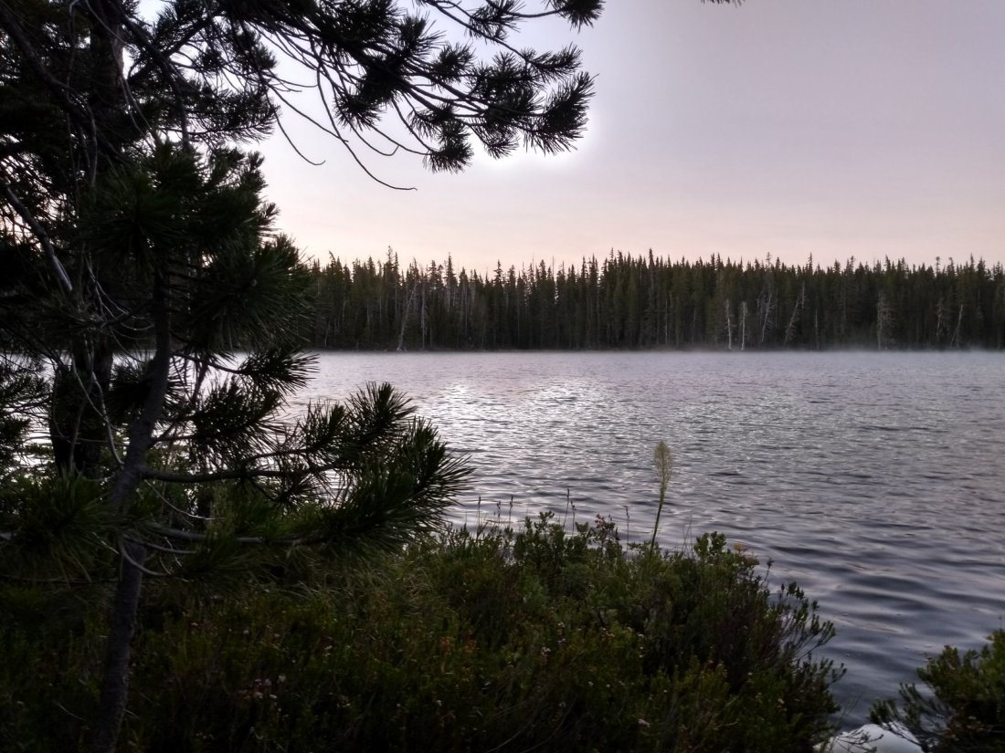
Then my eyes focused upon the undergrowth next to the tent. I watched in horror as first two, then eight, then a dozen, twenty, thirty mosquitoes emerged from under leaves and branches, making a straight line for the netting of the tent door.
A quote from Lewis Puller, one of the most decorated Marines ever, seemed appropriate here. “They are in front of us, behind us, and we are flanked on both sides by the enemy … They can’t get away from us now!”
I’m afraid the enemy managed a few bites in unmentionable places before we were able to hit the trail this morning. Once we started hiking, we didn’t stop for six and a half miles, until we reached the luxury of Shelter Cove Resort and Campground beside Odell Lake.
We stopped at Shelter Cove, glad to escape mosquitoes and recoup after nine days on the trail. We had three more miles to hike in order to reach Highway 58, where Jay’s sister and brother-in-law would pick us up tomorrow for a visit with family and yet another week of cat-sitting. I was glad to spend the rest of this day enjoying the lavish wind and sun at the lake shore, as well as treats such as hot food, showers, electricity, and internet!

July 4, 2018
The importance of water is a lesson the PCT teaches again and again. Though this area boasts of many ponds, lakes, streams, and springs, the actual trail tends to stick to the tops of ridges, making for a very dry walk with steep side trips to fetch life-giving liquid. Thus, you can imagine our delight and appreciation this morning when we came across a water cache left by a trail angel named Devilfish.

Once again mosquitoes reigned as we hiked through the forest. “Just keep walking,” became our mantra as we swatted whining insects and applied repellent.
Mid-afternoon came, with heat and sun. ‘You can do it,’ I encouraged myself. ‘It’s lovely out here. This is just a few miles of discomfort.’ I swatted two more mosquitoes. ‘Okay, maybe lots of miles of discomfort.’
Just then, the trees opened up as the trail contoured across a scree field. Above Jay’s head loomed a giant pointed mountain with towers and castles off each side! Where had that come from? “Jay!” I called out. “Oh my gosh! What is that?”
“Mt. Thielsen,” came the matter of fact reply. “It’s something, isn’t it?”

Our map informed us that Mt. Thielsen was an extinct shield volcano which stopped erupting about 250,000 years ago. Three different ice ages had eroded the mountain, leaving the center of the volcano as an eye-catching spire. The thin, tapering pinnacle acted as a natural lightning rod, forming a rare variant of fulgurite (substance formed when lightning melts rock). Lathrop Glacier, just below the summit, gave mute testimony of long ago mountain-shaving ice age forces.
A couple hours after my first sighting, the trail brought us to the shoulder of Mt. Thielsen, with a beguiling breeze which blew away all traces of mosquitoes. It was an easy decision to eat dinner there, watching light and shadow chase across the surface of the mountain as clouds scudded high above.
‘Here we are, on the birthday of our country,’ I thought. ‘We haven’t spoken to another person all day. One state away, my best friend is singing in a chorus, listening to cannons firing, and eating chocolate cake surrounded by hundreds of other celebrants. All over the nation, people will be watching fireworks tonight. The thing is, I’m totally content with our light and cloud show! This scenery is truly incredible.’
“What a way to appreciate our nation,” I sighed in happiness. Jay grinned at me, silently agreeing.

July 5, 2018
We camped last night above Thielsen Creek, with a view of the mountain top from our tent door. This morning Jay woke me just in time to see the whole mountain awash with the alpine glow of sunrise. Later, as I braved mosquitoes to fetch water, I couldn’t resist one more picture of this incredible mountain.

In the early afternoon, Jay and I noticed a log with a rather large symmetrical pile of sawdust beside it. Intrigued, we stopped to watch.

A tiny fleck of sawdust caught a miniscule speckle of sunlight as it drifted onto the top of the mound. Fascinated, we leaned in for a closer look.

Dark movement in the hole above the pyramid of wood shavings caught our attention.

As we watched, we suddenly saw … carpenter ants! They were busily hollowing out this log, turning it into a catacomb of intersecting tunnels and passageways, making a safe nest for their colony. That pile of chewed wood had been placed there one infinitesimal fragment at a time. No ant had said, “Oh, this is too big of a job.” They’d just got on with it, busily making a place for themselves.
Once again I found myself lost in wonder, this time inspired by a small pile of sawdust. Truly we live in an extraordinary world, from awe-inspiring mountains to staggering examples of the minute. It is a privilege to witness this earth!
(Below is a 15 second video of the ants in action, from Jay’s phone camera.)

July 2, 2018
Yesterday, I ran a gauntlet of winged, bloodthirsty adversaries to fetch cold, crystal clear water from Christi’s Spring. Today our watering hole was an unnamed pond near Jack’s Spring.
The forest around the pond was patchily burned, giving the breeze room to maneuver and blow away many of the mosquitoes. Sitting next to the lily pads, we drained the last drops from our water bottles.

Holding empty bottles, I slowly sidled onto a fallen log, scooping water several yards from the shore.

The water was a discouraging yellow color, but we went ahead and treated it with Aquamira drops, hoping it would taste okay.

Thirty minutes later, when the Aquamira had taken effect, I took a careful swallow. Fresh green taste permeated my mouth – reminiscent of a kale and spinach smoothie with no sugar. The last pond had tasted of fermented alfalfa (aka the smell of horse manure), so I was encouraged by the relative fresh taste of this pond. Jay and I put tea bags in our water bottles anyway. If I’m going to drink yellow water, I’d just as soon drink tea flavor!
Flowers mixed with mushrooms and burned areas gave us endless variety in the day.


Much of the forest we hiked through today was intermittently burned, with blackened tree trunks and little undergrowth, but green needles in the treetops. However, one area had been seared so badly, even the dirt was charred.

Sixteen PCT miles plus one mile of road walk brought us to Mazama Campground at Crater Lake in the late afternoon. We carefully threaded our way through a large parking lot, blessedly mosquito free, though busily full of moving cars. Jay agreed to guard our packs outside the campground store while I joined the line to register for a campsite.
I relaxed as I stood in the long, slow moving line, enjoying the opportunity to listen, trying to identify people’s origins from their accents. At the registration window, I heard a lady tell two well-dressed women before me, “I believe we have one or two campsites left.”
The second registrar beckoned me over. I grinned at him. “My husband and I are PCT hikers. We would like to camp here tonight if it’s possible?”
“Oh sure,” the young man smiled back. “It will cost $5.00 to camp at the ‘Hike In’ site. There are already several PCT hikers down there. Let me take your name and print a permit for you to attach to your tent.”
The other registrar interrupted. “Did you just give her the last empty campsite?”
From the other window, a chorus of “Oh, nooooo!” sounded from the two women, who looked slightly desperate.
“No,” my registrar reassured. “She’s a PCT hiker.”
“Yeah, he put me with all the other hiker trash,” I laughed. The two registrars snickered.
“What does that mean, hiker trash?” One woman looked puzzled.
“Oh, well,” I paused in thought. “We’re all on the trail for so long, and we get so dirty … and by the time we’re finished, our gear and clothes are ragged and done for. ‘Hiker trash’ seems a good description.”
“Oh, I see. It’s a term of endearment for your colleagues,” she nodded. I giggled as I looked down at my stained and ragged shirt. What a way to describe us!
With tent permit in hand, Jay and I bought six days of food from the camp store, treated ourselves to a delicious hot meal at the restaurant, then moseyed downhill to the campground. Jay set up our tent in the deepening dusk among other quiet PCT hiker tents. I happily stowed our heavy food bags in the bear box provided, then skipped off to the campground bathhouse for a wonderful shower!
July 3, 2018
Colors glowed with the appearance of light in the sky. We rose, silently breaking camp, trying not to waken occupants of the many tents nearby. Even in the predawn coolness, sweat beaded across my face as we climbed 1.5 miles up the steep trail from the Mazama Campground back to the PCT. From there, it was 3.5 miles to Crater Lake Lodge, still mostly uphill. Breakfast was a treat after such a workout!

How to describe the next 10 miles as we hiked alongside Crater Lake? The water glowed, a mixture of deep royal and sapphire sky blue. A breeze swept over the lake, effectively vanquishing mosquitoes as it cooled my face. Next to the lodge, the trail looked deceptively inviting, wide and flat. Soon it began a series of steep ups and downs, giving my legs a workout, but rewarding my soul with stunning vista after vista. We climbed Watchman’s Tower, and could see all the way from Mount Shasta in the south to the Three Sisters in the north!
The Klamath tribe of Native Americans have an oral history of ancestors witnessing the collapse of gigantic Mount Mazama. Geologists estimate the event happened about 7,700 years ago, with the mountain blowing out 12 cubic miles of volcanic rock, creating a caldera 5 miles in diameter. Once the insides of the exploded mountain cooled, water began collecting from rainfall and snow melt, creating the incredible beauty of Crater Lake.
Infant to the Earth
Blue abyss enclosed in rock
Ancient to mankind
(Haiku by Jay)


Words cannot do this place justice. Perhaps this quote from one of my very favorite books helps to illustrate that sense of being transported to a place of mystery as we hiked, seeing the lake again and again this day.
“All this he saw, for one moment breathless and intense, vivid on the morning sky; and still, as he looked, he lived; and still, as he lived, he wondered.”
Kenneth Grahame, The Wind in the Willows
